Ishtarlay District
District in Daykundi, Afghanistan
Ishtarlay اشترلی | |
|---|---|
District | |
 Local residents at the opening ceremony of an Afghan National Police (ANP) district headquarters in Ashtarlai district. | |
| 34°06′00″N 66°19′00″E / 34.1°N 66.3166666667°E / 34.1; 66.3166666667 | |
| Country | Afghanistan |
| Province | Daykundi |
| Elevation | 2,600 m (8,500 ft) |
| Part of a series on |
| Hazaras |
|---|
|
|
 Category Category |
|
Ishtarlay or Ashtarlay (Dari: اشترلی), is a district in the Daykundi Province of Afghanistan, located in the isolated central part of the country. It was created in 2005 from Daykundi district.[1]
Demographics
The population of Ashtarlay is made up of ethnic Hazaras.[1]
See also
 Afghanistan portal

References
- ^ a b "DaiKundi Province" (PDF). Government of Afghanistan and United Nations Development Programme (UNDP). Ministry of Rural Rehabilitation and Development. Retrieved 2012-10-28.
External links
- Video: B-Roll, Daykundi Province Handover to GIRoA Archived 2018-07-19 at the Wayback Machine by Defense Video & Imagery Distribution System
| ||
|---|---|---|
| Districts | 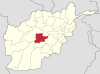 | |
| Landforms | ||
| Other | ||
 | This Daykundi Province, Afghanistan location article is a stub. You can help Wikipedia by expanding it. |
- v
- t
- e


