Charbolak District
District in Balkh, Afghanistan
Charbolak چاربولک | |
|---|---|
District | |
| 36°46′23″N 66°52′25″E / 36.77306°N 66.87361°E / 36.77306; 66.87361 | |
| Country |  Afghanistan Afghanistan |
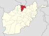
| Province | Balkh |
| Elevation | 300 m (1,000 ft) |
| Population (2009) | |
| • Total | 66,300 |
Chārbōlak (or Chahar Bolak or Char Bolak) (Dari: چاربولک) district (pop: 66,300)[1] is located in the western part of Balkh Province. Its capital is the village of Charbolak, 40 km northwest of Mazari Sharif. The majority of the population is Pashtun.[2]
The previous name of this district was Adina Masjid (آدینه مسجد), which was changed to Charbolak by Mohammad Gul Khan Momand.[3]
Sources
- ^ "Chahar Bolak". National Democratic Institute. Archived from the original on 1 December 2017. Retrieved 20 July 2015.
- ^ Chahar Bolak District (Char Bolak), Balkh Province. Afghan Biographies.
- ^ Ghulam Hazrat Kushan, Afghanistan dar masir-i sada-yi bistum, Afghan American Association, 1999. pp 184-7.
- v
- t
- e
Balkh Province
Capital: Balkh
- Balkh
- Charbolak
- Charkint
- Chimtal
- Dawlatabad
- Dihdadi
- Kaldar
- Khulm
- Kishindih
- Marmul
- Mazar-e Sharif
- Nahri Shahi
- Sholgara
- Shortepa
- Zari
- Balkh River
- Khulm River
- Koh e Alburz
- Kumargah
  | This Balkh Province, Afghanistan location article is a stub. You can help Wikipedia by expanding it. |
- v
- t
- e


