National Register of Historic Places listings in Berkshire County, Massachusetts
Map all coordinates using OpenStreetMap
Download coordinates as:
- KML
- GPX (all coordinates)
- GPX (primary coordinates)
- GPX (secondary coordinates)
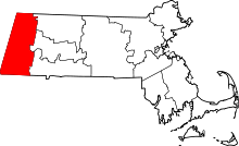
This is a list of the National Register of Historic Places listings in Berkshire County, Massachusetts.
This is intended to be a complete list of the properties and districts on the National Register of Historic Places in Berkshire County, Massachusetts, United States. Latitude and longitude coordinates are provided for many National Register properties and districts; these locations may be seen together in a map.[1]
There are 178 properties and districts listed on the National Register in the county, including 10 National Historic Landmarks.
| Barnstable | Berkshire | Bristol | Dukes | Essex | Franklin | Hampden | Hampshire | Middlesex | Nantucket | Norfolk | Plymouth | Suffolk | Worcester |
This National Park Service list is complete through NPS recent listings posted April 12, 2024.[2]
Current listings
| [3] | Name on the Register | Image | Date listed[4] | Location | City or town | Description |
|---|---|---|---|---|---|---|
| 1 | Allen Hotel |  | September 1, 1983 (#83000566) | Wendell Ave. 42°26′55″N 73°15′09″W / 42.448611°N 73.2525°W / 42.448611; -73.2525 (Allen Hotel) | Pittsfield | |
| 2 | William Russell Allen House |  | May 7, 1980 (#80000427) | 359 East St. 42°26′52″N 73°14′49″W / 42.447778°N 73.246944°W / 42.447778; -73.246944 (William Russell Allen House) | Pittsfield | |
| 3 | Anthony House |  | January 3, 1985 (#85000021) | 67 East Rd. 42°36′55″N 73°06′10″W / 42.615278°N 73.102778°W / 42.615278; -73.102778 (Anthony House) | Adams | Birthplace of suffragette Susan B. Anthony Birthplace Museum; now a historic house museum. |
| 4 | Armory Block |  | April 1, 1982 (#82004944) | 39-45 Park St. 42°37′20″N 73°07′14″W / 42.622222°N 73.120556°W / 42.622222; -73.120556 (Armory Block) | Adams | |
| 5 | Armstrong House |  | October 25, 1985 (#85003394) | 60 Brooklyn St. 42°42′26″N 73°06′47″W / 42.707222°N 73.113056°W / 42.707222; -73.113056 (Armstrong House) | North Adams | part of the North Adams Multiple Resource Area (MRA) |
| 6 | Arnold Print Works |  | October 25, 1985 (#85003379) | 87 Marshall St. 42°42′05″N 73°06′59″W / 42.701389°N 73.116389°W / 42.701389; -73.116389 (Arnold Print Works) | North Adams | now the Massachusetts Museum of Contemporary Art (MASS MoCA); part of the North Adams MRA |
| 7 | Colonel John Ashley House |  | February 10, 1975 (#75001915) | 117 Cooper Hill Rd. 42°03′34″N 73°21′23″W / 42.059444°N 73.356389°W / 42.059444; -73.356389 (Colonel John Ashley House) | Sheffield | Historic house museum operated by The Trustees of Reservations. The 1773 Sheffield Declaration was drafted in the house. In 1781 Elizabeth "Mum Bett" Freeman won her freedom in a case which led to the end of slavery in Massachusetts |
| 8 | P. J. Barrett Block |  | April 1, 1982 (#82004945) | 70-76 Park St. 42°37′24″N 73°07′15″W / 42.623333°N 73.120833°W / 42.623333; -73.120833 (P. J. Barrett Block) | Adams | |
| 9 | Beaver Mill |  | May 11, 1973 (#73000292) | Beaver St. 42°42′12″N 73°05′55″W / 42.703333°N 73.098611°W / 42.703333; -73.098611 (Beaver Mill) | North Adams | |
| 10 | Becket Center Historic District |  | August 11, 1982 (#82004952) | MA 8, Hamilton and YMCA Rds. 42°17′03″N 73°04′08″W / 42.284167°N 73.068889°W / 42.284167; -73.068889 (Becket Center Historic District) | Becket | |
| 11 | Berkshire Mill No. 1 |  | April 1, 1982 (#82004946) | Hoosac St. 42°37′31″N 73°07′06″W / 42.625386°N 73.118404°W / 42.625386; -73.118404 (Berkshire Mill No. 1) | Adams | |
| 12 | Berkshire Life Insurance Company Building |  | February 27, 1986 (#86000276) | 5-7 North St. 42°26′56″N 73°15′18″W / 42.448889°N 73.255°W / 42.448889; -73.255 (Berkshire Life Insurance Company Building) | Pittsfield | |
| 13 | Rev. Adonijah Bidwell House |  | August 26, 1982 (#82004954) | Royal Hemlocks and Art School Rds. 42°12′27″N 73°13′09″W / 42.2075°N 73.219167°W / 42.2075; -73.219167 (Rev. Adonijah Bidwell House) | Monterey | |
| 14 | Blackinton Historic District |  | October 25, 1985 (#85003384) | Roughly Massachusetts Ave. between Ashton and Doanes Aves. and Church Hill and Boston & Maine RR 42°42′13″N 73°09′50″W / 42.703535°N 73.163842°W / 42.703535; -73.163842 (Blackinton Historic District) | North Adams | part of the North Adams MRA |
| 15 | The Boardman |  | October 25, 1985 (#85003403) | 39-53 Montana St. 42°41′33″N 73°06′23″W / 42.6925°N 73.106389°W / 42.6925; -73.106389 (The Boardman) | North Adams | part of the North Adams MRA |
| 16 | Boston Finishing Works |  | October 4, 2016 (#16000690) | 160 Water St. 42°42′23″N 73°12′02″W / 42.706435°N 73.200665°W / 42.706435; -73.200665 (Boston Finishing Works) | Williamstown | |
| 17 | Capt. John Brewer House |  | March 29, 1984 (#84002083) | Main Rd. 42°10′40″N 73°12′29″W / 42.177778°N 73.208056°W / 42.177778; -73.208056 (Capt. John Brewer House) | Monterey | |
| 18 | Charles Browne House |  | October 25, 1985 (#85003413) | 932 S. Church St. 42°40′43″N 73°05′52″W / 42.678611°N 73.097778°W / 42.678611; -73.097778 (Charles Browne House) | North Adams | part of the North Adams MRA |
| 19 | Cheshire Town Hall Complex |  | March 7, 2017 (#100000719) | 80-84 Church & 23 Depot Sts. 42°33′43″N 73°09′46″W / 42.561894°N 73.162812°W / 42.561894; -73.162812 (Cheshire Town Hall Complex) | Cheshire | |
| 20 | Chesterwood |  | October 15, 1966 (#66000652) | 3 Williamsville Rd. 42°17′08″N 73°21′18″W / 42.2856°N 73.355°W / 42.2856; -73.355 (Chesterwood) | Stockbridge | Home of Daniel Chester French |
| 21 | Church on the Hill |  | September 30, 1982 (#82001894) | 169 Main St. 42°21′49″N 73°17′01″W / 42.3636°N 73.2836°W / 42.3636; -73.2836 (Church on the Hill) | Lenox | |
| 22 | Church Street-Cady Hill Historic District |  | March 10, 1983 (#83000567) | Roughly E. Main St. from Church to Pleasant St., and Church St. from Summer St. to Elmwood Ave.; also roughly bounded by E. Main and Holbrook Sts., Wall and Meadow Sts., Elmwood Ave., and Perry, South, and Ashland Sts. 42°41′48″N 73°06′26″W / 42.6967°N 73.1072°W / 42.6967; -73.1072 (Church Street-Cady Hill Historic District) | North Adams | Listed on the National Register as "Church Street Historic District" but renamed and expanded on October 25, 1985; second set of boundaries represents the increase |
| 23 | Citizens Hall |  | June 19, 1972 (#72000126) | 13 Willard Hill Rd. 42°18′58″N 73°19′52″W / 42.3161°N 73.3311°W / 42.3161; -73.3311 (Citizens Hall) | Interlaken | |
| 24 | H. W. Clark Biscuit Company |  | April 22, 2009 (#09000235) | 179-191 Ashland St. 42°41′38″N 73°06′32″W / 42.6938°N 73.1089°W / 42.6938; -73.1089 (H. W. Clark Biscuit Company) | North Adams | part of the North Adams MRA |
| 25 | Clark-Eames House |  | September 12, 1986 (#86002139) | 230 Middlefield Rd. 42°20′36″N 73°04′31″W / 42.3433°N 73.0753°W / 42.3433; -73.0753 (Clark-Eames House) | Washington | part of the Washington MRA |
| 26 | Clinton African Methodist Episcopal Zion Church |  | May 29, 2008 (#08000464) | 9 Elm Ct. 42°11′48″N 73°21′46″W / 42.1967°N 73.3629°W / 42.1967; -73.3629 (Clinton African Methodist Episcopal Zion Church) | Great Barrington | |
| 27 | Coleman Bridge |  | February 18, 2000 (#00000112) | Windsor Bush Rd. over Phelps Brook 42°31′56″N 72°59′36″W / 42.5322°N 72.9933°W / 42.5322; -72.9933 (Coleman Bridge) | Windsor | |
| 28 | Congregational Church of West Stockbridge |  | July 30, 1996 (#96000899) | 45 Main St. 42°19′57″N 73°22′01″W / 42.3325°N 73.3669°W / 42.3325; -73.3669 (Congregational Church of West Stockbridge) | West Stockbridge | |
| 29 | Crane and Company |  | July 1, 1983 (#83004376) | Off Main St. 42°28′10″N 73°10′42″W / 42.4694°N 73.1783°W / 42.4694; -73.1783 (Crane and Company) | Dalton | Listing encompasses what is now the Crane Company museum. |
| 30 | Cranesville Historic District |  | November 9, 2005 (#05001208) | North and south of Main St., west of Park Ave. 42°28′21″N 73°10′38″W / 42.4725°N 73.1772°W / 42.4725; -73.1772 (Cranesville Historic District) | Dalton | |
| 31 | Crowley House |  | October 25, 1985 (#85003414) | 365 W. Main St. 42°41′59″N 73°07′40″W / 42.6997°N 73.1278°W / 42.6997; -73.1278 (Crowley House) | North Adams | part of the North Adams MRA |
| 32 | Dalton Grange Hall No. 23 |  | November 10, 1983 (#83003924) | South St. and Grange Hall Rd. 42°27′38″N 73°10′58″W / 42.4606°N 73.1828°W / 42.4606; -73.1828 (Dalton Grange Hall No. 23) | Dalton | Demolished.[5] |
| 33 | W.E.B. Du Bois Boyhood Homesite |  | May 11, 1976 (#76000947) | MA 23 42°10′42″N 73°23′30″W / 42.1783°N 73.3917°W / 42.1783; -73.3917 (W.E.B. Du Bois Boyhood Homesite) | Great Barrington | Site of house where W.E.B. Du Bois, African American intellectual and activist, grew up. |
| 34 | Dwight–Henderson House |  | March 26, 1976 (#76000237) | Main St. 42°11′29″N 73°21′56″W / 42.1914°N 73.3656°W / 42.1914; -73.3656 (Dwight–Henderson House) | Great Barrington | Home of colonial militia general Joseph Dwight. |
| 35 | Philip Eames House |  | September 12, 1986 (#86002140) | 88 Stone House Rd. 42°22′18″N 73°07′09″W / 42.3717°N 73.1192°W / 42.3717; -73.1192 (Philip Eames House) | Washington | part of the Washington MRA |
| 36 | East Lawn Cemetery and Sherman Burbank Memorial Chapel |  | September 14, 2000 (#00001086) | 605 Main St. 42°42′27″N 73°11′47″W / 42.7075°N 73.1964°W / 42.7075; -73.1964 (East Lawn Cemetery and Sherman Burbank Memorial Chapel) | Williamstown | |
| 37 | East Main Street Cemetery |  | June 2, 2000 (#00000567) | E. Main St. 42°28′24″N 73°09′05″W / 42.4733°N 73.1514°W / 42.4733; -73.1514 (East Main Street Cemetery) | Dalton | |
| 38 | East Otis Schoolhouse |  | May 27, 2021 (#100006595) | 2 Old Blandford Rd. 42°10′19″N 73°02′02″W / 42.1719°N 73.03383°W / 42.1719; -73.03383 (East Otis Schoolhouse) | Otis | |
| 39 | Eaton, Crane & Pike Company Factory |  | August 3, 1990 (#90001166) | 75 S. Church St. 42°26′47″N 73°15′38″W / 42.4464°N 73.2606°W / 42.4464; -73.2606 (Eaton, Crane & Pike Company Factory) | Pittsfield | |
| 40 | Elm Court |  | December 30, 1985 (#85003184) | Stockbridge St. 42°20′19″N 73°17′31″W / 42.3386°N 73.2919°W / 42.3386; -73.2919 (Elm Court) | Lenox and Stockbridge | |
| 41 | Elm–Maple–South Streets Historic District |  | September 8, 2004 (#04000932) | 2 Depot St., 2-14 Elm St., 1-2 Laurel Ln., 1-4 Maple St., 1-11 South St. 42°16′46″N 73°18′47″W / 42.2794°N 73.3131°W / 42.2794; -73.3131 (Elm–Maple–South Streets Historic District) | Stockbridge | |
| 42 | Fairview Cemetery |  | May 11, 2000 (#00000483) | Curtis Ave. 42°28′37″N 73°10′21″W / 42.476944°N 73.1725°W / 42.476944; -73.1725 (Fairview Cemetery) | Dalton | |
| 43 | Farnams Village Historic District |  | April 27, 2000 (#99000866) | Farnams Rd., Lanesborough Rd., and Cheshire Rd. 42°32′44″N 73°11′31″W / 42.545556°N 73.191944°W / 42.545556; -73.191944 (Farnams Village Historic District) | Cheshire | |
| 44 | General John and Mary Fellows Farmstead |  | August 28, 2018 (#100002828) | 1601 Barnum St. 42°03′40″N 73°23′58″W / 42.0612°N 73.3995°W / 42.0612; -73.3995 (General John and Mary Fellows Farmstead) | Sheffield | |
| 45 | Fitch–Hoose House |  | June 24, 2010 (#10000390) | 6 Gulf Rd. 42°28′52″N 73°10′32″W / 42.481111°N 73.175556°W / 42.481111; -73.175556 (Fitch–Hoose House) | Dalton | |
| 46 | Five Corners Historic District |  | January 7, 1993 (#92001717) | Junction of Cold Spring, Green River, New Ashford, Hancock, and Sloan Rds., and the surrounding area 42°39′35″N 73°14′33″W / 42.659722°N 73.2425°W / 42.659722; -73.2425 (Five Corners Historic District) | Williamstown | |
| 47 | Freeman's Grove Historic District |  | October 25, 1985 (#85003388) | Roughly bounded by Liberty St., Eagle St., Bracewell Ave., and Houghton St. 42°42′14″N 73°06′39″W / 42.703960°N 73.110947°W / 42.703960; -73.110947 (Freeman's Grove Historic District) | North Adams | part of the North Adams MRA |
| 48 | Freight Yard Historic District |  | June 13, 1972 (#72000131) | West of the Hadley Overpass and southwest of the Hoosac River 42°41′18″N 73°06′54″W / 42.688333°N 73.115°W / 42.688333; -73.115 (Freight Yard Historic District) | North Adams | Part of the Western Gateway Heritage State Park |
| 49 | Frelinghuysen Morris House and Studio | 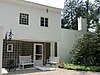 | May 31, 2016 (#16000304) | 92 Hawthorne St. and 159 West St. 42°20′56″N 73°17′59″W / 42.348784°N 73.299639°W / 42.348784; -73.299639 (Frelinghuysen Morris House and Studio) | Stockbridge | |
| 50 | Glendale Power House | 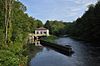 | June 24, 1982 (#82004957) | MA 183 42°16′50″N 73°21′11″W / 42.280556°N 73.353056°W / 42.280556; -73.353056 (Glendale Power House) | Stockbridge | |
| 51 | Golden Hill Bridge |  | February 9, 1994 (#93001592) | Golden Hill Rd. over the Housatonic R. 42°19′18″N 73°14′33″W / 42.321667°N 73.2425°W / 42.321667; -73.2425 (Golden Hill Bridge) | Lee | |
| 52 | Goodwood |  | April 15, 1982 (#82004955) | 311 Summit Rd. 42°23′49″N 73°21′22″W / 42.396944°N 73.356111°W / 42.396944; -73.356111 (Goodwood) | Richmond | |
| 53 | Hall's Tavern |  | March 10, 1983 (#83000568) | 31 North St. 42°33′46″N 73°09′58″W / 42.562778°N 73.166111°W / 42.562778; -73.166111 (Hall's Tavern) | Cheshire | |
| 54 | Hancock Shaker Village |  | November 24, 1968 (#68000037) | 5 mi (8.0 km) south of Pittsfield on U.S. Route 20, the Hancock Turnpike 42°26′03″N 73°22′27″W / 42.434167°N 73.374167°W / 42.434167; -73.374167 (Hancock Shaker Village) | Hancock and Pittsfield | |
| 55 | Hancock Town Hall |  | September 26, 1975 (#73001956) | MA 43 42°32′53″N 73°18′39″W / 42.548056°N 73.310833°W / 42.548056; -73.310833 (Hancock Town Hall) | Hancock | |
| 56 | Samuel Harrison House |  | March 22, 2006 (#06000147) | 80 Third St. 42°27′02″N 73°14′46″W / 42.450636°N 73.2461°W / 42.450636; -73.2461 (Samuel Harrison House) | Pittsfield | |
| 57 | Hathaway Tenement |  | October 25, 1985 (#85003415) | 311-321 River St. 42°42′13″N 73°07′12″W / 42.703611°N 73.12°W / 42.703611; -73.12 (Hathaway Tenement) | North Adams | part of the North Adams MRA |
| 58 | Hillside Cemetery |  | July 19, 2001 (#01000722) | West Main St. 42°42′00″N 73°07′24″W / 42.700042°N 73.1232°W / 42.700042; -73.1232 (Hillside Cemetery) | North Adams | part of the North Adams MRA |
| 59 | Hoosac Street School |  | February 10, 1988 (#87002547) | 20 Hoosac St. 42°37′31″N 73°06′53″W / 42.625278°N 73.114722°W / 42.625278; -73.114722 (Hoosac Street School) | Adams | |
| 60 | Hoosac Tunnel | 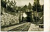 | November 2, 1973 (#73000294) | From North Adams on the west to the Deerfield River on the east 42°40′30″N 73°02′43″W / 42.675°N 73.045278°W / 42.675; -73.045278 (Hoosac Tunnel) | North Adams | |
| 61 | Housatonic Congregational Church |  | April 18, 2002 (#02000377) | 1089 Main St. 42°15′29″N 73°21′56″W / 42.258056°N 73.365556°W / 42.258056; -73.365556 (Housatonic Congregational Church) | Great Barrington | |
| 62 | Frank Howard Building |  | August 14, 2012 (#12000499) | 124-132 Fenn St., 67-71 Federal St. 42°26′59″N 73°15′07″W / 42.449737°N 73.251956°W / 42.449737; -73.251956 (Frank Howard Building) | Pittsfield | |
| 63 | Hyde House |  | November 21, 1976 (#76000239) | 144 W. Park St. 42°18′13″N 73°15′12″W / 42.303611°N 73.253333°W / 42.303611; -73.253333 (Hyde House) | Lee | |
| 64 | Hyde School |  | June 4, 2004 (#04000566) | 100 High St. 42°18′24″N 73°14′53″W / 42.3066°N 73.247975°W / 42.3066; -73.247975 (Hyde School) | Lee | |
| 65 | Jacob's Pillow Dance Festival |  | February 5, 2001 (#00001458) | George Carter Rd. 42°15′52″N 73°07′05″W / 42.264444°N 73.118056°W / 42.264444; -73.118056 (Jacob's Pillow Dance Festival) | Becket | Declared a National Historic Landmark on May 27, 2003 |
| 66 | Johnson Manufacturing Company |  | October 25, 1985 (#85003418) | 65 Brown St. 42°42′08″N 73°07′18″W / 42.702222°N 73.121667°W / 42.702222; -73.121667 (Johnson Manufacturing Company) | North Adams | part of the North Adams MRA; demolished in 2007. |
| 67 | Johnson School |  | October 25, 1985 (#85003416) | School St. 42°42′18″N 73°07′08″W / 42.705°N 73.118889°W / 42.705; -73.118889 (Johnson School) | North Adams | part of the North Adams MRA |
| 68 | Jones Block |  | April 1, 1982 (#82004947) | 49-53 Park St. 42°37′20″N 73°07′12″W / 42.622353°N 73.119982°W / 42.622353; -73.119982 (Jones Block) | Adams | |
| 69 | Kenmore |  | March 28, 1996 (#96000326) | Junction of MA 41 and MA 295 42°23′37″N 73°21′54″W / 42.393611°N 73.365°W / 42.393611; -73.365 (Kenmore) | Richmond | |
| 70 | Lee Lower Main Street Historic District |  | March 26, 1976 (#09000090) | Roughly the area surrounding Main and Park Sts. 42°18′17″N 73°14′56″W / 42.304753°N 73.248814°W / 42.304753; -73.248814 (Lee Lower Main Street Historic District) | Lee | |
| 71 | Lee Station |  | December 27, 2010 (#10001067) | 109 Railroad St. 42°18′25″N 73°15′06″W / 42.306944°N 73.251667°W / 42.306944; -73.251667 (Lee Station) | Lee | |
| 72 | Lenox Academy |  | September 30, 1982 (#82001895) | 75 Main St. 42°21′32″N 73°17′05″W / 42.358889°N 73.284722°W / 42.358889; -73.284722 (Lenox Academy) | Lenox | |
| 73 | Lenox High School |  | August 25, 2004 (#04000903) | 109 Housatonic St. 42°21′21″N 73°16′44″W / 42.355948°N 73.278819°W / 42.355948; -73.278819 (Lenox High School) | Lenox | Listing is for 1908 high school building, now apartments. |
| 74 | Lenox Library |  | April 3, 1973 (#73000291) | 18 Main St. 42°21′27″N 73°17′06″W / 42.3575°N 73.285°W / 42.3575; -73.285 (Lenox Library) | Lenox | |
| 75 | Lenox Railroad Station |  | June 16, 1989 (#89000225) | Housatonic St. and Willow Creek Rd. 42°21′01″N 73°14′44″W / 42.350278°N 73.245556°W / 42.350278; -73.245556 (Lenox Railroad Station) | Lenox | |
| 76 | Lenox Village Historic District |  | June 27, 2022 (#100006987) | Main, Church, Cliffwood, Franklin, Greenwood, High, Housatonic, Hubbard, Hynes, Kemble, Old Center, Tucker and Walker Sts.; Fairview and St. Ann's Ave.; Old Stockbridge and Ore Bed Rds..; Hillside Dr. 42°21′28″N 73°16′58″W / 42.3577°N 73.2829°W / 42.3577; -73.2829 (Lenox Village Historic District) | Lenox | |
| 77 | Lower Historic District |  | September 12, 1986 (#86002141) | Washington Mountain Rd. 42°20′24″N 73°07′04″W / 42.34°N 73.117778°W / 42.34; -73.117778 (Lower Historic District) | Washington | part of the Washington MRA |
| 78 | Mahaiwe Block |  | September 12, 2008 (#08000898) | 6-14 Castle St. and 314-322 Main St. 42°11′38″N 73°21′46″W / 42.193823°N 73.362864°W / 42.193823; -73.362864 (Mahaiwe Block) | Great Barrington | |
| 79 | Main Street Cemetery |  | May 18, 2000 (#00000502) | Main St. 42°28′27″N 73°10′31″W / 42.474167°N 73.175278°W / 42.474167; -73.175278 (Main Street Cemetery) | Dalton | |
| 80 | Main Street Historic District |  | January 17, 2002 (#01001466) | 1-57 Main St., 1-2 Pine St., 2 Sergeant St. 42°16′55″N 73°19′22″W / 42.281944°N 73.322778°W / 42.281944; -73.322778 (Main Street Historic District) | Stockbridge | |
| 81 | Maple Street Cemetery |  | June 2, 2004 (#04000536) | Maple St. 42°37′35″N 73°07′29″W / 42.626389°N 73.124722°W / 42.626389; -73.124722 (Maple Street Cemetery) | Adams | |
| 82 | Mausert Block |  | April 1, 1982 (#82004948) | 19-27 Park St. 42°37′17″N 73°07′14″W / 42.621389°N 73.120556°W / 42.621389; -73.120556 (Mausert Block) | Adams | |
| 83 | Herman Melville House |  | October 15, 1966 (#66000126) | Holmes Rd. 42°24′56″N 73°15′04″W / 42.4156°N 73.2511°W / 42.4156; -73.2511 (Herman Melville House) | Pittsfield | |
| 84 | Merrell Tavern |  | February 23, 1972 (#72000136) | MA 102 42°16′36″N 73°16′59″W / 42.2767°N 73.2831°W / 42.2767; -73.2831 (Merrell Tavern) | South Lee | |
| 85 | Methodist Episcopal Society of Tyringham |  | August 30, 2000 (#00000986) | 128-130 Main Rd. 42°14′38″N 73°12′10″W / 42.2439°N 73.2028°W / 42.2439; -73.2028 (Methodist Episcopal Society of Tyringham) | Tyringham | |
| 86 | Middlefield–Becket Stone Arch Railroad Bridge District | 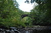 | April 11, 1980 (#80000502) | Middlefield vicinity 42°18′44″N 73°01′10″W / 42.3122°N 73.0194°W / 42.3122; -73.0194 (Middlefield–Becket Stone Arch Railroad Bridge District) | Becket | Extends into Chester and Middlefield. |
| 87 | Mill River Historic District |  | May 17, 1994 (#94000423) | Roughly bounded by Main St. and River Church, Southfield, Clayton, School, and Hayes Hill Rds., Town of New Marlborough 42°06′49″N 73°16′06″W / 42.1136°N 73.2683°W / 42.1136; -73.2683 (Mill River Historic District) | Mill River | |
| 88 | Mill Village Historic District |  | October 6, 1983 (#83003926) | Cole Ave., Mill, Arnold, and Elm Sts. 42°43′00″N 73°11′25″W / 42.7167°N 73.1903°W / 42.7167; -73.1903 (Mill Village Historic District) | Williamstown | |
| 89 | Mission House |  | November 24, 1968 (#68000038) | Main St. 42°17′00″N 73°18′57″W / 42.2832°N 73.3157°W / 42.2832; -73.3157 (Mission House) | Stockbridge | |
| 90 | Mohawk Trail | 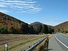 | April 3, 1973 (#73000283) | Along the bank of the Cold River 42°38′15″N 72°57′13″W / 42.6375°N 72.9536°W / 42.6375; -72.9536 (Mohawk Trail) | Florida and Savoy | Extends into Charlemont in Franklin County |
| 91 | Montville Baptist Church |  | October 12, 2006 (#06000936) | 5 Hammertown Rd. 42°07′07″N 73°07′30″W / 42.1187°N 73.1249°W / 42.1187; -73.1249 (Montville Baptist Church) | Sandisfield | Now the Sandisfield Arts Center |
| 92 | Monument Mills |  | November 29, 1983 (#83003927) | Park and Front Sts. 42°15′19″N 73°21′52″W / 42.2553°N 73.3644°W / 42.2553; -73.3644 (Monument Mills) | Great Barrington | |
| 93 | Monument Square–Eagle Street Historic District |  | June 19, 1972 (#72000132) | Monument Square and environs, at the eastern end of Main St.; also roughly bounded by Holden, Center, and Union Sts., East Middle School, Summer, and Main Sts. 42°41′57″N 73°06′37″W / 42.6992°N 73.1103°W / 42.6992; -73.1103 (Monument Square–Eagle Street Historic District) | North Adams | Second set of boundaries represents a boundary increase of August 25, 1988 |
| 94 | Morewood School | 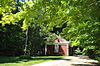 | May 31, 1984 (#84002084) | 30 S. Mountain Rd. 42°25′48″N 73°15′40″W / 42.43°N 73.261111°W / 42.43; -73.261111 (Morewood School) | Pittsfield | |
| 95 | Mount Greylock Summit Historic District | 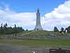 | April 20, 1998 (#98000349) | Junction of Notch, Rockwell, and Summit Rds. 42°38′16″N 73°10′06″W / 42.637778°N 73.168333°W / 42.637778; -73.168333 (Mount Greylock Summit Historic District) | Adams | |
| 96 | The Mount |  | November 11, 1971 (#71000900) | South of Lenox on U.S. Route 7 42°19′53″N 73°16′54″W / 42.331389°N 73.281667°W / 42.331389; -73.281667 (The Mount) | Lenox | |
| 97 | Naumkeag |  | November 3, 1975 (#75000264) | 5 Prospect Hill Rd. 42°17′17″N 73°19′05″W / 42.288056°N 73.318056°W / 42.288056; -73.318056 (Naumkeag) | Stockbridge | |
| 98 | New Boston Inn |  | September 1, 1988 (#88001459) | Junction of MA 8 and MA 57 42°05′38″N 73°04′40″W / 42.093889°N 73.077778°W / 42.093889; -73.077778 (New Boston Inn) | Sandisfield | |
| 99 | New Boston Village Historic District | | April 8, 2022 (#100007554) | 97-101 North Main and 79-110 South Main Sts. (MA 8), 2-4 Tolland (MA 57), 3-22 Sandisfield, (MA 57), and 2 River Rds., 4 Cannon Mountain and 3 & 5 Willow Lns. 42°05′38″N 73°04′37″W / 42.0938°N 73.0769°W / 42.0938; -73.0769 (New Boston Village Historic District) | Sandisfield | |
| 100 | New Marlborough Village |  | September 30, 1982 (#82001896) | MA 57, New Marlborough, Monterey and Southfield Rds. 42°07′30″N 73°13′38″W / 42.125°N 73.227222°W / 42.125; -73.227222 (New Marlborough Village) | New Marlborough | |
| 101 | Nichols–Sterner House |  | September 17, 1987 (#87001997) | 428 Swamp Rd. 42°24′20″N 73°19′10″W / 42.405452°N 73.319575°W / 42.405452; -73.319575 (Nichols–Sterner House) | Richmond | |
| 102 | Norad Mill |  | October 25, 1985 (#85003417) | 60 Roberts Dr. 42°41′55″N 73°08′20″W / 42.698611°N 73.138889°W / 42.698611; -73.138889 (Norad Mill) | North Adams | part of the North Adams MRA |
| 103 | Normal School Historic District |  | October 25, 1985 (#85003391) | Roughly Church and Blackinton Sts. 42°41′27″N 73°06′10″W / 42.690833°N 73.102778°W / 42.690833; -73.102778 (Normal School Historic District) | North Adams | Mostly Victorian residences near the Massachusetts College of Liberal Arts; part of the North Adams MRA |
| 104 | North Becket Village Historic District |  | July 26, 1988 (#88000229) | Main, High, and Pleasant Sts. 42°19′57″N 73°04′58″W / 42.3325°N 73.082778°W / 42.3325; -73.082778 (North Becket Village Historic District) | Becket | |
| 105 | North Egremont Historic District |  | January 20, 1989 (#88003126) | Roughly bounded by Shun Toll Rd., Rt. 71, Hillsdale Rd., and Mill Rd. 42°11′55″N 73°26′25″W / 42.198611°N 73.440278°W / 42.198611; -73.440278 (North Egremont Historic District) | Egremont | |
| 106 | Northeast School |  | August 30, 2002 (#02000902) | 981 Summit Rd. 42°24′00″N 73°19′54″W / 42.4°N 73.331667°W / 42.4; -73.331667 (Northeast School) | Richmond | |
| 107 | Old Central Fire Station |  | November 2, 1977 (#77000177) | 66 Allen St. 42°26′58″N 73°15′09″W / 42.449444°N 73.2525°W / 42.449444; -73.2525 (Old Central Fire Station) | Pittsfield | |
| 108 | Old Central High School |  | August 6, 1980 (#80000428) | 99 2nd St.[6] 42°27′03″N 73°14′56″W / 42.450833°N 73.248889°W / 42.450833; -73.248889 (Old Central High School) | Pittsfield | |
| 109 | Old Churchyard Cemetery |  | April 16, 2012 (#12000206) | Adjacent to 918 Jenks Rd. 42°34′51″N 73°07′27″W / 42.580815°N 73.124107°W / 42.580815; -73.124107 (Old Churchyard Cemetery) | Cheshire | |
| 110 | Old Covered Bridge |  | November 24, 1978 (#78000445) | Covered Bridge Lane 42°07′26″N 73°21′17″W / 42.123889°N 73.354722°W / 42.123889; -73.354722 (Old Covered Bridge) | Sheffield | |
| 111 | Old Curtisville Historic District |  | October 29, 1976 (#76000250) | North of Stockbridge on MA 183 42°18′57″N 73°19′57″W / 42.315833°N 73.3325°W / 42.315833; -73.3325 (Old Curtisville Historic District) | Stockbridge | |
| 112 | Old Town Hall |  | April 26, 1972 (#72001299) | 32 East St. at the corner of Allen St. 42°26′54″N 73°15′11″W / 42.448333°N 73.253056°W / 42.448333; -73.253056 (Old Town Hall) | Pittsfield | |
| 113 | Benjamin Osborn House |  | October 1, 1987 (#87001758) | West St., east down abandoned lane 42°07′02″N 73°28′12″W / 42.117222°N 73.47°W / 42.117222; -73.47 (Benjamin Osborn House) | Mount Washington | Destroyed.[7] |
| 114 | Otis Center Historic District |  | April 7, 2022 (#100007553) | 11-29 East Otis, 12-41 Monterey, 14-144 North Main, 8-120 South Main, 25 & 37 Witter Rds. 42°11′35″N 73°05′31″W / 42.1931°N 73.0920°W / 42.1931; -73.0920 (Otis Center Historic District) | Otis | |
| 115 | Park Square Historic District |  | July 24, 1975 (#75001911) | At the junction of North, South, East, and West Sts.; also roughly bounded by E. Housatonic, South, North and Fenn Sts. and Wendell Ave. 42°26′54″N 73°15′12″W / 42.448333°N 73.253333°W / 42.448333; -73.253333 (Park Square Historic District) | Pittsfield | Second set of boundaries represents a boundary increase of December 23, 1991 |
| 116 | Park Street Firehouse |  | January 28, 1982 (#82004949) | 47 Park St. 42°37′20″N 73°07′12″W / 42.622222°N 73.119936°W / 42.622222; -73.119936 (Park Street Firehouse) | Adams | |
| 117 | Pettibone Farm |  | January 4, 1991 (#90001944) | Old Cheshire Rd., north of its junction with Nobodys Rd. 42°32′01″N 73°12′01″W / 42.533611°N 73.200278°W / 42.533611; -73.200278 (Pettibone Farm) | Lanesborough | |
| 118 | Phillips Woolen Mill |  | September 30, 1982 (#82001897) | 71 Grove St. 42°36′23″N 73°08′05″W / 42.606389°N 73.134722°W / 42.606389; -73.134722 (Phillips Woolen Mill) | Adams | |
| 119 | Pilgrim Memorial Church and Parish House |  | November 25, 2005 (#05001323) | 249 Wahconah St. 42°27′56″N 73°15′14″W / 42.465556°N 73.253889°W / 42.465556; -73.253889 (Pilgrim Memorial Church and Parish House) | Pittsfield | |
| 120 | Pittsfield & North Adams Passenger Station and Baggage & Express House |  | April 1, 1982 (#82004950) | 10 Pleasant St. 42°37′18″N 73°07′09″W / 42.621798°N 73.119068°W / 42.621798; -73.119068 (Pittsfield & North Adams Passenger Station and Baggage & Express House) | Adams | |
| 121 | Pittsfield Cemetery |  | March 13, 2007 (#07000145) | 203 Wahconah St. 42°28′01″N 73°15′28″W / 42.466936°N 73.257783°W / 42.466936; -73.257783 (Pittsfield Cemetery) | Pittsfield | |
| 122 | Charles Whittlesey Power House |  | August 8, 1997 (#97000820) | 575 South St. 42°25′44″N 73°15′21″W / 42.428889°N 73.255833°W / 42.428889; -73.255833 (Charles Whittlesey Power House) | Pittsfield | |
| 123 | Providence Court |  | November 20, 1987 (#87001107) | 379 East St. 42°26′51″N 73°14′47″W / 42.4475°N 73.246389°W / 42.4475; -73.246389 (Providence Court) | Pittsfield | |
| 124 | Quaker Meetinghouse |  | August 17, 1976 (#76000236) | Maple Street Cemetery 42°37′38″N 73°07′34″W / 42.627222°N 73.126111°W / 42.627222; -73.126111 (Quaker Meetinghouse) | Adams | |
| 125 | Ramsdell Public Library |  | July 25, 2014 (#14000440) | 1087 Main St. 42°15′29″N 73°21′55″W / 42.2581°N 73.3653°W / 42.2581; -73.3653 (Ramsdell Public Library) | Great Barrington | |
| 126 | Renfrew Mill No. 2 |  | October 14, 1982 (#82000474) | 217 Columbia St. 42°38′15″N 73°06′26″W / 42.6375°N 73.107222°W / 42.6375; -73.107222 (Renfrew Mill No. 2) | Adams | |
| 127 | A.H. Rice Silk Mill |  | March 2, 2015 (#15000047) | 55 Spring St. 42°27′24″N 73°14′30″W / 42.4568°N 73.2417°W / 42.4568; -73.2417 (A.H. Rice Silk Mill) | Pittsfield | |
| 128 | Richmond Furnace Historical and Archeological District |  | August 31, 1999 (#99001044) | State, Cone Hill, and Furnace Rds. 42°21′21″N 73°22′32″W / 42.355833°N 73.375556°W / 42.355833; -73.375556 (Richmond Furnace Historical and Archeological District) | Richmond | |
| 129 | Rising Paper Mill |  | August 11, 1975 (#75000253) | North of Great Barrington on MA 183 at Risingdale 42°14′28″N 73°21′28″W / 42.241111°N 73.357778°W / 42.241111; -73.357778 (Rising Paper Mill) | Great Barrington | |
| 130 | Rock Ridge |  | September 16, 1983 (#83000569) | Tyringham Rd. 42°11′08″N 73°13′19″W / 42.185556°N 73.221944°W / 42.185556; -73.221944 (Rock Ridge) | Monterey | |
| 131 | Philemon Sage House |  | August 31, 1982 (#82001898) | MA 183 42°03′17″N 73°09′03″W / 42.054722°N 73.150833°W / 42.054722; -73.150833 (Philemon Sage House) | Sandisfield | |
| 132 | Saint Andrew's Chapel |  | September 12, 1986 (#86002142) | Washington Mountain Rd. 42°21′27″N 73°07′58″W / 42.3575°N 73.132778°W / 42.3575; -73.132778 (Saint Andrew's Chapel) | Washington | part of the Washington MRA |
| 133 | St. Joseph's School |  | December 22, 1983 (#83003928) | Eagle St. 42°42′04″N 73°06′33″W / 42.701111°N 73.109167°W / 42.701111; -73.109167 (St. Joseph's School) | North Adams | |
| 134 | St. Luke's Episcopal Church |  | February 23, 1972 (#72000127) | U.S. 7 42°32′06″N 73°13′48″W / 42.5351°N 73.2299°W / 42.5351; -73.2299 (St. Luke's Episcopal Church) | Lanesborough | |
| 135 | Searles Castle |  | April 15, 1982 (#82004953) | Main St. 42°11′23″N 73°21′42″W / 42.189722°N 73.361667°W / 42.189722; -73.361667 (Searles Castle) | Great Barrington | |
| 136 | Shadow Brook Farm Historic District |  | March 10, 1988 (#88000202) | Lenox West Rd., MA 183 near Bucks Ln. 42°20′41″N 73°19′38″W / 42.344722°N 73.327222°W / 42.344722; -73.327222 (Shadow Brook Farm Historic District) | Stockbridge | |
| 137 | Shaker Farm |  | November 6, 1995 (#95001198) | opposite 1448 Dublin Rd. 42°22′53″N 73°21′13″W / 42.381389°N 73.353611°W / 42.381389; -73.353611 (Shaker Farm) | Richmond | |
| 138 | Sheffield Center Historic District |  | December 1, 1989 (#89002060) | Roughly US 7/Main St. from Miller Ave. to Salisbury Rd. 42°06′22″N 73°21′09″W / 42.106111°N 73.3525°W / 42.106111; -73.3525 (Sheffield Center Historic District) | Sheffield | |
| 139 | Sheffield Plain Historic District |  | June 23, 1988 (#88000881) | Roughly 0.5 miles (0.80 km) off U.S. Route 7, south from Cook Rd. 42°07′22″N 73°21′20″W / 42.122778°N 73.355556°W / 42.122778; -73.355556 (Sheffield Plain Historic District) | Sheffield | |
| 140 | Thomas Shepard House |  | May 31, 1984 (#84002085) | 764 East Hill Rd. 42°05′21″N 73°12′02″W / 42.08929°N 73.200682°W / 42.08929; -73.200682 (Thomas Shepard House) | New Marlborough | |
| 141 | Eber Sherman Farm |  | October 6, 1983 (#83003929) | 1010 State Rd. 42°42′03″N 73°10′10″W / 42.70082°N 73.16938°W / 42.70082; -73.16938 (Eber Sherman Farm) | North Adams | |
| 142 | William B. Sherman Farm |  | October 25, 1985 (#85003419) | 1072 State Rd. 42°42′03″N 73°10′24″W / 42.700833°N 73.173333°W / 42.700833; -73.173333 (William B. Sherman Farm) | North Adams | part of the North Adams MRA |
| 143 | Sibley–Corcoran House |  | September 12, 1986 (#86002143) | 387 Valley Rd. 42°22′33″N 73°06′46″W / 42.375722°N 73.112639°W / 42.375722; -73.112639 (Sibley–Corcoran House) | Washington | part of the Washington MRA |
| 144 | Simmons Block |  | April 1, 1982 (#82004951) | 86-90 Park St. 42°37′25″N 73°07′14″W / 42.623611°N 73.120556°W / 42.623611; -73.120556 (Simmons Block) | Adams | |
| 145 | Col. Benjamin Simond House |  | September 1, 1983 (#83000570) | 643 Simonds Rd. 42°43′47″N 73°12′20″W / 42.7297°N 73.2056°W / 42.7297; -73.2056 (Col. Benjamin Simond House) | Williamstown | |
| 146 | Society of the Congregational Church of Great Barrington |  | August 20, 1992 (#92000999) | 241 and 251 Main St. 42°11′43″N 73°21′41″W / 42.1953°N 73.3614°W / 42.1953; -73.3614 (Society of the Congregational Church of Great Barrington) | Great Barrington | |
| 147 | South Center School House |  | September 12, 1986 (#86002144) | Washington Mountain Rd. 42°21′00″N 73°07′33″W / 42.35°N 73.1258°W / 42.35; -73.1258 (South Center School House) | Washington | part of the Washington MRA |
| 148 | South Egremont Village Historic District |  | May 31, 1984 (#84002086) | MA 23-41, Buttonball Lane, Sheffield, and Pinecrest Hill Rds. 42°09′28″N 73°24′38″W / 42.1578°N 73.4106°W / 42.1578; -73.4106 (South Egremont Village Historic District) | South Egremont | |
| 149 | South Lee Historic District |  | February 18, 1999 (#99000237) | 1365-1710 Pleasant-1120-1140 Fairview St.-15-80 Willow St. 42°16′42″N 73°16′33″W / 42.2783°N 73.2759°W / 42.2783; -73.2759 (South Lee Historic District) | Lee | |
| 150 | South Mountain Concert Hall |  | August 14, 1973 (#73001943) | New South Mountain Rd. 42°25′14″N 73°15′52″W / 42.4206°N 73.2645°W / 42.4206; -73.2645 (South Mountain Concert Hall) | Pittsfield | |
| 151 | Springside Park |  | June 27, 2008 (#08000553) | 874 North St. 42°28′17″N 73°14′40″W / 42.4715°N 73.2445°W / 42.4715; -73.2445 (Springside Park) | Pittsfield | |
| 152 | Stafford Hill Memorial | 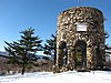 | February 14, 1986 (#86000260) | Stafford Hill Rd. 42°34′28″N 73°06′59″W / 42.5744°N 73.1164°W / 42.5744; -73.1164 (Stafford Hill Memorial) | Cheshire | |
| 153 | Stockbridge Casino |  | August 27, 1976 (#76000249) | E. Main St. at Yale Hill Rd. 42°16′56″N 73°18′06″W / 42.2822°N 73.3017°W / 42.2822; -73.3017 (Stockbridge Casino) | Stockbridge | |
| 154 | Summer Street Historic District |  | September 5, 1985 (#85002009) | Crandall, Center, East, Liberty, Orchard and Summer Sts. 42°37′07″N 73°07′01″W / 42.6186°N 73.1169°W / 42.6186; -73.1169 (Summer Street Historic District) | Adams | |
| 155 | Sykes House |  | October 25, 1985 (#85003420) | 521 W. Main St. 42°41′56″N 73°07′59″W / 42.6989°N 73.1331°W / 42.6989; -73.1331 (Sykes House) | North Adams | part of the North Adams MRA |
| 156 | Taconic and West Avenues Historic District |  | June 11, 1998 (#98000680) | Roughly bounded by Main St., Maple, West, and Taconic Aves., and Castle St. 42°11′27″N 73°22′05″W / 42.1908°N 73.3681°W / 42.1908; -73.3681 (Taconic and West Avenues Historic District) | Great Barrington | |
| 157 | Trinity Episcopal Church |  | April 4, 1996 (#96000363) | 102 Walker St. 42°21′16″N 73°16′56″W / 42.3544°N 73.2822°W / 42.3544; -73.2822 (Trinity Episcopal Church) | Lenox | |
| 158 | Tyringham Cemetery |  | September 16, 2009 (#09000716) | Church Rd. 42°14′34″N 73°12′05″W / 42.2427°N 73.2014°W / 42.2427; -73.2014 (Tyringham Cemetery) | Tyringham | |
| 159 | Tyringham Center School |  | November 5, 2020 (#100005764) | 2 Church Rd. 42°14′39″N 73°12′15″W / 42.2443°N 73.2042°W / 42.2443; -73.2042 (Tyringham Center School) | Tyringham | |
| 160 | Tyringham Library |  | January 11, 2018 (#100001960) | 118 Main Rd. 42°14′45″N 73°12′15″W / 42.2459°N 73.2042°W / 42.2459; -73.2042 (Tyringham Library) | Tyringham | |
| 161 | Tyringham Shaker Settlement Historic District |  | October 15, 1987 (#87001785) | Jerusalem Rd. 42°14′46″N 73°13′30″W / 42.2461°N 73.225°W / 42.2461; -73.225 (Tyringham Shaker Settlement Historic District) | Tyringham | |
| 162 | Upper Historic District |  | September 2, 1987 (#86002145) | Roughly between Branch and Frost Rds. on Washington Mountain Rd. 42°21′48″N 73°08′37″W / 42.3633°N 73.1436°W / 42.3633; -73.1436 (Upper Historic District) | Washington | part of the Washington MRA |
| 163 | Upper North Street Commercial District |  | December 27, 2002 (#02001615) | 220-555 North St., 33 Eagle St. 42°27′14″N 73°15′09″W / 42.4539°N 73.2525°W / 42.4539; -73.2525 (Upper North Street Commercial District) | Pittsfield | |
| 164 | US Post Office–Great Barrington Main |  | January 10, 1986 (#86000163) | 222 Main St. 42°11′47″N 73°21′40″W / 42.1963°N 73.3611°W / 42.1963; -73.3611 (US Post Office–Great Barrington Main) | Great Barrington | |
| 165 | US Post Office–Williamstown Main |  | July 17, 1986 (#86002243) | 56 Spring St. 42°42′38″N 73°12′14″W / 42.7106°N 73.2039°W / 42.7106; -73.2039 (US Post Office–Williamstown Main) | Williamstown | |
| 166 | Ventfort Hall |  | March 5, 1993 (#93000055) | 120 and 148 Walker St. and 55 Kemble St. 42°21′11″N 73°16′48″W / 42.3531°N 73.28°W / 42.3531; -73.28 (Ventfort Hall) | Lenox | |
| 167 | Villa Virginia |  | November 29, 1983 (#83003930) | Ice Glen Rd. 42°16′27″N 73°18′41″W / 42.2742°N 73.3114°W / 42.2742; -73.3114 (Villa Virginia) | Stockbridge | |
| 168 | Wahconah Park |  | August 12, 2005 (#05000878) | 143 Wahconah St. 42°27′45″N 73°15′05″W / 42.4626°N 73.2515°W / 42.4626; -73.2515 (Wahconah Park) | Pittsfield | |
| 169 | Wells House |  | October 25, 1985 (#85003393) | 568 W. Main St. 42°41′54″N 73°08′05″W / 42.6983°N 73.1347°W / 42.6983; -73.1347 (Wells House) | North Adams | part of the North Adams MRA |
| 170 | West Stockbridge Grange No. 246 |  | February 5, 1999 (#99000134) | 5 Swamp Rd. 42°20′09″N 73°22′07″W / 42.3358°N 73.3686°W / 42.3358; -73.3686 (West Stockbridge Grange No. 246) | West Stockbridge | |
| 171 | West Stockbridge Town Hall |  | July 1, 2009 (#09000469) | 9 Main St. 42°20′03″N 73°22′02″W / 42.3342°N 73.3671°W / 42.3342; -73.3671 (West Stockbridge Town Hall) | West Stockbridge | |
| 172 | Western Railroad Stone Arch Bridges and Chester Factory Village Depot |  | January 13, 2021 (#100006273) | Vicinity of Herbert Cross Road, Middlefield/Becket Line (Bridges and Roadbed); 10 Prospect Street (Depot) 42°18′20″N 73°00′19″W / 42.3055°N 73.0054°W / 42.3055; -73.0054 (Western Railroad Stone Arch Bridges and Chester Factory Village Depot) | Becket | Extends into Chester and Middlefield; includes a subset of the Middlefield-Becket Stone Arch Railroad Bridge District. |
| 173 | Westover–Bacon–Potts Farm |  | July 27, 1990 (#90000157) | MA 41, south of its junction with MA 23 42°08′53″N 73°25′01″W / 42.1481°N 73.4169°W / 42.1481; -73.4169 (Westover–Bacon–Potts Farm) | Egremont | |
| 174 | Wheatleigh |  | April 6, 1982 (#82004956) | W. Hawthorne Rd. 42°20′27″N 73°18′14″W / 42.3408°N 73.3039°W / 42.3408; -73.3039 (Wheatleigh) | Stockbridge | |
| 175 | Wheeler Family Farmstead |  | September 6, 2011 (#11000614) | 817 S. Main St. 42°10′43″N 73°21′46″W / 42.1786°N 73.3628°W / 42.1786; -73.3628 (Wheeler Family Farmstead) | Great Barrington | |
| 176 | Williamstown Rail Yard and Station Historic District |  | June 3, 1994 (#94000544) | Junction of Cole Ave. and N. Hoosac Rd. 42°43′11″N 73°11′25″W / 42.7197°N 73.1903°W / 42.7197; -73.1903 (Williamstown Rail Yard and Station Historic District) | Williamstown | |
| 177 | Windsor Print Works |  | May 17, 1973 (#73000296) | 121 Union St. 42°42′02″N 73°06′18″W / 42.7006°N 73.105°W / 42.7006; -73.105 (Windsor Print Works) | North Adams | |
| 178 | Wollison–Shipton Building |  | September 30, 1982 (#82001899) | 142-156 North St. 42°27′02″N 73°15′12″W / 42.4506°N 73.2533°W / 42.4506; -73.2533 (Wollison–Shipton Building) | Pittsfield |
See also
Wikimedia Commons has media related to National Register of Historic Places in Berkshire County, Massachusetts.
- List of National Historic Landmarks in Massachusetts
- National Register of Historic Places listings in Massachusetts
References
- ^ The latitude and longitude information provided in this table was derived originally from the National Register Information System, which has been found to be fairly accurate for about 99% of listings. Some locations in this table may have been corrected to current GPS standards.
- ^ National Park Service, United States Department of the Interior, "National Register of Historic Places: Weekly List Actions", retrieved April 12, 2024.
- ^ Numbers represent an alphabetical ordering by significant words. Various colorings, defined here, differentiate National Historic Landmarks and historic districts from other NRHP buildings, structures, sites or objects.
- ^ The eight-digit number below each date is the number assigned to each location in the National Register Information System database, which can be viewed by clicking the number.
- ^ "MACRIS inventory record for Dalton Grange". Commonwealth of Massachusetts. Retrieved 2013-12-02.
- ^ http://mhc-macris.net/Details.aspx?MhcId=PIT.55 [bare URL]
- ^ Johnson, Patrick (December 16, 2019). "Suspicious fire in Mt. Washington claims Osborn House, historic 1750s cabin where Mother Ann Lee, leader of Shakers, once stayed". Springfield Republican. Springfield, MA. Retrieved 17 December 2019.
- v
- t
- e

| Barnstable County | |
|---|---|
| Bristol County | |
| Essex County | |
| Hampden County | |
| Middlesex County | |
| Norfolk County | |
| Suffolk County | |
| Worcester County |
 Category
 National Register of Historic Places portal
 United States portal


Municipalities and communities of Berkshire County, Massachusetts, United States | ||
|---|---|---|
County seat: Pittsfield | ||
| Cities |  | |
| Towns | ||
| CDPs |
| |
| Other villages | ||
| ||


