National Register of Historic Places listings in McCreary County, Kentucky

This is a list of the National Register of Historic Places listings in McCreary County, Kentucky.
It is intended to be a complete list of the properties on the National Register of Historic Places in McCreary County, Kentucky, United States. The locations of National Register properties for which the latitude and longitude coordinates are included below, may be seen in a map.[1]
There are 3 properties listed on the National Register in the county.
This National Park Service list is complete through NPS recent listings posted September 5, 2024.[2]
Map all coordinates using OpenStreetMap
Download coordinates as:
- KML
- GPX (all coordinates)
- GPX (primary coordinates)
- GPX (secondary coordinates)
Current listings
| [3] | Name on the Register | Image | Date listed[4] | Location | City or town | Description |
|---|---|---|---|---|---|---|
| 1 | Barren Fork Coal Camp and Mine Archeological District | 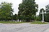 | September 23, 1997 (#97001125) | Barren Fork Rd., north of Whitley City[5] 36°46′39″N 84°28′07″W / 36.777500°N 84.468611°W / 36.777500; -84.468611 (Barren Fork Coal Camp and Mine Archeological District) | Whitley City | |
| 2 | Stearns Administrative and Commercial District |  | November 16, 1988 (#88002528) | Old U.S. Route 27 36°41′55″N 84°28′36″W / 36.698611°N 84.476667°W / 36.698611; -84.476667 (Stearns Administrative and Commercial District) | Stearns | Includes the McCreary County Museum |
| 3 | Stearns Golf Course | Upload image | September 29, 2015 (#15000654) | 131 Clubhouse Dr. 36°42′07″N 84°28′37″W / 36.7020°N 84.4770°W / 36.7020; -84.4770 (Stearns Golf Course) | Stearns |
See also
Wikimedia Commons has media related to National Register of Historic Places in McCreary County, Kentucky.
- List of National Historic Landmarks in Kentucky
- National Register of Historic Places listings in Kentucky
References
- ^ The latitude and longitude information provided in this table was derived originally from the National Register Information System, which has been found to be fairly accurate for about 99% of listings. Some locations in this table may have been corrected to current GPS standards.
- ^ National Park Service, United States Department of the Interior, "National Register of Historic Places: Weekly List Actions", retrieved September 5, 2024.
- ^ Numbers represent an alphabetical ordering by significant words. Various colorings, defined here, differentiate National Historic Landmarks and historic districts from other NRHP buildings, structures, sites or objects.
- ^ The eight-digit number below each date is the number assigned to each location in the National Register Information System database, which can be viewed by clicking the number.
- ^ Daniel Boone National Forest. Barren Fork Accessible Heritage Trail #621. United States Department of Agriculture, 2014-05-29. Accessed 2014-07-14.
- v
- t
- e
- List of U.S. National Historic Landmarks by state:
- Alabama
- Alaska
- Arizona
- Arkansas
- California
- Colorado
- Connecticut
- Delaware
- Florida
- Georgia
- Hawaii
- Idaho
- Illinois
- Indiana
- Iowa
- Kansas
- Kentucky
- Louisiana
- Maine
- Maryland
- Massachusetts
- Michigan
- Minnesota
- Mississippi
- Missouri
- Montana
- Nebraska
- Nevada
- New Hampshire
- New Jersey
- New Mexico
- New York
- North Carolina
- North Dakota
- Ohio
- Oklahoma
- Oregon
- Pennsylvania
- Rhode Island
- South Carolina
- South Dakota
- Tennessee
- Texas
- Utah
- Vermont
- Virginia
- Washington
- West Virginia
- Wisconsin
- Wyoming
 National Register of Historic Places portal
 Category


Municipalities and communities of McCreary County, Kentucky, United States | ||
|---|---|---|
County seat: Whitley City | ||
| CDPs |  | |
| Other communities | ||
| ||


