Pirita | |
|---|---|
District of Tallinn | |
 Pirita from above | |
 Flag  Coat of arms | |
 Location of Pirita in Tallinn. | |
| Coordinates: 59°28′01″N 24°49′58″E / 59.46694°N 24.83278°E | |
| Country | Estonia |
| County | Harju County |
| City | Tallinn |
| Government | |
| • District Elder | Doris Raudsepp (Reform Party) |
| Area | |
• Total | 18.7 km2 (7.2 sq mi) |
| Population (1 August 2025[1]) | |
• Total | 19,746 |
| • Density | 1,100/km2 (2,700/sq mi) |
| Website | tallinn.ee |
Pirita is one of the eight administrative districts (Estonian: linnaosa) of Tallinn, the capital of Estonia.
Pirita occupies a relatively large area, but compared to other districts of Tallinn its population of 19,746 (as of 1 August 2025) is relatively small. It mostly consists of private houses instead of the large blocks of flats typical of some other districts of Tallinn, such as Lasnamäe and Mustamäe. Large parts of the district consist of newly built modern buildings and houses. Pirita Beach is located in Pirita.
Pirita is one of the most prestigious and wealthiest districts of Tallinn,[2] partly thanks to natural features such as its beach and yachting harbour. Pirita Beach is the largest in Tallinn, and in the summer it can attract up to 30,000 visitors a day.
Population
[edit]Pirita has a population of 19,746 (As of 1 August 2025[update]).[1]
| Ethnicity | 1989[3] | 2000[3] | 2011[4] | 2021[5] | ||||
|---|---|---|---|---|---|---|---|---|
| amount | % | amount | % | amount | % | amount | % | |
| Estonians | 7210 | 86.3 | 8856 | 88.9 | 12667 | 78.4 | 12402 | 71.5 |
| Russians | 810 | 9.70 | 746 | 7.49 | 2732 | 16.9 | 3531 | 20.3 |
| Ukrainians | - | - | - | - | 203 | 1.26 | 369 | 2.13 |
| Belarusians | - | - | - | - | 79 | 0.49 | 128 | 0.74 |
| Finns | - | - | - | - | 103 | 0.64 | 122 | 0.70 |
| Jews | - | - | - | - | 77 | 0.48 | 68 | 0.39 |
| Latvians | - | - | - | - | 22 | 0.14 | 49 | 0.28 |
| Germans | - | - | - | - | 22 | 0.14 | 35 | 0.20 |
| Tatars | - | - | - | - | 17 | 0.11 | 23 | 0.13 |
| Poles | - | - | - | - | 11 | 0.07 | 27 | 0.16 |
| Lithuanians | - | - | - | - | 23 | 0.14 | 44 | 0.25 |
| unknown | 0 | 0.00 | 44 | 0.44 | 34 | 0.21 | 98 | 0.56 |
| other | 330 | 3.95 | 316 | 3.17 | 175 | 1.08 | 458 | 2.64 |
| Total | 8350 | 100 | 9962 | 100 | 16165 | 100 | 17354 | 100 |
| Year | 2004 | 2005 | 2006 | 2007 | 2008 | 2009 | 2010 | 2011 | 2012 | 2013 | 2014 |
|---|---|---|---|---|---|---|---|---|---|---|---|
| Population | 10,388 | 11,299 | 12,277 | 13,235 | 14,039 | 14,595 | 15,135 | 15,567 | 16,636 | 17,019 | 17,373 |
Subdistricts
[edit]Pirita is divided into 9 subdistricts (Estonian: asum): Iru, Kloostrimetsa, Kose, Laiaküla, Lepiku, Maarjamäe, Merivälja, Mähe, and Pirita.
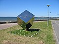
Landmarks
[edit]- Pirita monastery
- Tallinn TV Tower
- Tallinn Botanic Garden
- Pirita Yachting Centre
- Pirita Beach
- Metsakalmistu cemetery
- Pärnamäe cemetery
- Pirita Velodrome
Gallery
[edit]-

-
 Maarjamäe War Memorial
 -
 Monument to Michael Park
 -
 Pirita Beach
 -
 Pirita Beach
 -

-
 Academy of Internal Defence
 -
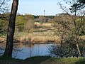 Pirita Forest
 -
 Cycle track
 -

.jpg)


References
[edit]- ^ a b "Tallinna elanike arv" (in Estonian). Tallinn City Government. Retrieved 27 November 2014.
- ^ "Millist piirkonda eelistavad rikkad inimesed?".
- ^ a b 2000. aasta rahva ja eluruumide loendus (PDF) (in Estonian and English). Tallinn: Statistikaamet. 2001. pp. 69, 78. ISBN 9985-74-167-6.
- ^ "RL0429: RAHVASTIK RAHVUSE, SOO, VANUSERÜHMA JA ELUKOHA JÄRGI, 31. DETSEMBER 2011". Estonian Statistical Database (in Estonian).
- ^ "RL21429: RAHVASTIK RAHVUSE, SOO, VANUSERÜHMA JA ELUKOHA (HALDUSÜKSUS) JÄRGI, 31. DETSEMBER 2021". Estonian Statistical Database (in Estonian).
External links
[edit]Administrative districts (linnaosad) and subdistricts (asumid) of Tallinn | ||
|---|---|---|
| Haabersti |  | |
| Kesklinn | ||
| Kristiine | ||
| Lasnamäe | ||
| Mustamäe | ||
| Nõmme | ||
| Pirita | ||
| Põhja-Tallinn | ||