Shikaoi, Hokkaido
You can help expand this article with text translated from the corresponding article in Japanese. (June 2022) Click [show] for important translation instructions.
- Machine translation, like DeepL or Google Translate, is a useful starting point for translations, but translators must revise errors as necessary and confirm that the translation is accurate, rather than simply copy-pasting machine-translated text into the English Wikipedia.
- Consider adding a topic to this template: there are already 3,701 articles in the main category, and specifying
|topic=will aid in categorization. - Do not translate text that appears unreliable or low-quality. If possible, verify the text with references provided in the foreign-language article.
- You must provide copyright attribution in the edit summary accompanying your translation by providing an interlanguage link to the source of your translation. A model attribution edit summary is
Content in this edit is translated from the existing Japanese Wikipedia article at [[:ja:鹿追町]]; see its history for attribution. - You may also add the template
{{Translated|ja|鹿追町}}to the talk page. - For more guidance, see Wikipedia:Translation.
Town in Hokkaido, Japan
Shikaoi  Flag  | |
|---|---|
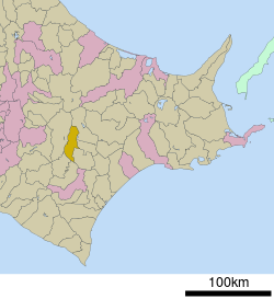 Location of Shikaoi in Hokkaido (Tokachi Subprefecture) | |
| 43°6′N 142°59′E / 43.100°N 142.983°E / 43.100; 142.983 | |
| Country | Japan |
| Region | Hokkaido |
| Prefecture | Hokkaido (Tokachi Subprefecture) |
| District | Katō |
| Area | |
| • Total | 399.69 km2 (154.32 sq mi) |
| Population (September 30, 2016) | |
| • Total | 5,570 |
| • Density | 14/km2 (36/sq mi) |
| Time zone | UTC+09:00 (JST) |
| Climate | Dfb |
| Website | www |
Shikaoi (鹿追町, Shikaoi-chō) is a town located in Tokachi Subprefecture, Hokkaido, Japan. The name "Shikaoi" means "Following (hunting) deer".
As of September 2016, the town has an estimated population of 5,570 and a density of 14 persons per km2. The total area is 399.69 km2. There are several towns around Shikaoi including Shimizu, Shintoku, and Shihoro
History
Shikaoi's beginning can be traced back to 1902, when Mr. Yamada of Tokyo settled into what is now the main street of Shikaoi. By 1913, a train station opened up the flow of settlers from Honshu. Not long after this, a post office, a police station and several small restaurants opened.
In 1920, the population of Shikaoi was 4,526 people (822 families). In April 1921, it became the Shikaoi village. Kasai Railway was laid in 1923 to aid the transporting of beets from the region. Also, general cargo and passenger transport were permitted in May 1925. A big role was played for industrial development of Shikaoi by the upgrading a network of roads and railway.
The population increased rapidly by the settlement of Japan Self-Defense Forces Stationing Grounds after the World War. (Population of 10,448 people, 1,970 families in the 1960 census). The Shikaoi region and Shikaoi Town came together in 1959.
After a peak population of 10,778 people in 1961, it decreased gradually by the influence of cold-weather damage to agriculture. But after 1993, it became stable with many efforts, including improved agriculture.
In 1984, Shikaoi began a sister town relationship with Stony Plain, Alberta, Canada.[1] Since that time, ongoing exchange programs have kept the relationship strong. The exchange program has also provided Shikaoi the opportunity to advance by visiting ideas gathered during exchanges.
Climate
| Climate data for Shikaoi (1991−2020 normals, extremes 1978−present) | |||||||||||||
|---|---|---|---|---|---|---|---|---|---|---|---|---|---|
| Month | Jan | Feb | Mar | Apr | May | Jun | Jul | Aug | Sep | Oct | Nov | Dec | Year |
| Record high °C (°F) | 7.1 (44.8) | 11.4 (52.5) | 16.9 (62.4) | 27.8 (82.0) | 36.5 (97.7) | 36.0 (96.8) | 35.1 (95.2) | 35.7 (96.3) | 34.0 (93.2) | 25.1 (77.2) | 19.9 (67.8) | 14.2 (57.6) | 36.5 (97.7) |
| Mean daily maximum °C (°F) | −2.5 (27.5) | −1.7 (28.9) | 2.9 (37.2) | 10.4 (50.7) | 16.9 (62.4) | 20.4 (68.7) | 23.3 (73.9) | 24.3 (75.7) | 20.8 (69.4) | 14.5 (58.1) | 6.9 (44.4) | −0.2 (31.6) | 11.3 (52.4) |
| Daily mean °C (°F) | −6.7 (19.9) | −6.2 (20.8) | −1.6 (29.1) | 5.0 (41.0) | 11.0 (51.8) | 14.8 (58.6) | 18.5 (65.3) | 19.6 (67.3) | 15.9 (60.6) | 9.5 (49.1) | 2.8 (37.0) | −3.9 (25.0) | 6.6 (43.8) |
| Mean daily minimum °C (°F) | −11.9 (10.6) | −11.8 (10.8) | −6.5 (20.3) | −0.2 (31.6) | 5.5 (41.9) | 10.1 (50.2) | 14.5 (58.1) | 15.6 (60.1) | 11.5 (52.7) | 4.7 (40.5) | −1.3 (29.7) | −8.2 (17.2) | 1.8 (35.3) |
| Record low °C (°F) | −26.3 (−15.3) | −25.2 (−13.4) | −21.3 (−6.3) | −12.4 (9.7) | −4.3 (24.3) | 0.0 (32.0) | 4.6 (40.3) | 6.2 (43.2) | 1.4 (34.5) | −3.9 (25.0) | −12.4 (9.7) | −19.0 (−2.2) | −26.3 (−15.3) |
| Average precipitation mm (inches) | 34.1 (1.34) | 27.7 (1.09) | 41.5 (1.63) | 54.4 (2.14) | 83.9 (3.30) | 81.9 (3.22) | 128.7 (5.07) | 168.4 (6.63) | 141.7 (5.58) | 88.2 (3.47) | 56.5 (2.22) | 45.9 (1.81) | 952.8 (37.51) |
| Average precipitation days (≥ 1.0 mm) | 6.7 | 6.3 | 8.0 | 9.0 | 9.8 | 10.3 | 12.4 | 12.7 | 11.7 | 9.9 | 9.2 | 8.2 | 114.2 |
| Mean monthly sunshine hours | 153.0 | 152.5 | 189.4 | 181.4 | 176.2 | 133.8 | 113.7 | 119.8 | 139.9 | 160.6 | 140.2 | 133.6 | 1,794.3 |
| Source: JMA[2][3] | |||||||||||||
References
External links
 Media related to Shikaoi, Hokkaidō at Wikimedia Commons
- Official Website (in Japanese)
| ||||||||||||
|---|---|---|---|---|---|---|---|---|---|---|---|---|
|  | |||||||||||
|
| ||||||||||||
| ||||||||||||
| ||||||||||||
| ||||||||||||
| ||||||||||||
| ||||||||||||
| ||||||||||||
| ||||||||||||
| ||||||||||||
| ||||||||||||
| ||||||||||||
| ||||||||||||

Authority control databases | |
|---|---|
| International |
|
| National |
|
 | This Hokkaidō location article is a stub. You can help Wikipedia by expanding it. |
- v
- t
- e


