Steeton, West Yorkshire
Village in West Yorkshire, England
Human settlement in England
- Steeton with Eastburn
- City of Bradford
- West Yorkshire
- Keighley
Steeton is a village in the City of Bradford metropolitan borough, West Yorkshire, England. Historically part of the West Riding of Yorkshire, it is situated approximately 5 miles (8 km) south-east from Skipton, 3 miles (5 km) north-west from Keighley and just south of the A629 road. The village is part of Steeton with Eastburn civil parish.
History
The village is mentioned in the Domesday book along with Eastburn, Grassington, Linton and Threshfield as belonging to Gamelbar.[2]
In 1752–53 the Keighley and Kendal Turnpike[3] followed Hollins Bank Road with the toll bar situated at the bottom of Steeton Bank. An inn named the “Pack Horse” was located nearby.[4]
The first toll gate on the turnpike was set up in 1753 at "Steeton Cross" at the foot of the hill. When the new road past Hawkcliffe Farm was made, the bar was removed to what is now called "Old Bar-house" to intercept the traffic by Old Bar-house Lane as well as that by the new road.[5]

Numbers 14–20 High Street, during the second half of the 18th century, used to be an inn called the "Star", but its licence and name were moved to a new building at the road junction on the main turnpike road to the north, the present A629.[6]: p.24 The pub was called the "Old Star" as seen on Google Maps Street View and is on the OLD A629, on the corner of that road and Station Road. The Old Star closed in 2014 and was subsequently converted into 3 houses.
Numbers 44 and 46 Upper School Street, built in the Queen Anne period, during the 1770s became the "Goat’s Head" on the original route of the Keighley to Kendal turnpike down. Following its realignment the inn's name and licence was moved to its present building opposite the Station Road junction. The second location, with quoined angles, gable stacks and integral canted bay windows, was probably built as a farmhouse in the mid-18th century.[6]: p.25
A rare two-storey Second World War pillbox in the village was listed by English Heritage for protection status in 2010. the pillbox along with two others on the site, was constructed as a defence for the former Royal Ordnance Factory that operated in the village during the Second World War.[7] The plant opened in 1940 and produced over 200 million munition components before the end of the war.[8]
Governance
The village is part of the civil parish of Steeton with Eastburn. The parish is part of the Craven ward of the Metropolitan borough of the City of Bradford, part of the Metropolitan county of West Yorkshire.[9]
Population
According to the 2011 census, 4,375 people were resident in the Steeton with Eastburn civil parish.[1]
Facilities
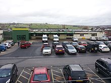
The village has a major hospital, (Airedale General Hospital), a Pie Shop, a news agency, three hair dressing saloons, a fruit shop, a Chinese takeaway, a transport cafe, two parks, a public house, a bowling green, a war memorial, two village greens, a football pitch, a cricket pitch, a graveyard, a primary school, an hotel, a Church of England church and a Methodist church. A Morrisons local store was also opened in the village in May 2014, but this became a My Local store when Morrisons withdrew from the village.[10] Since then the site of the old Morrisons has become a Co-op Food store.
Education
Steeton Primary School is the village primary school which formed in 1851,[11] which also has an intake of pupils from the Keighley area. Children in the west of the village may also attend Eastburn Infant & Junior School in the bordering village of Eastburn. For secondary education, most children attend South Craven School in Cross Hills, with grammar school students attending either Ermysted's Grammar School or Skipton Girls' High School, both in Skipton.
Transport
Buses from Keighley and district pass through every seven minutes. Steeton and Silsden railway station, which also serves the neighbouring town of Silsden, lies on the outskirts of the village .
References
- ^ a b UK Census (2011). "Local Area Report – Steeton with Eastburn Parish (1170210962)". Nomis. Office for National Statistics. Retrieved 1 November 2018.
- ^ Powell-Smith, Anna. "Steeton Domesday Book". opendomesday.org. Retrieved 26 January 2016.
- ^ "On the Move" (PDF). NCBPT. North Craven Building Preservation Trust. Retrieved 26 January 2016.
- ^ Gray, Johnny (1891). Through Airedale from Goole to Malham. Leeds. p. 199. Retrieved 26 January 2016.
{{cite book}}: CS1 maint: location missing publisher (link) - ^ Brigg, John J (1927). The King's Highway in Craven, with sketch maps.
- ^ a b "Steeton Conservation Area Assessment" (PDF). Transportation Planning and Design Department, the City of Bradford Metropolitan District Council. Retrieved 18 October 2012.
- ^ "Heritage campaigners save rare World War Two pillbox". Craven Herald. 2 January 2010. Retrieved 26 January 2016.
- ^ Young, Chris (16 September 2023). "Wartime weapons casings add to cost of new rail park-and-ride". The Yorkshire Post. p. 20. ISSN 0963-1496.
- ^ "Craven". 2010. Retrieved 28 January 2014.
- ^ "My Local opens its doors". Yorkshire Post. 26 October 2015. Retrieved 26 January 2016.
- ^ "Treasures reveal 100 years of history". Keighley News. 14 June 2008. Retrieved 26 January 2016.
External links
![]() Media related to Steeton at Wikimedia Commons
Media related to Steeton at Wikimedia Commons
- Steeton.net
- Steeton at Curlie.
- v
- t
- e
villages,
areas
and wards
- Addingham
- Allerton
- Apperley Bridge
- Baildon
- Barkerend
- Belle Vue
- Ben Rhydding
- Bingley
- Bingley Rural
- Bingley ward
- Bolton and Undercliffe
- Bowling and Barkerend
- Bradford
- Bradford Moor
- Broomfields
- Burley in Wharfedale
- Burley Woodhead
- Buttershaw
- City of Bradford
- City ward
- Clayton
- Cottingley
- Craven ward
- Crossflatts
- Cross Roads
- Cullingworth
- Cutler Heights
- Denholme
- Dudley Hill
- East Morton
- East Bowling
- Eastburn
- Eccleshill
- Egypt
- Eldwick
- Esholt
- Frizinghall
- Forster Square
- Gilstead
- Girlington
- Great Horton
- Greengates
- Hainworth
- Harden
- Haworth
- Haworth, Cross Roads and Stanbury
- Heaton
- Holme Wood
- Idle
- Idle and Thackley
- Ilkley
- Ingrow
- Keighley
- Keighley Central
- Keighley East
- Keighley West
- Laisterdyke
- Laycock
- Little Germany
- Little Horton
- Long Lee
- Longlands
- Low Moor
- Lumbfoot
- Manningham
- Menston
- Oakenshaw
- Oakworth
- Odsal
- Oldfield
- Oxenhope
- Queensbury
- Ravenscliffe
- Riddlesden
- Royds
- Ryecroft
- Saltaire
- Sandy Lane
- Shipley
- Silsden
- Staithgate
- Stanbury
- Steeton
- Steeton with Eastburn
- Thackley
- Thornbury
- Thornton
- Thornton and Allerton
- Thorpe Edge
- Toller
- Tong ward
- Tong village
- Trident
- Tyersal
- Wharfedale ward
- Wibsey
- Wilsden
- Windhill and Wrose
- Worth Valley
- Wrose
- Wyke
- Bradford-Keighley Youth Parliament
- City of Bradford Metropolitan District Council
- Constituencies
- Council
- Councillors
- Parishes
- Politics
- Wards
Leisure and
Tourism
| Education | |
|---|---|
| Health |
| Publishing | |
|---|---|
| Radio |
|
| TV |
| Clubs |
|
|---|---|
| Venues |
|
| Rivers | |
|---|---|
| Canals | |
| Crossings |
| Air | |
|---|---|
| Rail |
|
| Bus | |
| Road |
- Crime
- History
- Military
- Postcodes
- Timeline
- People
- Geology
- Aire Valley Fault
- Denholme Clough Fault
 Category
| Authority control databases: Geographic |
|
|---|


