Subprefecture of Santo Amaro
Subprefecture in Southeast, Brazil
Subprefecture of Santo Amaro | |
|---|---|
Subprefecture | |
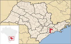
 Location of the Subprefecture of Santo Amaro in São Paulo | |
 Location of municipality of São Paulo within the State of São Paulo | |
| Country |  Brazil Brazil |
| Region | Southeast |
| State |  São Paulo São Paulo |
| Municipality |  São Paulo São Paulo |
| Administrative Zone | South-Central |
| Districts | Santo Amaro, Campo Belo, Campo Grande |
| Government | |
| • Type | Subprefecture |
| • Subprefect | Ailton Araujo Brandão |
| Area | |
| • Total | 37.8 km2 (14.6 sq mi) |
| Population (2005) | |
| • Total | 207,421 |
| Website | Subprefeitura Santo Amaro (Portuguese) |
The Subprefecture of Santo Amaro is one of 32 subprefectures of the city of São Paulo, Brazil. It comprises three districts: Santo Amaro, Campo Belo, and Campo Grande.[1]
Once part of an independent municipality, this subprefecture hosts the Congonhas Airport, the Apple Store of São Paulo and the Brazilian headquarters of many companies such as Deloitte, SAP, Oracle, KPMG, Cargill, Electrolux and PepsiCo, as well as the Brazilian companies Banco Votorantim, NET and Vivo. This subprefecture also features many theatres and concert halls and has the famous cable-stayed Octávio Frias de Oliveira Bridge, one of the landmarks of São Paulo, connecting it to the subprefecture of Butantã, in the other side of the river.
See also
References
- ^ Official Subprefecture Website (Portuguese) Archived 2011-01-27 at the Wayback Machine
External links
- Roman Catholic Diocese of Santo Amaro
- v
- t
- e

- Aricanduva
- Butantã
- Campo Limpo
- Capela do Socorro
- Casa Verde
- Cidade Ademar
- Cidade Tiradentes
- Ermelino Matarazzo
- Freguesia-Brasilândia
- Guaianases
- Ipiranga
- Itaim Paulista
- Itaquera
- Jabaquara
- Jaçanã-Tremembé
- Lapa
- M'Boi Mirim
- Mooca
- Parelheiros
- Penha
- Perus
- Pinheiros
- Pirituba-Jaraguá
- Santana-Tucuruvi
- Santo Amaro
- São Mateus
- São Miguel Paulista
- Sé
- Sapopemba
- Vila Maria-Vila Guilherme
- Vila Mariana
- Vila Prudente
- Água Rasa
- Alto de Pinheiros
- Anhanguera
- Aricanduva
- Artur Alvim
- Barra Funda
- Bela Vista
- Belém
- Bom Retiro
- Brasilândia
- Brás
- Butantã
- Cachoeirinha
- Cambuci
- Campo Belo
- Campo Grande
- Campo Limpo
- Cangaíba
- Capão Redondo
- Carrão
- Casa Verde
- Cidade Ademar
- Cidade Dutra
- Cidade Líder
- Cidade Tiradentes
- Consolação
- Cursino
- Ermelino Matarazzo
- Freguesia do Ó
- Grajaú
- Guaianases
- Iguatemi
- Ipiranga
- Itaim Bibi
- Itaim Paulista
- Itaquera
- Jabaquara
- Jaçanã
- Jaguara
- Jaguaré
- Jaraguá
- Jardim Helena
- Jardim Paulista
- Jardim São Luís
- Jardim Ângela
- José Bonifácio
- Lajeado
- Lapa
- Liberdade
- Limão
- Mandaqui
- Marsilac
- Moema
- Mooca
- Morumbi
- Parelheiros
- Pari
- Parque do Carmo
- Pedreira
- Penha
- Perdizes
- Perus
- Pinheiros
- Pirituba
- Ponte Rasa
- Raposo Tavares
- República
- Rio Pequeno
- Sacomã
- Santa Cecília
- Santana
- Santo Amaro
- São Domingos
- São Lucas
- São Mateus
- São Miguel Paulista
- São Rafael
- Saúde
- Sapopemba
- Sé
- Socorro
- Tatuapé
- Tremembé
- Tucuruvi
- Vila Andrade
- Vila Curuçá
- Vila Formosa
- Vila Guilherme
- Vila Jacuí
- Vila Leopoldina
- Vila Maria
- Vila Mariana
- Vila Matilde
- Vila Medeiros
- Vila Prudente
- Vila Sônia
23°39′S 46°42′W / 23.650°S 46.700°W / -23.650; -46.700
 | This geographical article relating to the state of São Paulo is a stub. You can help Wikipedia by expanding it. |
- v
- t
- e


