Vestre Gausdal
Former municipality in Oppland, Norway
Former municipality in Oppland, Norway
Vestre Gausdal Municipality Vestre Gausdal herred | |
|---|---|
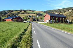 View of the Bødalen area in Vestre Gausdal | |
 Oppland within Norway | |
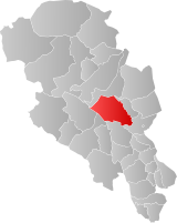 Vestre Gausdal within Oppland | |
| Coordinates: 61°12′N 10°09′E / 61.2°N 10.15°E / 61.2; 10.15 | |
| Country | Norway |
| County | Oppland |
| District | Gudbrandsdal |
| Established | 1879 |
| • Preceded by | Gausdal Municipality |
| Disestablished | 1 Jan 1962 |
| • Succeeded by | Gausdal Municipality |
| Administrative centre | Forset |
| Area (upon dissolution) | |
| • Total | 959 km2 (370 sq mi) |
| Population (1962) | |
| • Total | 2,590 |
| • Density | 2.7/km2 (7.0/sq mi) |
| Demonym | Gausdøl[1] |
| Time zone | UTC+01:00 (CET) |
| • Summer (DST) | UTC+02:00 (CEST) |
| ISO 3166 code | NO-0523[2] |
Data from Statistics Norway | |
Vestre Gausdal is a former municipality in the old Oppland county, Norway. The 959-square-kilometre (370 sq mi) municipality[3] existed from 1879 until its dissolution in 1962. The area is now part of Gausdal Municipality. The administrative centre was the village of Forset.[4]
History
In 1879, the large Gausdal Municipality was divided into two separate municipalities: Vestre Gausdal (population: 2,362) and Østre Gausdal (population: 5,911). Vestre Gausdal Municipality included the larger, more rural parts of the old municipality and Østre Gausdal was much smaller and more densely populated and it was located in the southwestern part of the old municipality. During the 1950s, there was a boundary dispute between the neighboring municipalities of Vestre Gausdal and Sør-Fron. On 27 July 1956, a land court determined the final boundary between the two municipalities and a small part of Vestre Gausdal (population: 7) was transferred to the neighboring Sør-Fron Municipality.[5] During the 1960s, there were many municipal mergers across Norway due to the work of the Schei Committee. On 1 January 1962, the two municipalities of Vestre Gausdal (population: 2,590) and Østre Gausdal (population: 3,942) were reunited as Gausdal Municipality.[6]
Name
When the large Gausdal Municipality was divided into two new municipalities in 1879, the western part was given the prefix vestre which means "western". The municipality is named after the Gausdalen valley (Old Norse: Gausdalr) since the municipality is located in the valley. The first element is named after the river Gausa which flows through the valley. The river name comes from the verb gjósa which means to "gush", "burst out", or "stream forcefully". The last element is dalr which means "valley" or "dale".[7]
Government
While it existed, this municipality was responsible for primary education (through 10th grade), outpatient health services, senior citizen services, unemployment, social services, zoning, economic development, and municipal roads. During its existence, this municipality was governed by a municipal council of directly elected representatives. The mayor was indirectly elected by a vote of the municipal council.[8]
Municipal council
The municipal council (Herredsstyre) of Vestre Gausdal was made up of representatives that were elected to four year terms. The party breakdown of the final municipal council was as follows:
| Party name (in Norwegian) | Number of representatives | |
|---|---|---|
| Labour Party (Arbeiderpartiet) | 12 | |
| Centre Party (Senterpartiet) | 7 | |
| Liberal Party (Venstre) | 2 | |
| Total number of members: | 21 | |
| Party name (in Norwegian) | Number of representatives | |
|---|---|---|
| Labour Party (Arbeiderpartiet) | 10 | |
| Farmers' Party (Bondepartiet) | 6 | |
| Liberal Party (Venstre) | 5 | |
| Total number of members: | 21 | |
| Party name (in Norwegian) | Number of representatives | |
|---|---|---|
| Labour Party (Arbeiderpartiet) | 15 | |
| Farmers' Party (Bondepartiet) | 8 | |
| Liberal Party (Venstre) | 1 | |
| Total number of members: | 24 | |
| Party name (in Norwegian) | Number of representatives | |
|---|---|---|
| Labour Party (Arbeiderpartiet) | 15 | |
| Farmers' Party (Bondepartiet) | 9 | |
| Total number of members: | 24 | |
| Party name (in Norwegian) | Number of representatives | |
|---|---|---|
| Labour Party (Arbeiderpartiet) | 15 | |
| Farmers' Party (Bondepartiet) | 7 | |
| Joint list of the Liberal Party (Venstre) and the Radical People's Party (Radikale Folkepartiet) | 2 | |
| Total number of members: | 24 | |
| Party name (in Norwegian) | Number of representatives | |
|---|---|---|
| Labour Party (Arbeiderpartiet) | 13 | |
| Radical People's Party (Radikale Folkepartiet) | 1 | |
| Farmers' Party (Bondepartiet) | 8 | |
| Local List(s) (Lokale lister) | 2 | |
| Total number of members: | 24 | |
| Note: Due to the German occupation of Norway during World War II, no elections were held for new municipal councils until after the war ended in 1945. | ||
Mayors
This list is incomplete; you can help by adding missing items. (May 2023) |
The mayors of Vestre Gausdal (incomplete list):
- 1945-1956: Hans Høistad (Ap)
- 1956-1957: Hans Krag Sandberg (RF)
- 1958-1959: Magnus Saghaugen (Ap)
- 1960-1961: Jørgen Johansen (Ap)
See also
References
- ^ "Navn på steder og personer: Innbyggjarnamn" (in Norwegian). Språkrådet.
- ^ Bolstad, Erik; Thorsnæs, Geir, eds. (26 January 2023). "Kommunenummer". Store norske leksikon (in Norwegian). Kunnskapsforlaget.
- ^ Helland, Amund (1913). "Østre Gausdal herred". V Kristians amt. Tredie del. Norges land og folk (in Norwegian). Kristiania, Norway: H. Aschehoug & Company. p. 399. Retrieved 18 July 2022.
- ^ Thorsnæs, Geir, ed. (8 February 2022). "Vestre Gausdal (tidligere kommune)". Store norske leksikon (in Norwegian). Kunnskapsforlaget. Retrieved 18 July 2022.
- ^ "Forskrift om grensefastsettelse, Sør-Fron og Vestre Gausdal kommuner, Oppland". Lovdata.no (in Norwegian). 27 July 1956. Retrieved 18 July 2022.
- ^ Jukvam, Dag (1999). Historisk oversikt over endringer i kommune- og fylkesinndelingen (PDF) (in Norwegian). Statistisk sentralbyrå. ISBN 9788253746845.
- ^ Rygh, Oluf (1900). Norske gaardnavne: Kristians amt (første halvdel) (in Norwegian) (4 ed.). Kristiania, Norge: W. C. Fabritius & sønners bogtrikkeri. p. 183.
- ^ Hansen, Tore; Vabo, Signy Irene, eds. (20 September 2022). "kommunestyre". Store norske leksikon (in Norwegian). Kunnskapsforlaget. Retrieved 1 January 2023.
- ^ "Kommunevalgene og Ordførervalgene 1959" (PDF) (in Norwegian). Oslo, Norge: Statistisk sentralbyrå. 1960.
- ^ "Kommunevalgene og Ordførervalgene 1955" (PDF) (in Norwegian). Oslo, Norge: Statistisk sentralbyrå. 1957.
- ^ "Kommunevalgene og Ordførervalgene 1951" (PDF) (in Norwegian). Oslo: Statistisk sentralbyrå. 1952.
- ^ "Kommunevalgene og Ordførervalgene 1947" (PDF) (in Norwegian). Oslo: Statistisk sentralbyrå. 1948.
- ^ "Kommunevalgene og Ordførervalgene 1945" (PDF) (in Norwegian). Oslo: Statistisk sentralbyrå. 1947.
- ^ "Kommunevalgene og Ordførervalgene 1937" (PDF) (in Norwegian). Oslo: Statistisk sentralbyrå. 1938.
- v
- t
- e
- Main article: Innlandet
- Capitals: Hamar; Lillehammer
- County government: Innlandet County Municipality
- County lists:

| Gudbrandsdalen | |
|---|---|
| Valdres | |
| Vestoppland | |
| Glåmdal | |
| Hedmarka | |
| Østerdalen |
| |||||||||||


