Whittier, Denver
Whittier is a neighborhood of Denver, Colorado, located approximately two miles northeast of downtown Denver. The boundaries of the neighborhood are 23rd Avenue to the south, Martin Luther King Boulevard (32nd) to the north, Downing St. to the west and York St. to the east. The neighborhood is mostly residential and old (1890s) by standards of the cities of the American West. Most of the housing stock was built prior to the 1940s.[1]
The neighborhood is named for an elementary school located at 25th Avenue and Downing St. which was named after John Greenleaf Whittier (1807-1892), an abolitionist poet and a founding member of the American Republican political party. Given the philosophy of Whittier, the neighborhood was ethnically integrated from its inception.
Today, the Whittier neighborhood is ethnically diverse with Blacks, Hispanics, and Whites composing the population. A combination of proximity to downtown, parks and a public golf course in addition to a housing stock of early twentieth century homes of craftsman architecture at reasonable prices is driving an influx of young professionals and their families to the Whittier neighborhood.
Notable people

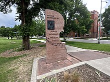
- Bob Ragland (1938 – 2021) artist, teacher, television host, author, and activist. The nearby Bob Ragland branch of the Denver Public Library is named after him.[2][3]
References
- ^ Neighborhood Summary: Whittier, The Piton Foundation website, accessed October 18, 2010
- ^ Mullen, David (2021-04-21). "Teacher, award-winning artist, and longtime Denver resident Bob Ragland dies at 82". Denver Gazette. Retrieved 2022-11-16.
- ^ "Bob Ragland (1938 - 2021)". Denver Public Library History. 2022-08-02. Retrieved 2022-11-16.
39°45′26″N 104°58′00″W / 39.757187°N 104.96664°W / 39.757187; -104.96664
- v
- t
- e
 | This Denver-related article is a stub. You can help Wikipedia by expanding it. |
- v
- t
- e
Neighborhoods of the City and County of Denver | ||
|---|---|---|
| Central |
|  |
| North of CBD |
| |
| Northeast of CBD |
| |
| Northwest of CBD |
| |
| South of CBD |
| |
| Southeast of CBD |
| |
| East of CBD |
| |
| West of CBD |
| |
| Historic Districts |
| |
| ||


