List of listed buildings in Innerleithen, Scottish Borders
This is a list of listed buildings in the parish of Innerleithen in the Scottish Borders, Scotland.
Map all coordinates using OpenStreetMap
Download coordinates as:
- KML
- GPX (all coordinates)
- GPX (primary coordinates)
- GPX (secondary coordinates)
List
| Name | Location | Date Listed | Grid Ref. [note 1] | Geo-coordinates | Notes | LB Number [note 2] | Image |
|---|---|---|---|---|---|---|---|
| Leithen Road, Old Bridge | 55°37′24″N 3°03′37″W / 55.623259°N 3.060304°W / 55.623259; -3.060304 (Leithen Road, Old Bridge) | Category C(S) | 34969 |  Upload Photo | |||
| 15 Pirn Road | 55°37′14″N 3°03′35″W / 55.620659°N 3.059631°W / 55.620659; -3.059631 (15 Pirn Road) | Category C(S) | 34971 | Upload Photo | |||
| Holylee, Lodge | 55°37′37″N 2°58′10″W / 55.627039°N 2.969388°W / 55.627039; -2.969388 (Holylee, Lodge) | Category C(S) | 49124 | Upload Photo | |||
| Leithen Water, Weir, Sluice, Bridge And Mill Lade | 55°38′08″N 3°03′20″W / 55.635528°N 3.05568°W / 55.635528; -3.05568 (Leithen Water, Weir, Sluice, Bridge And Mill Lade) | Category C(S) | 49128 | Upload Photo | |||
| Walkerburn, Caberston Farm House And Steading | 55°37′29″N 3°01′12″W / 55.624643°N 3.020005°W / 55.624643; -3.020005 (Walkerburn, Caberston Farm House And Steading) | Category C(S) | 49130 | Upload Photo | |||
| Walkerburn, Galashiels Road, Stoneyhill Cottage (Former Stoneyhill Lodge) Including Boundary Wall And Gatepier | 55°37′25″N 3°00′52″W / 55.623736°N 3.014455°W / 55.623736; -3.014455 (Walkerburn, Galashiels Road, Stoneyhill Cottage (Former Stoneyhill Lodge) Including Boundary Wall And Gatepier) | Category A | 49134 | Upload Photo | |||
| 24 And 26 Chapel Street, Lothian And Borders Co-Operative Society Ltd | 55°37′13″N 3°03′44″W / 55.620141°N 3.062348°W / 55.620141; -3.062348 (24 And 26 Chapel Street, Lothian And Borders Co-Operative Society Ltd) | Category C(S) | 51074 | Upload Photo | |||
| Leithen Road, Kirklands Farmhouse Including Boundary Walls And Gatepiers | 55°37′33″N 3°03′34″W / 55.625801°N 3.059388°W / 55.625801; -3.059388 (Leithen Road, Kirklands Farmhouse Including Boundary Walls And Gatepiers) | Category C(S) | 51082 | Upload Photo | |||
| St Ronan's Terrace, Tiendside Including Boundary Walls | 55°37′16″N 3°04′07″W / 55.621246°N 3.068619°W / 55.621246; -3.068619 (St Ronan's Terrace, Tiendside Including Boundary Walls) | Category C(S) | 51089 | Upload Photo | |||
| Damside, Ballantyne Cashmere Uk, Caerlee Mill Including Boilerhouse, Chimney, Weaving Sheds, Ancillary Buildings, Boundary Walls And Gatepiers | 55°37′16″N 3°03′50″W / 55.621144°N 3.063757°W / 55.621144; -3.063757 (Damside, Ballantyne Cashmere Uk, Caerlee Mill Including Boilerhouse, Chimney, Weaving Sheds, Ancillary Buildings, Boundary Walls And Gatepiers) | Category B | 34968 | Upload Photo | |||
| Walkerburn, Galashiels Road, Stoneyhill House, Stables And Boundary Walls | 55°37′30″N 3°00′47″W / 55.624971°N 3.012962°W / 55.624971; -3.012962 (Walkerburn, Galashiels Road, Stoneyhill House, Stables And Boundary Walls) | Category A | 12930 | Upload Photo | |||
| Nether Horsburgh Farm House, Walled Garden And Farm Buildings | 55°38′41″N 3°06′24″W / 55.644765°N 3.106694°W / 55.644765; -3.106694 (Nether Horsburgh Farm House, Walled Garden And Farm Buildings) | Category B | 8333 | Upload Photo | |||
| Glenormiston, Garden Cottage, Garden Wall And Ha - Ha | 55°37′49″N 3°05′18″W / 55.630416°N 3.088468°W / 55.630416; -3.088468 (Glenormiston, Garden Cottage, Garden Wall And Ha - Ha) | Category C(S) | 49119 | Upload Photo | |||
| Holylee Farm, Holylee Cottages | 55°37′43″N 2°58′03″W / 55.628734°N 2.967572°W / 55.628734; -2.967572 (Holylee Farm, Holylee Cottages) | Category C(S) | 49123 | Upload Photo | |||
| Holylee, Walled Garden | 55°37′41″N 2°58′08″W / 55.627952°N 2.968776°W / 55.627952; -2.968776 (Holylee, Walled Garden) | Category C(S) | 49125 | Upload Photo | |||
| Kirnie Law Reservoir And Surge Tower | 55°38′15″N 3°02′12″W / 55.637389°N 3.036635°W / 55.637389; -3.036635 (Kirnie Law Reservoir And Surge Tower) | Category B | 49126 | Upload Photo | |||
| Walkerburn, Galashiels Road, Walkerburn Parish Church (Church Of Scotland) Including Boundary Walls | 55°37′28″N 3°00′42″W / 55.624559°N 3.011649°W / 55.624559; -3.011649 (Walkerburn, Galashiels Road, Walkerburn Parish Church (Church Of Scotland) Including Boundary Walls) | Category B | 49133 | Upload Photo | |||
| 1 Buccleuch Street, Innerleithen Public Library Including Boundary Walls | 55°37′11″N 3°03′35″W / 55.619678°N 3.059811°W / 55.619678; -3.059811 (1 Buccleuch Street, Innerleithen Public Library Including Boundary Walls) | Category C(S) | 51073 | Upload Photo | |||
| Church Street, St Andrews Episcopal Church Including Boundary Walls And Gates | 55°37′20″N 3°03′43″W / 55.622212°N 3.06188°W / 55.622212; -3.06188 (Church Street, St Andrews Episcopal Church Including Boundary Walls And Gates) | Category C(S) | 51075 | Upload Photo | |||
| 5, 7, 9 And 11 High Street, Robert Smail's Printing Works, Including Printing Works, Courtyard And Mill Lade | 55°37′10″N 3°03′43″W / 55.61947°N 3.061996°W / 55.61947; -3.061996 (5, 7, 9 And 11 High Street, Robert Smail's Printing Works, Including Printing Works, Courtyard And Mill Lade) | Category C(S) | 51077 | Upload Photo | |||
| Peebles Road, Easter And Wester Caerlee (Formerly Caerlee House) Including Wash House And Garage | 55°37′00″N 3°04′21″W / 55.616637°N 3.07259°W / 55.616637; -3.07259 (Peebles Road, Easter And Wester Caerlee (Formerly Caerlee House) Including Wash House And Garage) | Category C(S) | 51086 | Upload Photo | |||
| Waverley Road, Runic Cross Including Boundary Walls | 55°37′06″N 3°03′47″W / 55.618356°N 3.063062°W / 55.618356; -3.063062 (Waverley Road, Runic Cross Including Boundary Walls) | Category C(S) | 51090 | Upload Photo | |||
| Walkerburn, Galashiels Road, Sunnybrae Lodge Including Gatepiers, Stables And Boundary Walls | 55°37′25″N 3°00′54″W / 55.623651°N 3.015056°W / 55.623651; -3.015056 (Walkerburn, Galashiels Road, Sunnybrae Lodge Including Gatepiers, Stables And Boundary Walls) | Category A | 49136 | Upload Photo | |||
| 91 High Street And St James Hall (Formerly St James Rc School And Schoolhouse) Including Boundary Walls | 55°37′06″N 3°03′53″W / 55.618278°N 3.064791°W / 55.618278; -3.064791 (91 High Street And St James Hall (Formerly St James Rc School And Schoolhouse) Including Boundary Walls) | Category C(S) | 51076 | Upload Photo | |||
| 2 Leithen Crescent, Vale Of Leithen Social Club Including Boundary Walls And Railings | 55°37′11″N 3°03′41″W / 55.619727°N 3.061416°W / 55.619727; -3.061416 (2 Leithen Crescent, Vale Of Leithen Social Club Including Boundary Walls And Railings) | Category C(S) | 51081 | Upload Photo | |||
| Leithen Road, Municipal Buildings And Memorial Hall | 55°37′15″N 3°03′43″W / 55.620881°N 3.061955°W / 55.620881; -3.061955 (Leithen Road, Municipal Buildings And Memorial Hall) | Category C(S) | 51084 | Upload Photo | |||
| Peebles Road, Alpinebikes, Former Congregational Chapel | 55°37′05″N 3°04′01″W / 55.617935°N 3.066972°W / 55.617935; -3.066972 (Peebles Road, Alpinebikes, Former Congregational Chapel) | Category C(S) | 51085 | Upload Photo | |||
| St Ronan's Terrace, Glenroy (Formerly St Ronan's Lodge) Including Boundary Walls | 55°37′24″N 3°04′04″W / 55.623301°N 3.067865°W / 55.623301; -3.067865 (St Ronan's Terrace, Glenroy (Formerly St Ronan's Lodge) Including Boundary Walls) | Category C(S) | 51087 | Upload Photo | |||
| St Ronan's Terrace, The Pines (Formerly Bellenden) Including Garden Walls, Steps, Ancillary Structures, Boundary Walls Gates And Gatepiers | 55°37′15″N 3°04′07″W / 55.620903°N 3.068705°W / 55.620903; -3.068705 (St Ronan's Terrace, The Pines (Formerly Bellenden) Including Garden Walls, Steps, Ancillary Structures, Boundary Walls Gates And Gatepiers) | Category B | 51088 | Upload Photo | |||
| Morningside Meikle Sawmill Wheelhouse And Turbine House Including Mill Lade | 55°37′05″N 3°03′41″W / 55.618189°N 3.061501°W / 55.618189; -3.061501 (Morningside Meikle Sawmill Wheelhouse And Turbine House Including Mill Lade) | Category C(S) | 34976 | Upload Photo | |||
| Glenormiston, Lodge Including Gatepiers, Gates And Railings | 55°37′42″N 3°05′40″W / 55.628288°N 3.094429°W / 55.628288; -3.094429 (Glenormiston, Lodge Including Gatepiers, Gates And Railings) | Category C(S) | 8319 | Upload Photo | |||
| Walkerburn, The Kirna (formerly Grangehill), also known as Kirna House | 55°37′34″N 3°01′57″W / 55.625975°N 3.032601°W / 55.625975; -3.032601 (Walkerburn, The Kirna (formerly Grangehill), also known as Kirna House) | Category A | 8323 |  Upload another image | |||
| Glenormiston, Velvet Hall Cottage | 55°37′32″N 3°05′20″W / 55.625444°N 3.088854°W / 55.625444; -3.088854 (Glenormiston, Velvet Hall Cottage) | Category C(S) | 49121 | Upload Photo | |||
| Walkerburn, Bascule Bridge (Over The River Tweed) | 55°37′19″N 3°01′01″W / 55.621918°N 3.01698°W / 55.621918; -3.01698 (Walkerburn, Bascule Bridge (Over The River Tweed)) | Category C(S) | 49129 | Upload Photo | |||
| Walkerburn, Galashiels Road, Sunnybrae House | 55°37′27″N 3°00′58″W / 55.624217°N 3.01615°W / 55.624217; -3.01615 (Walkerburn, Galashiels Road, Sunnybrae House) | Category C(S) | 49135 | Upload Photo | |||
| Walkerburn, Galashiels Road, Tweedvale House | 55°37′27″N 3°01′01″W / 55.624264°N 3.016962°W / 55.624264; -3.016962 (Walkerburn, Galashiels Road, Tweedvale House) | Category C(S) | 49138 | Upload Photo | |||
| High Street, St James Roman Catholic Church And Presbytery Including Boundary Walls And Gatepiers | 55°37′05″N 3°03′54″W / 55.61814°N 3.065136°W / 55.61814; -3.065136 (High Street, St James Roman Catholic Church And Presbytery Including Boundary Walls And Gatepiers) | Category B | 34974 | Upload Photo | |||
| Walkerburn, Prefabricated Cast - Iron Urinal | 55°37′26″N 3°01′11″W / 55.623945°N 3.019685°W / 55.623945; -3.019685 (Walkerburn, Prefabricated Cast - Iron Urinal) | Category A | 8326 |  Upload another image | |||
| Walkerburn, Caberston Road, Ballantyne Memorial Institute | 55°37′21″N 3°01′03″W / 55.622508°N 3.017408°W / 55.622508; -3.017408 (Walkerburn, Caberston Road, Ballantyne Memorial Institute) | Category C(S) | 49131 | Upload Photo | |||
| 13A And 15 High Street | 55°37′10″N 3°03′44″W / 55.619513°N 3.062204°W / 55.619513; -3.062204 (13A And 15 High Street) | Category C(S) | 51078 | Upload Photo | |||
| 2 High Street, Bank Of Scotland | 55°37′11″N 3°03′44″W / 55.619829°N 3.062101°W / 55.619829; -3.062101 (2 High Street, Bank Of Scotland) | Category C(S) | 51079 | Upload Photo | |||
| Leithen Road, Leithen Bank | 55°37′31″N 3°03′35″W / 55.625269°N 3.059596°W / 55.625269; -3.059596 (Leithen Road, Leithen Bank) | Category C(S) | 51083 | Upload Photo | |||
| Leithen Road, Innerleithen Parish Church Including Runic Cross, Boundary Walls, Gates And Gatepiers | 55°37′17″N 3°03′45″W / 55.621497°N 3.062401°W / 55.621497; -3.062401 (Leithen Road, Innerleithen Parish Church Including Runic Cross, Boundary Walls, Gates And Gatepiers) | Category B | 34966 | Upload Photo | |||
| Walkerburn, Galashiels Road, Lodge to Tweedvale House | 55°37′25″N 3°00′59″W / 55.62372°N 3.016392°W / 55.62372; -3.016392 (Walkerburn, Galashiels Road, Lodge to Tweedvale House) | Category B | 12931 | Upload Photo | |||
| Glenormiston House | 55°37′51″N 3°05′20″W / 55.630755°N 3.088763°W / 55.630755; -3.088763 (Glenormiston House) | Category C(S) | 8318 | Upload Photo | |||
| Lee Tower | 55°38′46″N 3°04′07″W / 55.646048°N 3.068484°W / 55.646048; -3.068484 (Lee Tower) | Category C(S) | 8320 | Upload Photo | |||
| Holylee Including Terrace Wall | 55°37′42″N 2°58′17″W / 55.628281°N 2.971404°W / 55.628281; -2.971404 (Holylee Including Terrace Wall) | Category B | 8324 | Upload Photo | |||
| Holylee Farm, Old Holylee | 55°37′46″N 2°58′05″W / 55.629468°N 2.967939°W / 55.629468; -2.967939 (Holylee Farm, Old Holylee) | Category B | 8325 | Upload Photo | |||
| Leithen Water, Bridge (Near Golf Course) | 55°38′15″N 3°03′25″W / 55.637386°N 3.056985°W / 55.637386; -3.056985 (Leithen Water, Bridge (Near Golf Course)) | Category C(S) | 49127 | Upload Photo | |||
| Wells Brae, St Ronan's Well, Former Pump Room, Bottling Plant, Ancillary Buildings And Boundary Walls | 55°37′26″N 3°04′03″W / 55.623807°N 3.067545°W / 55.623807; -3.067545 (Wells Brae, St Ronan's Well, Former Pump Room, Bottling Plant, Ancillary Buildings And Boundary Walls) | Category B | 34970 | Upload Photo | |||
| Leithen Lodge With Lochend Arch, Outbuildings And Sundial | 55°40′26″N 3°04′53″W / 55.673826°N 3.081405°W / 55.673826; -3.081405 (Leithen Lodge With Lochend Arch, Outbuildings And Sundial) | Category A | 13475 | 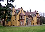 Upload another image | |||
| Glenormiston, Ivy Bridge | 55°37′44″N 3°05′27″W / 55.629012°N 3.090812°W / 55.629012; -3.090812 (Glenormiston, Ivy Bridge) | Category C(S) | 49120 | Upload Photo | |||
| Glenormiston, Water Tank | 55°37′52″N 3°05′17″W / 55.631094°N 3.087995°W / 55.631094; -3.087995 (Glenormiston, Water Tank) | Category C(S) | 49122 | Upload Photo | |||
| Walkerburn, Galashiels Road, Windlestraw, formerly Tweed Valley Country House, formerly Nether Caberston. Including Steps, Garden Terrace, Greenhouse And Garden Walls | 55°37′33″N 3°00′32″W / 55.625741°N 3.008916°W / 55.625741; -3.008916 (Walkerburn, Galashiels Road, Windlestraw, formerly Tweed Valley Country House, formerly Nether Caberston. Including Steps, Garden Terrace, Greenhouse And Garden Walls) | Category B | 49137 | Upload Photo | |||
| 42-48 (Even Nos) High Street, St Ronan's View | 55°37′09″N 3°03′49″W / 55.619132°N 3.063718°W / 55.619132; -3.063718 (42-48 (Even Nos) High Street, St Ronan's View) | Category C(S) | 51080 | Upload Photo | |||
| Leithen Road, Mansley Lodge And The Green Gates Including Boundary Walls | 55°37′38″N 3°03′32″W / 55.627323°N 3.058985°W / 55.627323; -3.058985 (Leithen Road, Mansley Lodge And The Green Gates Including Boundary Walls) | Category C(S) | 34972 | Upload Photo | |||
| Leithen Road, Leithen House Including Boundary Walls | 55°37′24″N 3°03′38″W / 55.623453°N 3.060691°W / 55.623453; -3.060691 (Leithen Road, Leithen House Including Boundary Walls) | Category C(S) | 34973 | Upload Photo | |||
| Walkerburn, Galashiels Road, War Memorial | 55°37′25″N 3°00′56″W / 55.623637°N 3.015659°W / 55.623637; -3.015659 (Walkerburn, Galashiels Road, War Memorial) | Category C(S) | 8322 | Upload Photo | |||
| Horsburgh, Viaduct | 55°38′24″N 3°06′56″W / 55.639941°N 3.11555°W / 55.639941; -3.11555 (Horsburgh, Viaduct) | Category B | 8327 | Upload Photo | |||
| Walkerburn, Galashiels Road, Holly House (Former Walkerburn Parish Church Manse) | 55°37′29″N 3°00′40″W / 55.624725°N 3.011161°W / 55.624725; -3.011161 (Walkerburn, Galashiels Road, Holly House (Former Walkerburn Parish Church Manse)) | Category C(S) | 49132 | Upload Photo |
Key
The scheme for classifying buildings in Scotland is:
- Category A: "buildings of national or international importance, either architectural or historic; or fine, little-altered examples of some particular period, style or building type."[1]
- Category B: "buildings of regional or more than local importance; or major examples of some particular period, style or building type, which may have been altered."[1]
- Category C: "buildings of local importance; lesser examples of any period, style, or building type, as originally constructed or moderately altered; and simple traditional buildings which group well with other listed buildings."[1]
In March 2016 there were 47,288 listed buildings in Scotland. Of these, 8% were Category A, and 50% were Category B, with the remaining 42% being Category C.[2]
Notes
- ^ Sometimes known as OSGB36, the grid reference (where provided) is based on the British national grid reference system used by the Ordnance Survey.
• "Guide to National Grid". Ordnance Survey. Retrieved 12 December 2007.
• "Get-a-map". Ordnance Survey. Retrieved 17 December 2007. - ^ Historic Environment Scotland assign a unique alphanumeric identifier to each designated site in Scotland, for listed buildings this always begins with "LB", for example "LB12345".
References
- All entries, addresses and coordinates are based on data from Historic Scotland. This data falls under the Open Government Licence
- ^ a b c "What is Listing?". Historic Environment Scotland. Retrieved 29 May 2018.
- ^ Scotland's Historic Environment Audit 2016 (PDF). Historic Environment Scotland and the Built Environment Forum Scotland. pp. 15–16. Retrieved 29 May 2018.
- v
- t
- e
- Abbey St Bathans
- Ancrum
- Ashkirk
- Ayton
- Bedrule
- Bowden
- Broughton, Glenholm and Kilbucho
- Bunkle and Preston
- Caddonfoot
- Castleton
- Cavers
- Channelkirk
- Chirnside
- Cockburnspath
- Coldingham
- Coldstream
- Crailing
- Cranshaws
- Drumelzier
- Duns
- Earlston
- Eccles
- Eckford
- Eddleston
- Ednam
- Edrom
- Ettrick
- Eyemouth
- Fala and Soutra
- Fogo
- Foulden
- Galashiels
- Gordon
- Greenlaw
- Hawick
- Heriot
- Hobkirk
- Hownam
- Hume
- Hutton
- Innerleithen
- Jedburgh
- Kelso
- Kirkhope
- Kirkurd
- Ladykirk
- Langton
- Lauder
- Legerwood
- Lilliesleaf
- Linton
- Longformacus
- Lyne
- Makerstoun
- Manor
- Maxton
- Melrose
- Mertoun
- Minto
- Mordington
- Morebattle
- Nenthorn
- Newlands
- Oxnam
- Peebles
- Penicuik
- Polwarth
- Roberton
- Roxburgh
- Selkirk
- Skirling
- Smailholm
- Southdean
- Sprouston
- St Boswells
- Stichill
- Stobo
- Stow
- Swinton
- Teviothead
- Traquair
- Tweedsmuir
- Westruther
- Whitsome
- Yarrow
- Yetholm


