New Bedford Whaling National Historical Park
US National Historical Park in Massachusetts
United States historic place
New Bedford Whaling National Historical Park | |
U.S. National Historical Park | |
 New Bedford Whaling National Historical Park Visitor Center | |
41°38′08″N 70°55′24″W / 41.63556°N 70.92333°W / 41.63556; -70.92333 | |
| Area | 34 acres (14 ha) |
|---|---|
| Built | 1790–1855 |
| Architect | Robert Mills, Richard Upjohn, Russell Warren, others |
| Architectural style | Federal, Greek Revival, Italianate |
| Visitation | 273,862 (2011) |
| Website | New Bedford Whaling National Historical Park |
| NRHP reference No. | 03000283 |
| Added to NRHP | 1996 |
New Bedford Whaling National Historical Park is a United States National Historical Park in New Bedford, Massachusetts, and is maintained by the National Park Service (NPS). The park commemorates the heritage of the world's preeminent whaling port during the nineteenth century.
Established in 1996, the park encompasses 34 acres (fourteen hectares) dispersed over thirteen city blocks. It includes a visitor center, the New Bedford National Historic Landmark District, the New Bedford Whaling Museum, the Seamen's Bethel, the schooner Ernestina, and the Rotch–Jones–Duff House and Garden Museum.
The only properties owned by the NPS are the Visitor Center and the Corson Maritime Learning Center. The park is a historic district administered under a partnership between the NPS, the City of New Bedford and private building owners to preserve the historic landscapes, structures, and collections and promote research and educational programming associated with the history of whaling. The enabling legislation also established a formal affiliation with the Iñupiat Heritage Center in Utqiaġvik, Alaska, to commemorate the more than 2,000 whaling voyages from New Bedford to the Western Arctic. The city promotes visitation to the park through advertising that calls it "New England's real seaport", as opposed to Connecticut's Mystic Seaport Museum which is a collection of historic buildings and vessels moved from various other locations throughout the region.
Although the Whaleman Memorial is not within the park's boundaries, it is located only two blocks beyond its western boundary at the corner of William and Pleasant Streets in front of the New Bedford Public Library.
-
 Visitor Center
 -
 Benjamin Rodman Mansion
 -
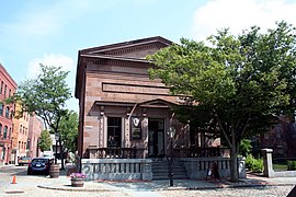
 Dover Street
 -
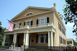 Rotch-Jones House


See also
- Merrill's Wharf Historic District
- New Bedford Whaling Museum
- National Register of Historic Places listings in New Bedford, Massachusetts
External links
Wikimedia Commons has media related to New Bedford Whaling National Historical Park.
- National Park Service: New Bedford Whaling National Historical Park
- New Bedford Whaling Museum
- The Schooner Ernestina
- v
- t
- e
| Former |
|---|
- Buttonwood Park Zoo
- St. Anthony of Padua Church
This list is incomplete.
See also: Media in Providence metropolitan area
See also: Media in Providence metropolitan area
New Bedford Whaling National Historical Park | ||
|---|---|---|
 | ||
| |||||||||||||||||
|---|---|---|---|---|---|---|---|---|---|---|---|---|---|---|---|---|---|
| |||||||||||||||||
| |||||||||||||||||
| |||||||||||||||||
| |||||||||||||||||
| |||||||||||||||||
| |||||||||||||||||
| |||||||||||||||||
| |||||||||||||||||

National Historical Parks of the United States | ||
|---|---|---|
|  | |
| |||||||||||||||||
|---|---|---|---|---|---|---|---|---|---|---|---|---|---|---|---|---|---|
| Topics |  | ||||||||||||||||
| Lists by county | |||||||||||||||||
| Lists by city |
| ||||||||||||||||
| Other lists | |||||||||||||||||
| |||||||||||||||||


Authority control databases | |
|---|---|
| International |
|
| National |
|


