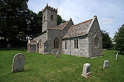
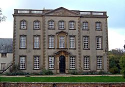
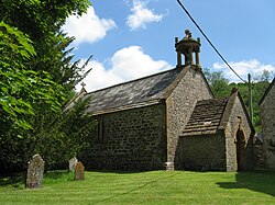
Grade I listed buildings in Dorset

There are over 9,000 Grade I listed buildings in England. This is a list of these buildings and structures in the county of Dorset, grouped first by the two unitary authority areas: first Bournemouth, Christchurch and Poole, then Dorset.

Map all coordinates using OpenStreetMap

Download coordinates as:

  • KML
  • GPX (all coordinates)
  • GPX (primary coordinates)
  • GPX (secondary coordinates)

Bournemouth, Christchurch and Poole

Bournemouth

Name Location Type Completed [note 1]Date designated Grid ref.[note 2]
Geo-coordinates
Entry number [note 3]Image
Church of St Clement Boscombe, Bournemouth Church 1871–73 5 May 1952 SZ1072892127
50°43′43″N 1°50′58″W / 50.728665°N 1.849367°W / 50.728665; -1.849367 (Church of St Clement)
1324751
Church of St Clement
More images
Church of St Peter Bournemouth Church 1851 5 May 1952 SZ0888391216
50°43′14″N 1°52′32″W / 50.720503°N 1.875529°W / 50.720503; -1.875529 (Church of St Peter)
1153014
Church of St Peter
Church of St Peter
More images
Church of St Stephen Bournemouth Church 1881–83 5 May 1952 SZ0852391507
50°43′23″N 1°52′50″W / 50.723126°N 1.880622°W / 50.723126; -1.880622 (Church of St Stephen)
1324756
Church of St Stephen
More images

Christchurch


Name Location Type Completed [note 1]Date designated Grid ref.[note 2]
Geo-coordinates
Entry number [note 3]Image
Christchurch Priory and Parish Church Christchurch Parish church 11th century 14 October 1953 SZ1603192531
50°43′56″N 1°46′27″W / 50.732177°N 1.774216°W / 50.732177; -1.774216 (Christchurch Priory and Parish Church)
1110141
Christchurch Priory and Parish Church
More images
Highcliffe Castle Christchurch Country house 1830–34 14 October 1953 SZ2028693208
50°44′17″N 1°42′50″W / 50.738133°N 1.713889°W / 50.738133; -1.713889 (Highcliffe Castle)
1110077
Highcliffe Castle
Highcliffe Castle
More images
Christchurch Castle Christchurch Castle 1100–35 14 October 1953 SZ1596892661
50°44′00″N 1°46′30″W / 50.733348°N 1.775103°W / 50.733348; -1.775103 (Christchurch Castle)
1153159
Christchurch Castle
Christchurch Castle
More images
The Constable's House Christchurch House 12th century 14 October 1953 SZ1605092706
50°44′02″N 1°46′26″W / 50.73375°N 1.773939°W / 50.73375; -1.773939 (The Constable's House)
1325069
The Constable's House
More images
Town Bridge Christchurch Bridge 15th or 16th century 14 October 1953 SZ1606992753
50°44′03″N 1°46′25″W / 50.734172°N 1.773668°W / 50.734172; -1.773668 (Town Bridge)
1304408
Town Bridge
Town Bridge
More images
Waterloo Bridge Christchurch Bridge 1816–17 14 October 1953 SZ1625692833
50°44′06″N 1°46′16″W / 50.734886°N 1.771014°W / 50.734886; -1.771014 (Waterloo Bridge)
1304449
Waterloo Bridge
Waterloo Bridge
More images

Poole

Name Location Type Completed [note 1]Date designated Grid ref.[note 2]
Geo-coordinates
Entry number [note 3]Image
Canford School Canford Magna, Poole Country house 1825–36 14 June 1954 SZ0335098917
50°47′23″N 1°57′14″W / 50.789813°N 1.953841°W / 50.789813; -1.953841 (Canford School)
1217460
Canford School
Canford School
More images
John of Gaunt's Kitchen, Canford School Canford Magna Kitchen block 15th century 14 June 1954 SZ0339598937
50°47′24″N 1°57′12″W / 50.789992°N 1.953203°W / 50.789992; -1.953203 (John of Gaunt's Kitchen, Canford School)
1217462
John of Gaunt's Kitchen, Canford School
Nineveh Court, attached carriage arch and screen wall, Canford School Canford Magna Sculpture gallery 1851 14 June 1954 SZ0341498941
50°47′24″N 1°57′11″W / 50.790028°N 1.952933°W / 50.790028; -1.952933 (Nineveh Court, attached carriage arch and screen wall, Canford School)
1217464
Nineveh Court, attached carriage arch and screen wall, Canford School
Merley House Poole Country house 1752–60 14 June 1954 SZ0086498321
50°47′04″N 1°59′21″W / 50.784462°N 1.989111°W / 50.784462; -1.989111 (Merley House)
1275387
Merley House
Merley House
More images
Scaplen's Court Poole House Late 15th to early 16th century 14 June 1954 SZ0087990359
50°42′46″N 1°59′20″W / 50.712862°N 1.988914°W / 50.712862; -1.988914 (Scaplen's Court)
1275378
Scaplen's Court
Scaplen's Court
More images
Parish Church of Canford Magna Canford Magna Parish church c.1200 14 June 1954 SZ0319498812
50°47′20″N 1°57′22″W / 50.788869°N 1.956055°W / 50.788869; -1.956055 (Parish Church of Canford Magna)
1217465
Parish Church of Canford Magna
More images
Sir Peter Thompson House Poole House 1746–49 14 June 1954 SZ0104890692
50°42′57″N 1°59′11″W / 50.715857°N 1.98652°W / 50.715857; -1.98652 (Sir Peter Thompson House)
1224145
Sir Peter Thompson House
More images
The Waterfront Museum, Local History Centre Poole Warehouse First half of the 15th century 14 June 1954 SZ0086190313
50°42′45″N 1°59′21″W / 50.712449°N 1.989169°W / 50.712449; -1.989169 (The Waterfront Museum, Local History Centre)
1217514
The Waterfront Museum, Local History Centre
More images

Dorset (unitary authority)

Eastern Dorset

Name Location Type Completed [note 1]Date designated Grid ref.[note 2]
Geo-coordinates
Entry number [note 3]Image
Church of All Saints Chalbury Parish church 13th-century origin 18 March 1955 SU0185606840
50°51′40″N 1°58′30″W / 50.861067°N 1.974999°W / 50.861067; -1.974999 (Church of All Saints)
1120141
Church of All Saints
More images
Church of St Mary and St Bartholomew Cranborne Parish church 12th century 18 March 1955 SU0545313247
50°55′07″N 1°55′26″W / 50.918659°N 1.923797°W / 50.918659; -1.923797 (Church of St Mary and St Bartholomew)
1120181
Church of St Mary and St Bartholomew
More images
Cranborne Manor House Cranborne Hunting lodge c.1207–08 18 March 1955 SU0531313228
50°55′07″N 1°55′33″W / 50.918489°N 1.925789°W / 50.918489; -1.925789 (Cranborne Manor House)
1120172
Cranborne Manor House
More images
Church of All Saints Gussage All Saints Parish church 14th century 18 March 1955 ST9984510827
50°53′49″N 2°00′13″W / 50.896922°N 2.003575°W / 50.896922; -2.003575 (Church of All Saints)
1304213
Church of All Saints
More images
Church of St Michael Gussage St Michael Parish church 12th-century tower 18 March 1955 ST9858511332
50°54′05″N 2°01′17″W / 50.901461°N 2.021493°W / 50.901461; -2.021493 (Church of St Michael)
1120146
Church of St Michael
More images
Church of St Wolfrida Horton Parish church Possible 12th or 13th-century origin 18 March 1955 SU0301507447
50°51′59″N 1°57′31″W / 50.86652°N 1.958526°W / 50.86652; -1.958526 (Church of St Wolfrida)
1154780
Church of St Wolfrida
More images
Crichel House Moor Crichel Country house 1743 18 March 1955 ST9942908324
50°52′28″N 2°00′34″W / 50.874414°N 2.009485°W / 50.874414; -2.009485 (Crichel House)
1120155
Crichel House
Crichel House
More images
Julian's Bridge Pamphill Bridge Probably late 15th century 14 June 1952 SZ0035899846
50°47′53″N 1°59′47″W / 50.798176°N 1.996287°W / 50.798176; -1.996287 (Julian's Bridge)
1323805
Julian's Bridge
Julian's Bridge
More images
Kingston Lacy House Pamphill House 1663–65 18 March 1955 ST9785301268
50°48′39″N 2°01′55″W / 50.810959°N 2.03184°W / 50.810959; -2.03184 (Kingston Lacy House)
1119511
Kingston Lacy House
Kingston Lacy House
More images
Parish Church of Saint Bartholomew Shapwick Parish church 12th-century origin 18 March 1955 ST9365601675
50°48′53″N 2°05′29″W / 50.814587°N 2.091416°W / 50.814587; -2.091416 (Parish Church of Saint Bartholomew)
1323469
Parish Church of Saint Bartholomew
More images
White Mill Bridge Sturminster Marshall Bridge 16th century 18 March 1955 ST9576700552
50°48′16″N 2°03′41″W / 50.804508°N 2.061439°W / 50.804508; -2.061439 (White Mill Bridge)
1120035
White Mill Bridge
White Mill Bridge
More images
Church of St Andrew Gussage St Andrew, Sixpenny Handley Chapel of ease 12th century 18 March 1955 ST9760714254
50°55′40″N 2°02′08″W / 50.927734°N 2.035421°W / 50.927734; -2.035421 (Church of St Andrew)
1153744
Church of St Andrew
Church of St Andrew
More images
Church of St Mary Almer, Sturminster Marshall Parish church 12th century 18 March 1955 SY9131798933
50°47′24″N 2°07′28″W / 50.789899°N 2.124551°W / 50.789899; -2.124551 (Church of St Mary)
1154550
Church of St Mary
Church of St Mary
More images
Dean's Court Wimborne Minster Country house 1725 14 June 1952 SZ0098999700
50°47′49″N 1°59′14″W / 50.796862°N 1.987334°W / 50.796862; -1.987334 (Dean's Court)
1119561
Dean's Court
Dean's Court
More images
The Minster Church of St Cuthburga Wimborne Minster Collegiate church 12th century 14 June 1952 SZ0094599932
50°47′56″N 1°59′17″W / 50.798949°N 1.987958°W / 50.798949; -1.987958 (The Minster Church of St Cuthburga)
1119581
The Minster Church of St Cuthburga
More images
Church of St Giles Wimborne St Giles Parish church 1732 18 March 1955 SU0319111960
50°54′26″N 1°57′22″W / 50.907102°N 1.955987°W / 50.907102; -1.955987 (Church of St Giles)
1120134
Church of St Giles
Church of St Giles
More images
St Giles House Wimborne St Giles Country house 17th century 18 March 1955 SU0323611591
50°54′14″N 1°57′19″W / 50.903784°N 1.95535°W / 50.903784; -1.95535 (St Giles House)
1120129
St Giles House
St Giles House
More images

Northern Dorset

Name Location Type Completed [note 1]Date designated Grid ref.[note 2]
Geo-coordinates
Entry number [note 3]Image
Anderson Manor Anderson Manor house 1622 14 July 1955 SY8802197604
50°46′40″N 2°10′17″W / 50.777888°N 2.171267°W / 50.777888; -2.171267 (Anderson Manor)
1118633
Anderson Manor
Anderson Manor
More images
Church of Saint Andrew Winterborne Tomson, Anderson Parish church 12th century 14 July 1955 SY8847597424
50°46′35″N 2°09′53″W / 50.776279°N 2.164822°W / 50.776279; -2.164822 (Church of Saint Andrew)
1118600
Church of Saint Andrew
More images
Church of St Peter and St Paul Blandford Forum Parish church 1732–39 27 October 1950 ST8856406311
50°51′22″N 2°09′50″W / 50.856197°N 2.163839°W / 50.856197; -2.163839 (Church of St Peter and St Paul)
1251913
Church of St Peter and St Paul
More images
Coupar House Blandford Forum House Mid-18th century 27 October 1950 ST8854906388
50°51′25″N 2°09′51″W / 50.856889°N 2.164055°W / 50.856889; -2.164055 (Coupar House)
1152976
Coupar House
Coupar House
More images
Greyhound House Blandford Forum Inn 1753 27 October 1950 ST8845106270
50°51′21″N 2°09′56″W / 50.855826°N 2.165443°W / 50.855826; -2.165443 (Greyhound House)
1152922
Greyhound House
Greyhound House
More images
Pump House Blandford Forum Portico 1760 27 October 1950 ST8853406296
50°51′22″N 2°09′51″W / 50.856061°N 2.164265°W / 50.856061; -2.164265 (Pump House)
1324829
Pump House
Pump House
More images
The Old House Blandford Forum House Mid-17th century 27 October 1950 ST8868006416
50°51′26″N 2°09′44″W / 50.857143°N 2.162195°W / 50.857143; -2.162195 (The Old House)
1108699
The Old House
The Old House
More images
Town Hall and Corn Exchange Blandford Forum Town hall 1734 27 October 1950 ST8849406328
50°51′23″N 2°09′53″W / 50.856348°N 2.164834°W / 50.856348; -2.164834 (Town Hall and Corn Exchange)
1324806
Town Hall and Corn Exchange
More images
18 and 20, Market Place Blandford Forum Inn 18th century 27 October 1950 ST8851606273
50°51′21″N 2°09′52″W / 50.855854°N 2.16452°W / 50.855854; -2.16452 (18 and 20, Market Place)
1108646
18 and 20, Market Place
More images
26, Market Place (Bastard House) Blandford Forum House 18th century 7 September 1973 ST8854606276
50°51′21″N 2°09′51″W / 50.855882°N 2.164094°W / 50.855882; -2.164094 (26, Market Place (Bastard House))
1108648
26, Market Place (Bastard House)
More images
Bryanston School Bryanston Country house 1889–94 11 June 1985 ST8703907370
50°51′56″N 2°11′08″W / 50.865687°N 2.185543°W / 50.865687; -2.185543 (Bryanston School)
1305449
Bryanston School
Bryanston School
More images
The Portman Chapel Bryanston Old Buildings, Bryanston Parish church 1745 14 July 1955 ST8746607054
50°51′46″N 2°10′46″W / 50.862855°N 2.179464°W / 50.862855; -2.179464 (The Portman Chapel)
1110183
The Portman Chapel
The Portman Chapel
More images
Church of St Mary Charlton Marshall Parish church 15th-century tower 14 July 1955 ST9003804074
50°50′10″N 2°08′34″W / 50.836108°N 2.142837°W / 50.836108; -2.142837 (Church of St Mary)
1171867
Church of St Mary
Church of St Mary
More images
Chettle House Chettle Country house c.1710 14 July 1955 ST9514013184
50°55′05″N 2°04′14″W / 50.918096°N 2.070508°W / 50.918096; -2.070508 (Chettle House)
1118513
Chettle House
Chettle House
More images
Tower of the former Church of St Mary East Compton, Compton Abbas Tower Late 15th century 16 August 1960 ST8755918800
50°58′07″N 2°10′43″W / 50.968481°N 2.178547°W / 50.968481; -2.178547 (Tower of the former Church of St Mary)
1172395
Tower of the former Church of St Mary
More images
Church of St Mary Gillingham Parish church 14th century 16 August 1960 ST8064326582
51°02′18″N 2°16′39″W / 51.038266°N 2.277455°W / 51.038266; -2.277455 (Church of St Mary)
1172499
Church of St Mary
Church of St Mary
More images
Church of St Paul Hammoon Parish church Late 12th or early 13th century 24 June 1985 ST8178414576
50°55′49″N 2°15′38″W / 50.930343°N 2.260576°W / 50.930343; -2.260576 (Church of St Paul)
1324608
Church of St Paul
Church of St Paul
More images
Church of St Mary and St James Droop, Hazelbury Bryan Parish church 15th century 4 October 1960 ST7532508287
50°52′25″N 2°21′07″W / 50.87355°N 2.352056°W / 50.87355; -2.352056 (Church of St Mary and St James)
1110493
Church of St Mary and St James
More images
Parish Church of All Saints Hilton Parish church 15th-century tower 14 July 1955 ST7816202975
50°49′33″N 2°18′41″W / 50.825897°N 2.311418°W / 50.825897; -2.311418 (Parish Church of All Saints)
1118613
Parish Church of All Saints
More images
Church of St Mary Iwerne Courtney Parish church 14th century 14 July 1955 ST8598912415
50°54′40″N 2°12′02″W / 50.911029°N 2.200658°W / 50.911029; -2.200658 (Church of St Mary)
1305327
Church of St Mary
Church of St Mary
More images
Ranston Ranston, Iwerne Courtney Country house 1753 14 July 1955 ST8628212356
50°54′38″N 2°11′47″W / 50.910506°N 2.196488°W / 50.910506; -2.196488 (Ranston)
1305285
Upload Photo
Church of St Mary Iwerne Minster Parish church 12th century 16 August 1960 ST8683414465
50°55′46″N 2°11′19″W / 50.929483°N 2.188714°W / 50.929483; -2.188714 (Church of St Mary)
1110192
Church of St Mary
Church of St Mary
More images
West Lodge (that part in the parish of Iwerne Minster) Iwerne Minster Country house 18th century 24 June 1985 ST8941515742
50°56′28″N 2°09′07″W / 50.94102°N 2.152026°W / 50.94102; -2.152026 (West Lodge (that part in the parish of Iwerne Minster))
1172300
Upload Photo
Stepleton House Iwerne Stepleton Country house Early to mid-17th century 14 July 1955 ST8633311294
50°54′03″N 2°11′45″W / 50.900957°N 2.195723°W / 50.900957; -2.195723 (Stepleton House)
1110203
Stepleton House
Stepleton House
More images
Church of St Nicholas Manston Parish church Early 13th century 4 October 1960 ST8164615049
50°56′05″N 2°15′45″W / 50.934592°N 2.262564°W / 50.934592; -2.262564 (Church of St Nicholas)
1110434
Church of St Nicholas
More images
Church of St Peter and St Paul Mappowder Parish church Late 15th century 4 October 1960 ST7353805987
50°51′10″N 2°22′38″W / 50.852788°N 2.377285°W / 50.852788; -2.377285 (Church of St Peter and St Paul)
1287754
Church of St Peter and St Paul
More images
Church of St Gregory Marnhull Parish church 12th century 4 October 1960 ST7815118717
50°58′03″N 2°18′45″W / 50.967453°N 2.312521°W / 50.967453; -2.312521 (Church of St Gregory)
1172545
Church of St Gregory
More images
Abbey Church of St Mary, St Sansom and St Branwalader Milton Abbey, Milton Abbas Abbey church 14th century 14 July 1955 ST7983202296
50°49′11″N 2°17′16″W / 50.819852°N 2.28767°W / 50.819852; -2.28767 (Abbey Church of St Mary, St Sansom and St Branwalader)
1304822
Abbey Church of St Mary, St Sansom and St Branwalader
More images
Chapel of Saint Catherine Milton Abbey, Milton Abbas Abbey chapel Late 12th century 14 July 1955 ST8011902343
50°49′13″N 2°17′01″W / 50.820285°N 2.283599°W / 50.820285; -2.283599 (Chapel of Saint Catherine)
1304728
Chapel of Saint Catherine
More images
Milton Abbey School Milton Abbey, Milton Abbas Country house 1771–76 26 June 1953 ST7985402377
50°49′14″N 2°17′15″W / 50.820581°N 2.287363°W / 50.820581; -2.287363 (Milton Abbey School)
1118566
Milton Abbey School
Milton Abbey School
More images
The Abbot's Hall and Kitchen, Milton Abbey Milton Abbey, Milton Abbas Great hall c.1498 26 June 1953 ST7985302339
50°49′13″N 2°17′15″W / 50.82024°N 2.287375°W / 50.82024; -2.287375 (The Abbot's Hall and Kitchen, Milton Abbey)
1152407
The Abbot's Hall and Kitchen, Milton Abbey
Park Wall Gold Hill, Shaftesbury Boundary wall c.1365 20 June 1952 ST8626222881
51°00′19″N 2°11′50″W / 51.005149°N 2.197173°W / 51.005149; -2.197173 (Park Wall)
1108773
Park Wall
Park Wall
The remains of Shaftesbury Abbey Shaftesbury Abbey 888 20 June 1952 ST8616322886
51°00′19″N 2°11′55″W / 51.005191°N 2.198584°W / 51.005191; -2.198584 (The remains of Shaftesbury Abbey)
1108779
The remains of Shaftesbury Abbey
More images
Church of the Holy Rood Shillingstone Parish church Early 12th century 4 October 1960 ST8247411470
50°54′09″N 2°15′02″W / 50.902435°N 2.250608°W / 50.902435; -2.250608 (Church of the Holy Rood)
1324658
Church of the Holy Rood
More images
Church of St Nicholas Silton Parish church Late 12th century 16 August 1960 ST7826429344
51°03′47″N 2°18′42″W / 51.063016°N 2.311552°W / 51.063016; -2.311552 (Church of St Nicholas)
1304821
Church of St Nicholas
More images
Church of St John Spetisbury Parish church Late 12th or early 13th century 14 July 1955 ST9094102924
50°49′33″N 2°07′48″W / 50.825782°N 2.129985°W / 50.825782; -2.129985 (Church of St John)
1305220
Church of St John
Church of St John
More images
Crawford Bridge Spetisbury Road bridge Medieval 14 July 1955 ST9189901978
50°49′02″N 2°06′59″W / 50.81729°N 2.116362°W / 50.81729; -2.116362 (Crawford Bridge)
1305264
Crawford Bridge
Crawford Bridge
More images
Church of St Michael Stour Provost Parish church Possibly 13th century origin 16 August 1960 ST7940221572
50°59′35″N 2°17′42″W / 50.993172°N 2.294868°W / 50.993172; -2.294868 (Church of St Michael)
1110379
Church of St Michael
More images
Parish Church of St Peter Stourton Caundle Parish church 13th century 4 October 1960 ST7145215198
50°56′08″N 2°24′28″W / 50.935515°N 2.407641°W / 50.935515; -2.407641 (Parish Church of St Peter)
1228147
Parish Church of St Peter
More images
Church of St Mary Sturminster Newton Parish church c.1400 4 October 1960 ST7880413950
50°55′29″N 2°18′11″W / 50.924612°N 2.302943°W / 50.924612; -2.302943 (Church of St Mary)
1324486
Church of St Mary
Church of St Mary
More images
Fiddleford Mill House Sturminster Newton Manor house Late 14th century 4 October 1960 ST8008213580
50°55′17″N 2°17′05″W / 50.92133°N 2.28474°W / 50.92133; -2.28474 (Fiddleford Mill House)
1324484
Fiddleford Mill House
More images
Town Bridge Sturminster Newton Road bridge Late 15th or early 16th century 4 October 1960 ST7844913573
50°55′16″N 2°18′29″W / 50.921208°N 2.307971°W / 50.921208; -2.307971 (Town Bridge)
1110531
Town Bridge
Town Bridge
More images
Church of St Mary Tarrant Crawford Parish church 12th century 26 June 1953 ST9229603467
50°49′50″N 2°06′39″W / 50.830685°N 2.110759°W / 50.830685; -2.110759 (Church of St Mary)
1110840
Church of St Mary
Church of St Mary
More images
Eastbury House including attached west courtyard and gateway Eastbury, Tarrant Gunville Service wing 1717–38 14 July 1955 ST9323012707
50°54′50″N 2°05′52″W / 50.913787°N 2.097671°W / 50.913787; -2.097671 (Eastbury House including attached west courtyard and gateway)
1324303
Eastbury House including attached west courtyard and gateway
More images
Church of St Mary Tarrant Hinton Parish church 14th century 14 July 1955 ST9362511150
50°53′59″N 2°05′31″W / 50.89979°N 2.092024°W / 50.89979; -2.092024 (Church of St Mary)
1118497
Church of St Mary
Church of St Mary
More images
Manor House Winterborne Clenston Manor house Early 16th century 14 July 1955 ST8387203130
50°49′39″N 2°13′49″W / 50.827479°N 2.230357°W / 50.827479; -2.230357 (Manor House)
1172313
Manor House
Manor House
More images
Manor Farm Barn Winterborne Clenston Barn Late 16th century 14 July 1955 ST8384903036
50°49′36″N 2°13′50″W / 50.826633°N 2.230679°W / 50.826633; -2.230679 (Manor Farm Barn)
1110166
Manor Farm Barn
Manor Farm Barn
More images
Church of St Mary Winterborne Stickland Parish church 13th century 14 July 1955 ST8346004626
50°50′27″N 2°14′11″W / 50.84092°N 2.236274°W / 50.84092; -2.236274 (Church of St Mary)
1305111
Church of St Mary
Church of St Mary
More images
Church of St Mary Winterborne Whitechurch Parish church Early 13th century 14 July 1955 ST8360600121
50°48′01″N 2°14′02″W / 50.800414°N 2.233998°W / 50.800414; -2.233998 (Church of St Mary)
1118538
Church of St Mary
Church of St Mary
More images

Southern Dorset

Name Location Type Completed [note 1]Date designated Grid ref.[note 2]
Geo-coordinates
Entry number [note 3]Image
Parish Church of St Laurence Affpuddle Parish church 15th century 20 November 1959 SY8053493710
50°44′34″N 2°16′38″W / 50.742667°N 2.277248°W / 50.742667; -2.277248 (Parish Church of St Laurence)
1323317
Parish Church of St Laurence
More images
Parish Church of St Nicholas Arne Parish church 13th century 20 November 1959 SY9723888127
50°41′34″N 2°02′26″W / 50.692784°N 2.040466°W / 50.692784; -2.040466 (Parish Church of St Nicholas)
1323421
Parish Church of St Nicholas
More images
Parish Church of St John the Baptist Southbrook, Bere Regis Parish church 16th century 20 November 1959 SY8474294756
50°45′08″N 2°13′04″W / 50.7522°N 2.217654°W / 50.7522; -2.217654 (Parish Church of St John the Baptist)
1170978
Parish Church of St John the Baptist
More images
Bloxworth House, including the attached wall and gate piers on east Bloxworth Country house 1608 20 November 1959 SY8793494961
50°45′15″N 2°10′21″W / 50.754119°N 2.172413°W / 50.754119; -2.172413 (Bloxworth House, including the attached wall and gate piers on east)
1171112
Upload Photo
Parish Church of St Andrew Bloxworth Parish church 14th century 20 November 1959 SY8805694715
50°45′07″N 2°10′14″W / 50.75191°N 2.170675°W / 50.75191; -2.170675 (Parish Church of St Andrew)
1171073
Parish Church of St Andrew
More images
Barnston Manor, including attached farm building on south-east Barnston, Church Knowle Manor house 16th century 20 November 1959 SY9307681537
50°38′01″N 2°05′57″W / 50.633486°N 2.099264°W / 50.633486; -2.099264 (Barnston Manor, including attached farm building on south-east)
1120351
Barnston Manor, including attached farm building on south-east
More images
Corfe Castle The Square, Corfe Castle Castle 14th century 20 November 1959 SY9591282286
50°38′25″N 2°03′33″W / 50.640249°N 2.059173°W / 50.640249; -2.059173 (Corfe Castle)
1121000
Corfe Castle
Corfe Castle
More images
Parish Church of Saint James Kingston Parish church c.1880 20 November 1959 SY9555679539
50°36′56″N 2°03′51″W / 50.615543°N 2.064174°W / 50.615543; -2.064174 (Parish Church of Saint James)
1120984
Parish Church of Saint James
More images
Lulworth Castle Lulworth Park, East Lulworth Hunting lodge c.1608 20 November 1959 SY8531482172
50°38′21″N 2°12′33″W / 50.639051°N 2.209041°W / 50.639051; -2.209041 (Lulworth Castle)
1323323
Lulworth Castle
Lulworth Castle
More images
Roman Catholic Chapel of St Mary Lulworth Park, East Lulworth Private chapel 1786–87 20 November 1959 SY8524882273
50°38′24″N 2°12′36″W / 50.639958°N 2.209979°W / 50.639958; -2.209979 (Roman Catholic Chapel of St Mary)
1323322
Roman Catholic Chapel of St Mary
More images
Parish Church of St Mary the Virgin Lytchett Matravers Parish church c.1500 20 November 1959 SY9359196169
50°45′54″N 2°05′32″W / 50.765073°N 2.092241°W / 50.765073; -2.092241 (Parish Church of St Mary the Virgin)
1171322
Parish Church of St Mary the Virgin
More images
Charborough Park Morden Country house Mid-17th century 20 November 1959 SY9257397886
50°46′50″N 2°06′24″W / 50.780501°N 2.106711°W / 50.780501; -2.106711 (Charborough Park)
1323286
Charborough Park
Charborough Park
More images
Moreton House Moreton House 1742–45 20 November 1959 SY8063289152
50°42′06″N 2°16′32″W / 50.701682°N 2.275618°W / 50.701682; -2.275618 (Moreton House)
1305008
Moreton House
Moreton House
More images
Creech Grange Steeple Manor house 16th-century origin 20 November 1959 SY9112482247
50°38′23″N 2°07′37″W / 50.639844°N 2.126882°W / 50.639844; -2.126882 (Creech Grange)
1304916
Creech Grange
Creech Grange
More images
Parish Church of St Michael Steeple Parish church 17th century 20 November 1959 SY9113680905
50°37′40″N 2°07′36″W / 50.627776°N 2.12668°W / 50.627776; -2.12668 (Parish Church of St Michael)
1152213
Parish Church of St Michael
More images
Parish Church of Saint Nicholas Studland Parish church 12th century 20 November 1959 SZ0364382511
50°38′32″N 1°56′59″W / 50.642277°N 1.949841°W / 50.642277; -1.949841 (Parish Church of Saint Nicholas)
1120271
Parish Church of Saint Nicholas
More images
Godlingston Manor Swanage Cross passage house c.1300 26 June 1952 SZ0148580221
50°37′18″N 1°58′49″W / 50.621693°N 1.980369°W / 50.621693; -1.980369 (Godlingston Manor)
1323633
Upload Photo
Church of St Martin Wareham Parish church c.1030 7 May 1952 SY9221987697
50°41′20″N 2°06′41″W / 50.688871°N 2.111514°W / 50.688871; -2.111514 (Church of St Martin)
1153149
Church of St Martin
Church of St Martin
More images
Holy Trinity Gallery (former Church of Holy Trinity) Wareham Church 14th century 7 May 1952 SY9234087212
50°41′04″N 2°06′35″W / 50.684511°N 2.10979°W / 50.684511; -2.10979 (Holy Trinity Gallery (former Church of Holy Trinity))
1153598
Holy Trinity Gallery (former Church of Holy Trinity)
More images
No 9, South St (the Manor House) including garden wall Wareham House 1712 7 May 1952 SY9236987326
50°41′08″N 2°06′34″W / 50.685536°N 2.109382°W / 50.685536; -2.109382 (No 9, South St (the Manor House) including garden wall)
1323598
No 9, South St (the Manor House) including garden wall
More images
Parish Church of Lady St Mary Wareham Parish church Probably early 16th century 7 May 1952 SY9249087193
50°41′04″N 2°06′28″W / 50.684342°N 2.107667°W / 50.684342; -2.107667 (Parish Church of Lady St Mary)
1120029
Parish Church of Lady St Mary
More images
Remains of Bindon Abbey Wool Abbey Late 12th to mid-13th century 20 November 1959 SY8540086814
50°40′51″N 2°12′29″W / 50.680798°N 2.20801°W / 50.680798; -2.20801 (Remains of Bindon Abbey)
1120360
Upload Photo
Parish Church of Saint Nicholas Worth Matravers Parish church 14th century 20 November 1959 SY9728277443
50°35′48″N 2°02′23″W / 50.596705°N 2.039762°W / 50.596705; -2.039762 (Parish Church of Saint Nicholas)
1120262
Parish Church of Saint Nicholas
More images
St Aldhelm's Chapel Worth Matravers Chapel of ease 12th century 20 November 1959 SY9607175559
50°34′47″N 2°03′25″W / 50.579756°N 2.056851°W / 50.579756; -2.056851 (St Aldhelm's Chapel)
1120256
St Aldhelm's Chapel
St Aldhelm's Chapel
More images

Western Dorset

Name Location Type Completed [note 1]Date designated Grid ref.[note 2]
Geo-coordinates
Entry number [note 3]Image
Chapel of St Catherine Abbotsbury Chapel c.1400 26 January 1956 SY5725484836
50°39′42″N 2°36′22″W / 50.661618°N 2.60614°W / 50.661618; -2.60614 (Chapel of St Catherine)
1172576
Chapel of St Catherine
More images
North wall of Abbey Church of St Peter Abbotsbury Wall 15th century 26 January 1956 SY5775085194
50°39′54″N 2°35′57″W / 50.664874°N 2.599164°W / 50.664874; -2.599164 (North wall of Abbey Church of St Peter)
1118743
North wall of Abbey Church of St Peter
Parish Church of St Nicholas Abbotsbury Parish church 14th century 26 January 1956 SY5776685209
50°39′54″N 2°35′56″W / 50.66501°N 2.598939°W / 50.66501; -2.598939 (Parish Church of St Nicholas)
1305224
Parish Church of St Nicholas
More images
The Abbey Dairy House Abbotsbury Gatehouse Late 14th century 26 January 1956 SY5771285116
50°39′51″N 2°35′59″W / 50.66417°N 2.599692°W / 50.66417; -2.599692 (The Abbey Dairy House)
1118706
The Abbey Dairy House
More images
The Malthouse 5 metres east of the Abbey House and attached walling Abbotsbury Abbey building c.1400 26 January 1956 SY5783585158
50°39′52″N 2°35′53″W / 50.664556°N 2.597957°W / 50.664556; -2.597957 (The Malthouse 5 metres east of the Abbey House and attached walling)
1118747
Upload Photo
Tithe Barn Abbotsbury Tithe barn c.1400 26 January 1956 SY5779385023
50°39′48″N 2°35′55″W / 50.663339°N 2.598536°W / 50.663339; -2.598536 (Tithe Barn)
1305209
Tithe Barn
Tithe Barn
More images
Athelhampton Hall Athelhampton Manor house 16th century 26 January 1956 SY7706194274
50°44′51″N 2°19′35″W / 50.747611°N 2.326503°W / 50.747611; -2.326503 (Athelhampton Hall)
1323995
Athelhampton Hall
Athelhampton Hall
More images
Parish Church of St Mary Batcombe Parish church 15th century 31 July 1961 ST6185803867
50°49′59″N 2°32′35″W / 50.83307°N 2.542982°W / 50.83307; -2.542982 (Parish Church of St Mary)
1118654
Parish Church of St Mary
More images
Church of St Mary Beaminster Parish church 13th century 11 November 1966 ST4789601244
50°48′30″N 2°44′27″W / 50.808393°N 2.740852°W / 50.808393; -2.740852 (Church of St Mary)
1219595
Church of St Mary
Church of St Mary
More images
Parnham House Parnham, Beaminster Country house Mid-16th century 12 June 1953 ST4751300284
50°47′59″N 2°44′46″W / 50.799727°N 2.74615°W / 50.799727; -2.74615 (Parnham House)
1221178
Parnham House
Parnham House
More images
Parish Church of Holy Trinity Bincombe Parish church Late 12th century 26 January 1956 SY6864484558
50°39′35″N 2°26′42″W / 50.659846°N 2.444975°W / 50.659846; -2.444975 (Parish Church of Holy Trinity)
1119256
Parish Church of Holy Trinity
More images
Church of St Peter and St Paul Bishop's Caundle Parish church 14th century 31 July 1961 ST6961813157
50°55′01″N 2°26′01″W / 50.917068°N 2.433569°W / 50.917068; -2.433569 (Church of St Peter and St Paul)
1118887
Church of St Peter and St Paul
More images
Old Holy Trinity Church Bothenhampton Parish church 15th century 5 September 1960 SY4752991753
50°43′23″N 2°44′41″W / 50.723019°N 2.744704°W / 50.723019; -2.744704 (Old Holy Trinity Church)
1324171
Old Holy Trinity Church
More images
Churchyard cross 7 metres north-west of tower of Church of St Mary Bradford Abbas Cross Late 15th century 31 July 1961 ST5872214290
50°55′36″N 2°35′19″W / 50.926577°N 2.588691°W / 50.926577; -2.588691 (Churchyard cross 7 metres north-west of tower of Church of St Mary)
1323880
Upload Photo
Parish Church of St Mary Bradford Abbas Parish church c.12th century 31 July 1961 ST5874014278
50°55′35″N 2°35′18″W / 50.926471°N 2.588433°W / 50.926471; -2.588433 (Parish Church of St Mary)
1323858
Parish Church of St Mary
More images
Parish Church of St Mary Bridport Parish church 13th century 28 November 1950 SY4657792595
50°43′50″N 2°45′30″W / 50.730503°N 2.758311°W / 50.730503; -2.758311 (Parish Church of St Mary)
1228336
Parish Church of St Mary
More images
Town Hall Bridport Town hall 1786 28 November 1950 SY4659192922
50°44′00″N 2°45′29″W / 50.733445°N 2.758161°W / 50.733445; -2.758161 (Town Hall)
1227851
Town Hall
Town Hall
More images
Church of the Holy Rood Buckland Newton Parish church 15th century 26 January 1956 ST6877105268
50°50′46″N 2°26′42″W / 50.846084°N 2.444941°W / 50.846084; -2.444941 (Church of the Holy Rood)
1118892
Church of the Holy Rood
More images
Parish Church of St Mary Burton Bradstock Parish church 14th century 5 September 1960 SY4886489492
50°42′10″N 2°43′32″W / 50.702807°N 2.725479°W / 50.702807; -2.725479 (Parish Church of St Mary)
1213878
Parish Church of St Mary
More images
Sherborne Castle Castleton, Sherborne Country house Late 16th century 11 July 1951 ST6491416404
50°56′46″N 2°30′03″W / 50.945998°N 2.500797°W / 50.945998; -2.500797 (Sherborne Castle)
1153912
Sherborne Castle
Sherborne Castle
More images
Sherborne Old Castle Castleton, Sherborne Bishop's palace 1107–35 11 July 1951 ST6480616780
50°56′58″N 2°30′09″W / 50.949372°N 2.50237°W / 50.949372; -2.50237 (Sherborne Old Castle)
1119378
Sherborne Old Castle
More images
Chantmarle (Police Training College) Cattistock Manor house 15th century 19 November 1985 ST5892102203
50°49′04″N 2°35′04″W / 50.817906°N 2.584498°W / 50.817906; -2.584498 (Chantmarle (Police Training College))
1119452
Chantmarle (Police Training College)
More images
Parish Church of Saint Peter and Saint Paul Cattistock Parish church 15th century, rebuilt 1857 26 January 1956 SY5914699525
50°47′38″N 2°34′52″W / 50.793841°N 2.581005°W / 50.793841; -2.581005 (Parish Church of Saint Peter and Saint Paul)
1118659
Parish Church of Saint Peter and Saint Paul
More images
Cerne Abbey Cerne Abbas House 15th-century fragments 26 January 1956 ST6653001355
50°48′39″N 2°28′35″W / 50.810772°N 2.476412°W / 50.810772; -2.476412 (Cerne Abbey)
1323849
Cerne Abbey
Cerne Abbey
More images
Churchyard Cross Cerne Abbas Cross 15th century 26 January 1956 ST6657201365
50°48′39″N 2°28′33″W / 50.810864°N 2.475817°W / 50.810864; -2.475817 (Churchyard Cross)
1119471
Churchyard Cross
Churchyard Cross
More images
Guest House of Cerne Abbey Cerne Abbas Cruck house Late 15th century 26 January 1956 ST6655301376
50°48′39″N 2°28′34″W / 50.810962°N 2.476088°W / 50.810962; -2.476088 (Guest House of Cerne Abbey)
1119470
Guest House of Cerne Abbey
More images
Parish Church of St Mary Cerne Abbas Parish church 14th century 26 January 1956 ST6659501215
50°48′34″N 2°28′32″W / 50.809517°N 2.475477°W / 50.809517; -2.475477 (Parish Church of St Mary)
1323846
Parish Church of St Mary
More images
The Abbot's Porch, Cerne Abbey Cerne Abbas Porch 1497–1509 26 January 1956 ST6653801409
50°48′41″N 2°28′35″W / 50.811258°N 2.476304°W / 50.811258; -2.476304 (The Abbot's Porch, Cerne Abbey)
1152342
The Abbot's Porch, Cerne Abbey
More images
The Tithe Barn Cerne Abbas Tithe barn Late 14th century 26 January 1956 ST6629401007
50°48′27″N 2°28′47″W / 50.807629°N 2.47973°W / 50.807629; -2.47973 (The Tithe Barn)
1119439
The Tithe Barn
The Tithe Barn
More images
3 & 5 Abbey St, Abbey Cottage and The Pitchmarket Cerne Abbas Abbey tenements Early 16th century 26 January 1956 ST6656701204
50°48′34″N 2°28′33″W / 50.809416°N 2.475873°W / 50.809416; -2.475873 (3 & 5 Abbey St, Abbey Cottage and The Pitchmarket)
1119467
3 & 5 Abbey St, Abbey Cottage and The Pitchmarket
7 Abbey Street Cerne Abbas Abbey tenements Early 16th century 26 January 1956 ST6656401219
50°48′34″N 2°28′33″W / 50.809551°N 2.475917°W / 50.809551; -2.475917 (7 Abbey Street)
1304868
7 Abbey Street
7 Abbey Street
9 Abbey Street Cerne Abbas Abbey tenements Early 16th century 26 January 1956 ST6656101235
50°48′35″N 2°28′33″W / 50.809695°N 2.475961°W / 50.809695; -2.475961 (9 Abbey Street)
1323848
9 Abbey Street
9 Abbey Street
Parish Church of St Mary Charminster Parish church 12th century 26 January 1956 SY6792392698
50°43′59″N 2°27′21″W / 50.733004°N 2.455884°W / 50.733004; -2.455884 (Parish Church of St Mary)
1324019
Parish Church of St Mary
More images
Wolfeton House Wolfeton, Charminster Manor house 16th century 20 September 1954 SY6782892127
50°43′40″N 2°27′26″W / 50.727865°N 2.45718°W / 50.727865; -2.45718 (Wolfeton House)
1324021
Wolfeton House
Wolfeton House
More images
Parish Church of St Martin Cheselbourne Parish church Late 13th century 26 January 1956 SY7621699586
50°47′43″N 2°20′20″W / 50.795345°N 2.338825°W / 50.795345; -2.338825 (Parish Church of St Martin)
1324023
Parish Church of St Martin
More images
Chideock Parish Church (St Giles) Chideock Parish church 14th century 5 September 1960 SY4215092868
50°43′57″N 2°49′16″W / 50.732533°N 2.821074°W / 50.732533; -2.821074 (Chideock Parish Church (St Giles))
1288169
Chideock Parish Church (St Giles)
More images
Parish Church (dedication unknown) Chilcombe Parish church 12th century 5 September 1960 SY5287791086
50°43′03″N 2°40′08″W / 50.71748°N 2.668861°W / 50.71748; -2.668861 (Parish Church (dedication unknown))
1288566
Parish Church (dedication unknown)
More images
Clifton House Clifton Maybank Manor house Mid-16th century 11 July 1951 ST5762813910
50°55′23″N 2°36′15″W / 50.923081°N 2.604211°W / 50.923081; -2.604211 (Clifton House)
1119383
Clifton House
Clifton House
More images
Church of St Mary Corscombe Parish church 15th century 11 November 1966 ST5222904865
50°50′29″N 2°40′47″W / 50.841327°N 2.679834°W / 50.841327; -2.679834 (Church of St Mary)
1290242
Church of St Mary
Church of St Mary
More images
Dewlish House Dewlish Country house 1702 26 January 1956 SY7709697431
50°46′34″N 2°19′34″W / 50.776002°N 2.326205°W / 50.776002; -2.326205 (Dewlish House)
1154339
Dewlish House
Dewlish House
More images
Church of St George Fordington, Dorchester Parish church 12th century 8 May 1950 SY6985390559
50°42′50″N 2°25′42″W / 50.713873°N 2.428362°W / 50.713873; -2.428362 (Church of St George)
1292171
Church of St George
Church of St George
More images
Church of St Peter. Railings on east and south sides of churchyard Dorchester Parish church 1420–21 8 May 1950 SY6924890737
50°42′56″N 2°26′13″W / 50.715442°N 2.436946°W / 50.715442; -2.436946 (Church of St Peter. Railings on east and south sides of churchyard)
1119031
Church of St Peter. Railings on east and south sides of churchyard
More images
Max Gate Dorchester House 1885 8 May 1970 SY7044189918
50°42′29″N 2°25′12″W / 50.70814°N 2.419982°W / 50.70814; -2.419982 (Max Gate)
1110618
Max Gate
Max Gate
More images
Roman House Dorchester Roman house 4th century 8 May 1950 SY6895690964
50°43′03″N 2°26′28″W / 50.717468°N 2.441101°W / 50.717468; -2.441101 (Roman House)
1210098
Roman House
Roman House
More images
Shire Hall Dorchester County hall 1797 8 May 1950 SY6910190736
50°42′56″N 2°26′21″W / 50.715426°N 2.439028°W / 50.715426; -2.439028 (Shire Hall)
1119069
Shire Hall
Shire Hall
More images
Parish Church of St James Lewcombe, East Chelborough Parish church 12th century 11 November 1966 ST5589607557
50°51′57″N 2°37′41″W / 50.865826°N 2.628082°W / 50.865826; -2.628082 (Parish Church of St James)
1119286
Parish Church of St James
More images
Parish Church of the Holy Trinity East Fleet Parish church 1827–29 26 January 1956 SY6338380521
50°37′24″N 2°31′08″W / 50.623235°N 2.519002°W / 50.623235; -2.519002 (Parish Church of the Holy Trinity)
1152080
Parish Church of the Holy Trinity
More images
Parish Church of St Lawrence Folke Parish church 1628 31 July 1961 ST6597013270
50°55′04″N 2°29′08″W / 50.91788°N 2.485472°W / 50.91788; -2.485472 (Parish Church of St Lawrence)
1172612
Parish Church of St Lawrence
More images
Church of St Mary Frampton Parish church 15th century 26 January 1956 SY6269594969
50°45′11″N 2°31′49″W / 50.753113°N 2.53019°W / 50.753113; -2.53019 (Church of St Mary)
1288540
Church of St Mary
Church of St Mary
More images
Parish Church of St Mary Frome St Quintin Parish church 13th century 26 January 1956 ST5989002668
50°49′20″N 2°34′15″W / 50.822155°N 2.570794°W / 50.822155; -2.570794 (Parish Church of St Mary)
1323860
Parish Church of St Mary
More images
Church of Holy Trinity Godmanstone Parish church 12th century 26 January 1956 SY6658997373
50°46′30″N 2°28′31″W / 50.774968°N 2.475211°W / 50.774968; -2.475211 (Church of Holy Trinity)
1215038
Church of Holy Trinity
More images
Church of the Assumption of the Blessed Virgin Mary Holnest Parish church Late 14th or early 15th century 31 July 1961 ST6561309818
50°53′13″N 2°29′25″W / 50.886818°N 2.490224°W / 50.886818; -2.490224 (Church of the Assumption of the Blessed Virgin Mary)
1118875
Church of the Assumption of the Blessed Virgin Mary
More images
Church of St Lawrence The Borough, Holwell Parish church Late 15th century 21 May 1984 ST6994011966
50°54′23″N 2°25′44″W / 50.906376°N 2.42889°W / 50.906376; -2.42889 (Church of St Lawrence)
1152109
Church of St Lawrence
More images
Parish Church of St Giles Hooke Parish church 15th century 11 November 1966 ST5354700167
50°47′57″N 2°39′38″W / 50.799191°N 2.66052°W / 50.799191; -2.66052 (Parish Church of St Giles)
1119416
Parish Church of St Giles
More images
Kingston Russell House Lower Kingston Russell Country house Late 17th century 26 January 1956 SY5719089549
50°42′14″N 2°36′27″W / 50.703994°N 2.607592°W / 50.703994; -2.607592 (Kingston Russell House)
1118704
Kingston Russell House
More images
Chapel of the Holy Trinity Leweston Chapel 1616 11 July 1951 ST6367712358
50°54′34″N 2°31′05″W / 50.909539°N 2.517999°W / 50.909539; -2.517999 (Chapel of the Holy Trinity)
1153840
Chapel of the Holy Trinity
More images
Church of St Martin, including churchyard boundary wall Lower Lillington Parish church 15th century 31 July 1961 ST6294912712
50°54′46″N 2°31′42″W / 50.912676°N 2.528389°W / 50.912676; -2.528389 (Church of St Martin, including churchyard boundary wall)
1304066
Church of St Martin, including churchyard boundary wall
More images
Parish Church of St Mary Litton Cheney Parish church 15th century 5 September 1960 SY5516790723
50°42′52″N 2°38′11″W / 50.714398°N 2.636381°W / 50.714398; -2.636381 (Parish Church of St Mary)
1214851
Parish Church of St Mary
More images
Parish Church of St Mary Magdelene Loders Parish church 14th century 5 September 1960 SY4911994273
50°44′45″N 2°43′21″W / 50.74582°N 2.722529°W / 50.74582; -2.722529 (Parish Church of St Mary Magdelene)
1288302
Parish Church of St Mary Magdelene
More images
Parish Church of St Peter Long Bredy Parish church 13th century 26 January 1956 SY5706590585
50°42′48″N 2°36′34″W / 50.713301°N 2.609483°W / 50.713301; -2.609483 (Parish Church of St Peter)
1118676
Parish Church of St Peter
More images
Parish Church of St James Longburton Parish church 13th century 31 July 1961 ST6488712755
50°54′47″N 2°30′03″W / 50.913184°N 2.500828°W / 50.913184; -2.500828 (Parish Church of St James)
1154083
Parish Church of St James
More images
West Hall Longburton House 17th century 11 July 1951 ST6530912895
50°54′52″N 2°29′41″W / 50.914469°N 2.494839°W / 50.914469; -2.494839 (West Hall)
1118868
West Hall
West Hall
More images
Parish Church of St Mary Lower Wraxall Parish church 12th century 11 November 1966 ST5757000828
50°48′20″N 2°36′13″W / 50.805444°N 2.603515°W / 50.805444; -2.603515 (Parish Church of St Mary)
1156747
Parish Church of St Mary
More images
Bridge 15 yards north-east of Buddle Bridge Lyme Regis Bridge Late 12th or early 13th century 23 April 1952 SY3426692110
50°43′30″N 2°55′57″W / 50.724877°N 2.932636°W / 50.724877; -2.932636 (Bridge 15 yards north-east of Buddle Bridge)
1324343
Upload Photo
Buddle Bridge Lyme Regis Bridge Probably 14th century 23 April 1952 SY3425192100
50°43′29″N 2°55′58″W / 50.724785°N 2.932847°W / 50.724785; -2.932847 (Buddle Bridge)
1110811
Buddle Bridge
Buddle Bridge
More images
Congregational Church and forecourt wall Lyme Regis Congregational church 1750–55 31 January 1974 SY3417492276
50°43′35″N 2°56′02″W / 50.726359°N 2.933969°W / 50.726359; -2.933969 (Congregational Church and forecourt wall)
1278935
Congregational Church and forecourt wall
More images
Parish Church of St Michael Lyme Regis Parish church 12th to 15th century 23 April 1952 SY3433592205
50°43′33″N 2°55′54″W / 50.725739°N 2.931676°W / 50.725739; -2.931676 (Parish Church of St Michael)
1229389
Parish Church of St Michael
More images
The Cobb piers and walls including north wall Lyme Regis Seawall Shown in 16th-century sketch 23 April 1952 SY3384391509
50°43′10″N 2°56′19″W / 50.719425°N 2.93852°W / 50.719425; -2.93852 (The Cobb piers and walls including north wall)
1229437
The Cobb piers and walls including north wall
More images
Church of St Mary Maiden Newton Parish church 12th century 26 January 1956 SY5962997886
50°46′45″N 2°34′26″W / 50.779137°N 2.573972°W / 50.779137; -2.573972 (Church of St Mary)
1215134
Church of St Mary
Church of St Mary
More images
Church of All Saints attached to Mapperton House Mapperton Parish church c.12th century 11 November 1966 SY5034299659
50°47′40″N 2°42′21″W / 50.794357°N 2.705925°W / 50.794357; -2.705925 (Church of All Saints attached to Mapperton House)
1215496
Church of All Saints attached to Mapperton House
More images
Mapperton Manor House Mapperton Manor house Mid-16th century 4 December 1951 SY5035399673
50°47′40″N 2°42′21″W / 50.794484°N 2.705771°W / 50.794484; -2.705771 (Mapperton Manor House)
1215471
Mapperton Manor House
More images
North Stables Mapperton Stable c.1670 4 December 1951 SY5030699688
50°47′41″N 2°42′23″W / 50.794614°N 2.70644°W / 50.794614; -2.70644 (North Stables)
1215497
Upload Photo
South Stables (barn and cart shed) Mapperton Barn 1670 4 December 1951 SY5030199654
50°47′40″N 2°42′23″W / 50.794308°N 2.706506°W / 50.794308; -2.706506 (South Stables (barn and cart shed))
1215498
Upload Photo
Parish Church of St Mary Melbury Bubb Parish church 15th century 31 July 1961 ST5959506549
50°51′25″N 2°34′31″W / 50.857033°N 2.575411°W / 50.857033; -2.575411 (Parish Church of St Mary)
1119274
Parish Church of St Mary
More images
Parish Church of St Osmond Melbury Osmond Parish church 15th century 11 November 1966 ST5740007832
50°52′06″N 2°36′24″W / 50.868411°N 2.606744°W / 50.868411; -2.606744 (Parish Church of St Osmond)
1119242
Parish Church of St Osmond
More images
Melbury House Melbury Sampford Country house c.1530 4 December 1951 ST5764705989
50°51′07″N 2°36′11″W / 50.851858°N 2.60302°W / 50.851858; -2.60302 (Melbury House)
1119248
Melbury House
Melbury House
More images
Parish Church of St Mary Melbury House, Melbury Sampford Parish church 15th century 11 November 1966 ST5773605971
50°51′06″N 2°36′06″W / 50.851702°N 2.601754°W / 50.851702; -2.601754 (Parish Church of St Mary)
1323935
Parish Church of St Mary
More images
Stable yard immediately north of Melbury House Melbury Sampford Stableyard Late 17th century 2 June 1986 ST5758406023
50°51′08″N 2°36′14″W / 50.852159°N 2.603919°W / 50.852159; -2.603919 (Stable yard immediately north of Melbury House)
1323936
Upload Photo
Bingham's Melcombe House Bingham's Melcombe, Melcombe Horsey House 16th century 26 January 1956 ST7716902150
50°49′06″N 2°19′32″W / 50.81844°N 2.325464°W / 50.81844; -2.325464 (Bingham's Melcombe House)
1324138
Bingham's Melcombe House
More images
Church of St Andrew Bingham's Melcombe, Melcombe Horsey Parish church Mid-14th century 26 January 1956 ST7727502082
50°49′04″N 2°19′26″W / 50.817833°N 2.323955°W / 50.817833; -2.323955 (Church of St Andrew)
1118852
Church of St Andrew
Church of St Andrew
More images
Higher Melcombe House with attached chapel Higher Melcombe, Melcombe Horsey Country house Possibly 15th century 26 January 1956 ST7494402412
50°49′15″N 2°21′25″W / 50.820703°N 2.357067°W / 50.820703; -2.357067 (Higher Melcombe House with attached chapel)
1152413
Higher Melcombe House with attached chapel
More images
Church of All Saints Nether Cerne Parish church Late 13th century 26 January 1956 SY6699098206
50°46′57″N 2°28′11″W / 50.782482°N 2.4696°W / 50.782482; -2.4696 (Church of All Saints)
1216512
Church of All Saints
More images
Parish Church of St Nicholas Nether Compton Parish church 13th century 31 July 1961 ST5983417244
50°57′12″N 2°34′24″W / 50.953218°N 2.573196°W / 50.953218; -2.573196 (Parish Church of St Nicholas)
1323910
Parish Church of St Nicholas
More images
Church of St Mary Netherbury Parish church 14th century 11 November 1966 SY4703299460
50°47′32″N 2°45′10″W / 50.792274°N 2.752855°W / 50.792274; -2.752855 (Church of St Mary)
1216095
Church of St Mary
Church of St Mary
More images
Parish Church of St Michael Over Compton Parish church 15th century 31 July 1961 ST5946316894
50°57′00″N 2°34′42″W / 50.950045°N 2.578438°W / 50.950045; -2.578438 (Parish Church of St Michael)
1119361
Parish Church of St Michael
More images
Moignes Court Owermoigne Moated house Late 13th century 26 January 1956 SY7704385714
50°40′14″N 2°19′34″W / 50.670634°N 2.326223°W / 50.670634; -2.326223 (Moignes Court)
1119236
Upload Photo
Church of St Mary Piddlehinton Parish church 15th century 26 January 1956 SY7157097158
50°46′24″N 2°24′16″W / 50.773301°N 2.404555°W / 50.773301; -2.404555 (Church of St Mary)
1304468
Church of St Mary
Church of St Mary
More images
Church of All Saints Piddletrenthide Parish church c.1500 26 January 1956 ST7021100730
50°48′19″N 2°25′27″W / 50.805353°N 2.424118°W / 50.805353; -2.424118 (Church of All Saints)
1324151
Church of All Saints
More images
Church of St Mary Pilsdon Parish church Late 14th century, restored 19th century 11 November 1966 SY4146999551
50°47′33″N 2°49′54″W / 50.792556°N 2.831787°W / 50.792556; -2.831787 (Church of St Mary)
1216401
Church of St Mary
Church of St Mary
More images
Parish Church of St Peter Portesham Parish church 13th century 26 January 1956 SY6025385840
50°40′15″N 2°33′50″W / 50.67086°N 2.56382°W / 50.67086; -2.56382 (Parish Church of St Peter)
1152497
Parish Church of St Peter
More images
Waddon Manor with courtyard walls, steps and gate-piers Waddon, Portesham Manor house Late 17th century 26 January 1956 SY6201385790
50°40′14″N 2°32′20″W / 50.670528°N 2.53891°W / 50.670528; -2.53891 (Waddon Manor with courtyard walls, steps and gate-piers)
1324241
Waddon Manor with courtyard walls, steps and gate-piers
More images
Mappercombe Manor House Mappercombe, Powerstock Manor house 17th century 4 December 1951 SY5120695122
50°45′13″N 2°41′35″W / 50.753634°N 2.693064°W / 50.753634; -2.693064 (Mappercombe Manor House)
1216408
Mappercombe Manor House
More images
Parish Church of St Mary Powerstock Parish church 14th century 11 November 1966 SY5170096192
50°45′48″N 2°41′10″W / 50.763297°N 2.686203°W / 50.763297; -2.686203 (Parish Church of St Mary)
1216639
Parish Church of St Mary
More images
Poxwell House Poxwell Manor house Early 17th century 26 January 1956 SY7412284017
50°39′19″N 2°22′03″W / 50.655251°N 2.367438°W / 50.655251; -2.367438 (Poxwell House)
1304095
Poxwell House
Poxwell House
More images
Parish Church of All Saints Poyntington Parish church 14th century 31 July 1961 ST6501919972
50°58′41″N 2°29′59″W / 50.978087°N 2.499646°W / 50.978087; -2.499646 (Parish Church of All Saints)
1119366
Parish Church of All Saints
More images
Church of Saint Mary Puddletown Parish church 16th century 26 January 1956 SY7587294352
50°44′54″N 2°20′36″W / 50.748264°N 2.343361°W / 50.748264; -2.343361 (Church of Saint Mary)
1154532
Church of Saint Mary
More images
Waterston Manor Lower Waterston, Puddletown Country house Early 17th century, rebuilt 1863 26 January 1956 SY7352995207
50°45′21″N 2°22′36″W / 50.75585°N 2.376632°W / 50.75585; -2.376632 (Waterston Manor)
1119080
Waterston Manor
Waterston Manor
More images
Parish Church of St Mary Puncknowle Parish church 12th century 5 September 1960 SY5350188646
50°41′44″N 2°39′35″W / 50.69559°N 2.659714°W / 50.69559; -2.659714 (Parish Church of St Mary)
1288107
Parish Church of St Mary
More images
Parish Church of St Peter Purse Caundle Parish church 15th century 31 July 1961 ST6960017590
50°57′25″N 2°26′03″W / 50.956929°N 2.434196°W / 50.956929; -2.434196 (Parish Church of St Peter)
1119331
Parish Church of St Peter
More images
The Manor House and attached walls north and south Purse Caundle Manor house 15th century 11 July 1951 ST6951817649
50°57′27″N 2°26′07″W / 50.957456°N 2.435369°W / 50.957456; -2.435369 (The Manor House and attached walls north and south)
1119330
The Manor House and attached walls north and south
More images
Parish Church of St Michael and All Angels Rampisham Parish church 15th century 11 November 1960 ST5616802206
50°49′04″N 2°37′25″W / 50.81773°N 2.623575°W / 50.81773; -2.623575 (Parish Church of St Michael and All Angels)
1323863
Parish Church of St Michael and All Angels
More images
Pugin Hall Rampisham Rectory 1846–47 19 November 1985 ST5587902626
50°49′17″N 2°37′40″W / 50.821485°N 2.627728°W / 50.821485; -2.627728 (Pugin Hall)
1323865
Pugin Hall
Pugin Hall
More images
Parish Church of St Nicholas Sandford Orcas Parish church 14th century 31 July 1961 ST6223821049
50°59′15″N 2°32′22″W / 50.987595°N 2.539369°W / 50.987595; -2.539369 (Parish Church of St Nicholas)
1119333
Parish Church of St Nicholas
More images
The Manor House Sandford Orcas Manor house c.1550 11 July 1951 ST6228021025
50°59′15″N 2°32′20″W / 50.987382°N 2.538769°W / 50.987382; -2.538769 (The Manor House)
1154226
The Manor House
The Manor House
More images
Abbey Church of St Mary Sherborne Abbey Early 12th century 28 November 1950 ST6379216489
50°56′48″N 2°31′00″W / 50.946692°N 2.516775°W / 50.946692; -2.516775 (Abbey Church of St Mary)
1110824
Abbey Church of St Mary
More images
Abbey Grange Sherborne Barn 15th century 28 November 1950 ST6373216695
50°56′55″N 2°31′04″W / 50.948541°N 2.51765°W / 50.948541; -2.51765 (Abbey Grange)
1304799
Upload Photo
Chapel at Sherborne School Sherborne Chapel 15th century 28 November 1950 ST6374816519
50°56′49″N 2°31′03″W / 50.946959°N 2.517405°W / 50.946959; -2.517405 (Chapel at Sherborne School)
1324313
Chapel at Sherborne School
Hospital of Saints John the Baptist and John the Evangelist Sherborne Hospital 1448 28 November 1950 ST6376916404
50°56′45″N 2°31′02″W / 50.945927°N 2.517094°W / 50.945927; -2.517094 (Hospital of Saints John the Baptist and John the Evangelist)
1110827
Hospital of Saints John the Baptist and John the Evangelist
More images
Library at Sherborne School Sherborne Abbey guest hall Probably 13th century 28 November 1950 ST6376216508
50°56′49″N 2°31′02″W / 50.946861°N 2.517204°W / 50.946861; -2.517204 (Library at Sherborne School)
1110832
Library at Sherborne School
More images
Sherborne House (Lord Digby's School for Girls) Sherborne House c.1720 28 November 1950 ST6390916922
50°57′02″N 2°30′55″W / 50.950593°N 2.515153°W / 50.950593; -2.515153 (Sherborne House (Lord Digby's School for Girls))
1110694
Sherborne House (Lord Digby's School for Girls)
More images
Part of Sherborne School on exterior of north transept of Abbey Church Sherborne Abbey building 13th century 28 November 1950 ST6376516497
50°56′48″N 2°31′02″W / 50.946763°N 2.51716°W / 50.946763; -2.51716 (Part of Sherborne School on exterior of north transept of Abbey Church)
1172618
Upload Photo
School House Dining Hall at Sherborne School Sherborne School 1606 or 1608 28 November 1950 ST6384516513
50°56′49″N 2°30′58″W / 50.946912°N 2.516023°W / 50.946912; -2.516023 (School House Dining Hall at Sherborne School)
1324335
Upload Photo
School House Studies at Sherborne School Sherborne Abbey building 15th century 28 November 1950 ST6376916531
50°56′49″N 2°31′02″W / 50.947069°N 2.517107°W / 50.947069; -2.517107 (School House Studies at Sherborne School)
1110788
Upload Photo
Sherborne Shell House in walled garden of Harper House Sherborne Shell house c.1750 17 June 2008 ST6393616660
50°56′54″N 2°30′53″W / 50.948239°N 2.514743°W / 50.948239; -2.514743 (Sherborne Shell House in walled garden of Harper House)
1392618
Upload Photo
The Cemetery Gate Sherborne Abbey gatehouse 15th century 28 November 1950 ST6387016503
50°56′49″N 2°30′56″W / 50.946823°N 2.515666°W / 50.946823; -2.515666 (The Cemetery Gate)
1324354
The Cemetery Gate
The Cemetery Gate
More images
The Conduit (The Parade) Sherborne Abbey conduit house Early 16th century 28 November 1950 ST6388616514
50°56′49″N 2°30′56″W / 50.946923°N 2.51544°W / 50.946923; -2.51544 (The Conduit (The Parade))
1110747
The Conduit (The Parade)
More images
Church of St Mary South Perrott Parish church 13th century 22 December 1983 ST4720506664
50°51′25″N 2°45′05″W / 50.857066°N 2.751441°W / 50.857066; -2.751441 (Church of St Mary)
1211922
Church of St Mary
Church of St Mary
More images
Church of Saint Michael Stinsford Parish church 13th-century origin 10 March 1987 SY7113390993
50°43′04″N 2°24′37″W / 50.717841°N 2.410267°W / 50.717841; -2.410267 (Church of Saint Michael)
1119091
Church of Saint Michael
More images
Kingston Maurward House (Dorset College of Agriculture) Kingston Maurward, Stinsford Country house c.1717 26 January 1956 SY7154491039
50°43′06″N 2°24′16″W / 50.718275°N 2.404449°W / 50.718275; -2.404449 (Kingston Maurward House (Dorset College of Agriculture))
1154732
Kingston Maurward House (Dorset College of Agriculture)
More images
The Old Manor House Kingston Maurward, Stinsford Manor house Late 16th century 26 January 1956 SY7184590984
50°43′04″N 2°24′01″W / 50.717796°N 2.400181°W / 50.717796; -2.400181 (The Old Manor House)
1119861
The Old Manor House
The Old Manor House
More images
Parish Church of St Edwold Stockwood Parish church 15th century 31 July 1961 ST5901706922
50°51′37″N 2°35′01″W / 50.860346°N 2.583664°W / 50.860346; -2.583664 (Parish Church of St Edwold)
1155008
Parish Church of St Edwold
More images
Parish Church of St Mary Stoke Abbott Parish church 13th century 11 November 1966 ST4536400593
50°48′08″N 2°46′36″W / 50.802306°N 2.776687°W / 50.802306; -2.776687 (Parish Church of St Mary)
1287199
Parish Church of St Mary
More images
Church of St Mary Stratton Parish church 12th century 26 January 1956 SY6511193776
50°44′33″N 2°29′45″W / 50.742536°N 2.49583°W / 50.742536; -2.49583 (Church of St Mary)
1216517
Church of St Mary
Church of St Mary
More images
Parish Church of Holy Trinity Swyre Parish church 15th century 5 September 1960 SY5280888238
50°41′31″N 2°40′10″W / 50.691865°N 2.669473°W / 50.691865; -2.669473 (Parish Church of Holy Trinity)
1279224
Parish Church of Holy Trinity
More images
Parish Church of St Nicholas Sydling St Nicholas Parish church c.1500 26 January 1956 SY6301299280
50°47′31″N 2°31′34″W / 50.791898°N 2.526132°W / 50.791898; -2.526132 (Parish Church of St Nicholas)
1156621
Parish Church of St Nicholas
More images
Symondsbury Parish Church (St John the Baptist) Symondsbury Parish church 14th century 5 September 1960 SY4450093629
50°44′23″N 2°47′16″W / 50.739605°N 2.787893°W / 50.739605; -2.787893 (Symondsbury Parish Church (St John the Baptist))
1216336
Symondsbury Parish Church (St John the Baptist)
More images
Forde Abbey Thorncombe Abbey 12th century 4 December 1951 ST3592405177
50°50′33″N 2°54′41″W / 50.842554°N 2.911432°W / 50.842554; -2.911432 (Forde Abbey)
1153362
Forde Abbey
Forde Abbey
More images
Holditch Court, tower 50 metres south of Holditch Court Farmhouse Thorncombe Tower of fortified manor house 15th century 4 December 1951 ST3448902152
50°48′55″N 2°55′53″W / 50.815194°N 2.931269°W / 50.815194; -2.931269 (Holditch Court, tower 50 metres south of Holditch Court Farmhouse)
1118927
Holditch Court, tower 50 metres south of Holditch Court Farmhouse
More images
Church of Saint John Tolpuddle Parish church 14th century 26 January 1956 SY7907394500
50°44′59″N 2°17′53″W / 50.74972°N 2.297999°W / 50.74972; -2.297999 (Church of Saint John)
1119870
Church of Saint John
More images
Martyrs' Cottage Tolpuddle Detached house Probably 18th century 26 January 1956 SY7949394415
50°44′56″N 2°17′31″W / 50.748971°N 2.292041°W / 50.748971; -2.292041 (Martyrs' Cottage)
1119869
Martyrs' Cottage
Martyrs' Cottage
More images
Church Farmhouse Trent Hall-house 15th century 11 July 1951 ST5890118505
50°57′52″N 2°35′12″W / 50.964491°N 2.586621°W / 50.964491; -2.586621 (Church Farmhouse)
1119345
Upload Photo
Parish Church of St Andrew Trent Parish church Early 14th century 31 July 1961 ST5895018536
50°57′53″N 2°35′09″W / 50.964773°N 2.585927°W / 50.964773; -2.585927 (Parish Church of St Andrew)
1323927
Parish Church of St Andrew
More images
The Chantry and attached walls Trent Chantry-house Mid-15th century 11 July 1951 ST5899418538
50°57′53″N 2°35′07″W / 50.964794°N 2.5853°W / 50.964794; -2.5853 (The Chantry and attached walls)
1303876
The Chantry and attached walls
More images
Dairy Cottage Up Cerne House Probably early 19th century 26 January 1956 ST6579102852
50°49′27″N 2°29′13″W / 50.82419°N 2.487041°W / 50.82419; -2.487041 (Dairy Cottage)
1153511
Dairy Cottage
Dairy Cottage
More images
Warmwell House Warmwell Manor house Early 17th century, probably after 1618 26 January 1956 SY7537585921
50°40′21″N 2°20′59″W / 50.672427°N 2.34984°W / 50.672427; -2.34984 (Warmwell House)
1119205
Warmwell House
Warmwell House
More images
Parish Church of St Andrew West Chelborough Parish church 15th century 11 November 1966 ST5416605447
50°50′48″N 2°39′09″W / 50.846718°N 2.652399°W / 50.846718; -2.652399 (Parish Church of St Andrew)
1303553
Parish Church of St Andrew
More images
Parish Church of St Peter West Knighton Parish church 12th century 27 October 1986 SY7324287623
50°41′15″N 2°22′49″W / 50.687638°N 2.380148°W / 50.687638; -2.380148 (Parish Church of St Peter)
1323955
Parish Church of St Peter
More images
Church of Saint Andrew West Stafford Parish church 16th century 26 January 1956 SY7255189626
50°42′20″N 2°23′24″W / 50.705618°N 2.390079°W / 50.705618; -2.390079 (Church of Saint Andrew)
1119840
Church of Saint Andrew
More images
Manor House West Stafford Manor house Early 18th century 26 January 1956 SY7284189688
50°42′22″N 2°23′10″W / 50.706189°N 2.385977°W / 50.706189; -2.385977 (Manor House)
1119843
Upload Photo
Stafford House, including attached garden walls on north and east West Stafford Country house 1633 26 January 1956 SY7243790017
50°42′33″N 2°23′30″W / 50.709128°N 2.391723°W / 50.709128; -2.391723 (Stafford House, including attached garden walls on north and east)
1303432
Stafford House, including attached garden walls on north and east
More images
Whitchurch Canonicorum Church (St Candida and Holy Cross) Whitchurch Canonicorum Minster 12th century 5 September 1960 SY3967895432
50°45′19″N 2°51′23″W / 50.755335°N 2.856517°W / 50.755335; -2.856517 (Whitchurch Canonicorum Church (St Candida and Holy Cross))
1227942
Whitchurch Canonicorum Church (St Candida and Holy Cross)
More images
Parish Church (dedication unknown) Whitcombe Parish church 12th century 26 January 1956 SY7165488308
50°41′37″N 2°24′10″W / 50.693722°N 2.40268°W / 50.693722; -2.40268 (Parish Church (dedication unknown))
1119215
Parish Church (dedication unknown)
More images
Came House Winterborne Came Country house 1754–62 26 January 1956 SY7045988246
50°41′35″N 2°25′11″W / 50.693105°N 2.419593°W / 50.693105; -2.419593 (Came House)
1119219
Came House
Came House
More images
Parish Church of St Peter Winterborne Came Parish church 14th century 26 January 1956 SY7047388399
50°41′40″N 2°25′10″W / 50.694482°N 2.419407°W / 50.694482; -2.419407 (Parish Church of St Peter)
1323962
Parish Church of St Peter
More images
Parish Church of St Martin Winterborne St Martin Parish church 15th century 26 January 1956 SY6475489008
50°41′59″N 2°30′02″W / 50.699638°N 2.500432°W / 50.699638; -2.500432 (Parish Church of St Martin)
1119183
Parish Church of St Martin
More images
Church of St Mary Winterbourne Abbas Parish church 13th century 26 January 1956 SY6187390482
50°42′46″N 2°32′29″W / 50.712711°N 2.541377°W / 50.712711; -2.541377 (Church of St Mary)
1229078
Church of St Mary
Church of St Mary
More images
Church of St Michael Winterbourne Steepleton Parish church 12th century 26 January 1956 SY6291289804
50°42′24″N 2°31′36″W / 50.706681°N 2.526593°W / 50.706681; -2.526593 (Church of St Michael)
1229137
Church of St Michael
More images
Woodsford Castle Woodsford Fortified manor house 14th century 26 January 1956 SY7581690383
50°42′45″N 2°20′38″W / 50.712571°N 2.343893°W / 50.712571; -2.343893 (Woodsford Castle)
1155314
Woodsford Castle
Woodsford Castle
More images
Parish Church of St Andrew Yetminster Parish church 15th century 31 July 1961 ST5944110645
50°53′38″N 2°34′41″W / 50.893853°N 2.578055°W / 50.893853; -2.578055 (Parish Church of St Andrew)
1154308
Parish Church of St Andrew
More images

Southern coastal area of Weymouth and Portland

Name Location Type Completed [note 1]Date designated Grid ref.[note 2]
Geo-coordinates
Entry number [note 3]Image
Church of St George, Reforne Easton, Portland Parish church 1766 16 January 1951 SY6865372012
50°32′49″N 2°26′38″W / 50.547025°N 2.443784°W / 50.547025; -2.443784 (Church of St George, Reforne)
1203132
Church of St George, Reforne
More images
Portland Castle Castletown, Portland Device Fort c.1540 17 May 1993 SY6845974370
50°34′06″N 2°26′48″W / 50.568219°N 2.446723°W / 50.568219; -2.446723 (Portland Castle)
1205262
Portland Castle
Portland Castle
More images
Rufus Castle with bridge Easton, Portland Castle Probably late 15th century 16 January 1951 SY6975771175
50°32′22″N 2°25′41″W / 50.539557°N 2.428135°W / 50.539557; -2.428135 (Rufus Castle with bridge)
1280727
Rufus Castle with bridge
More images
Church of All Saints Wyke Regis, Weymouth Parish church 1455 12 December 1953 SY6621277786
50°35′56″N 2°28′44″W / 50.598812°N 2.478761°W / 50.598812; -2.478761 (Church of All Saints)
1096743
Church of All Saints
More images
Church of St Mary Weymouth Parish church 1817, restored 1922 12 December 1953 SY6796478823
50°36′30″N 2°27′15″W / 50.608236°N 2.454097°W / 50.608236; -2.454097 (Church of St Mary)
1147947
Church of St Mary
Church of St Mary
More images
King's Statue Weymouth Statue 1809–10 12 December 1953 SY6801979302
50°36′45″N 2°27′12″W / 50.612547°N 2.453361°W / 50.612547; -2.453361 (King's Statue)
1365879
King's Statue
King's Statue
More images

Notes

  1. ^ a b c d e f g h The date given is the date used by Historic England as significant for the initial building or that of an important part in the structure's description.
  2. ^ a b c d e f g h Sometimes known as OSGB36, the grid reference is based on the British national grid reference system used by the Ordnance Survey.
  3. ^ a b c d e f g h The "List Entry Number" is a unique number assigned to each listed building and scheduled monument by Historic England.

See also

References

  • National Heritage List for England (NHLE)

External links

  • Media related to Grade I listed buildings in Dorset at Wikimedia Commons
  • v
  • t
  • e
CountiesDistrictsTowns and citiesBy type
  • v
  • t
  • e
Unitary authorities
Major settlements
(cities in italics)
Rivers
Topics