Grade I listed buildings in the East Riding of Yorkshire

Map all coordinates using OpenStreetMap
Download coordinates as:
- KML
- GPX (all coordinates)
- GPX (primary coordinates)
- GPX (secondary coordinates)
There are over 9,300 Grade I listed buildings in England. This page is a list of the 111 of these buildings in the ceremonial county of the East Riding of Yorkshire. In the United Kingdom, the term listed building refers to a building or other structure officially designated as being of special architectural, historical or cultural significance; Grade I structures are those considered to be "buildings of exceptional interest".[1] In England, the authority for listing under the Planning (Listed Buildings and Conservation Areas) Act 1990[2] rests with Historic England, a non-departmental public body sponsored by the Department for Culture, Media and Sport.
City of Kingston upon Hull
| Name | Location | Type | Completed [note 1] | Date designated | Grid ref.[note 2] Geo-coordinates | Entry number [note 3] | Image |
|---|---|---|---|---|---|---|---|
| Church of St James and Boundary Wall | Sutton, City of Kingston upon Hull | Gate Pier | c. 1347 | 13 October 1952 | TA1181032950 53°46′51″N 0°18′17″W / 53.78088°N 0.304622°W / 53.78088; -0.304622 (Church of St James and Boundary Wall) | 1293238 |  More images |
| Hull Charterhouse and Attached Boundary Wall and Railings | City of Kingston upon Hull | Gate | 1778–80 | 13 October 1952 | TA1004229353 53°44′56″N 0°19′58″W / 53.74894°N 0.332722°W / 53.74894; -0.332722 (Hull Charterhouse and Attached Boundary Wall and Railings) | 1208200 |  More images |
| Hull Trinity House | City of Kingston upon Hull | House | Late 18th century | 13 October 1952 | TA0988628600 53°44′32″N 0°20′07″W / 53.742208°N 0.335354°W / 53.742208; -0.335354 (Hull Trinity House) | 1219563 |  More images |
| Maisters House | City of Kingston upon Hull | House | 1743–44 | 13 October 1952 | TA1017228750 53°44′37″N 0°19′51″W / 53.743495°N 0.330966°W / 53.743495; -0.330966 (Maisters House) | 1283090 |  More images |
| Hull Minster | City of Kingston upon Hull | Gate | Late 20th century | 13 October 1952 | TA0994828535 53°44′30″N 0°20′04″W / 53.741611°N 0.334438°W / 53.741611; -0.334438 (Hull Minster) | 1292280 |  More images |
| Church of St Charles Borromeo and Adjoining Presbytery | City of Kingston upon Hull | Priests House | 1829 | 4 March 2015 | TA0963229094 53°44′48″N 0°20′21″W / 53.7467°N 0.339028°W / 53.7467; -0.339028 (Church of St Charles Borromeo and Adjoining Presbytery) | 1197723 |  More images |
| Statue of King William III and Flanking Lamps | City of Kingston upon Hull | Statue | 1734 | 13 October 1952 | TA1000528476 53°44′28″N 0°20′01″W / 53.741069°N 0.333595°W / 53.741069; -0.333595 (Statue of King William III and Flanking Lamps) | 1197697 |  More images |
| Wilberforce House Museum and Attached Garden Wall | City of Kingston upon Hull | House | c. 1590 | 13 October 1952 | TA1024928822 53°44′39″N 0°19′47″W / 53.744126°N 0.329774°W / 53.744126; -0.329774 (Wilberforce House Museum and Attached Garden Wall) | 1209831 |  More images |
East Riding of Yorkshire
| Name | Location | Type | Completed [note 1] | Date designated | Grid ref.[note 2] Geo-coordinates | Entry number [note 3] | Image |
|---|---|---|---|---|---|---|---|
| Church of St Andrew | Bainton, East Riding of Yorkshire | Church | c. 1280 | 20 September 1966 | SE9651652361 53°57′30″N 0°31′50″W / 53.958342°N 0.530537°W / 53.958342; -0.530537 (Church of St Andrew) | 1083830 |  More images |
| Church of All Saints | Barmston, East Riding of Yorkshire | Cross | 12th century | 30 June 1966 | TA1565258854 54°00′46″N 0°14′12″W / 54.012752°N 0.236572°W / 54.012752; -0.236572 (Church of All Saints) | 1083851 | 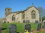 More images |
| Beverley North Bar Nos 65 and 67 (bar House) Including Garden Wall, Piers and Railings | Beverley, East Riding of Yorkshire | House | 1409 | 1 March 1950 | TA0299239871 53°50′42″N 0°26′10″W / 53.844879°N 0.436076°W / 53.844879; -0.436076 (Beverley North Bar Nos 65 and 67 (bar House) Including Garden Wall, Piers and Railings) | 1162565 |  More images |
| Gates, Gate Piers and Railings to Norwood House | Beverley, East Riding of Yorkshire | Gate | c. 1780 | 30 June 1987 | TA0331739921 53°50′43″N 0°25′52″W / 53.845264°N 0.431122°W / 53.845264; -0.431122 (Gates, Gate Piers and Railings to Norwood House) | 1318235 |  Upload Photo |
| Norwood House (formerly Beverley High School for Girls, now offices) | Beverley, East Riding of Yorkshire | House | c.1765–70 | 1 March 1950 | TA0330639936 53°50′43″N 0°25′53″W / 53.845401°N 0.431284°W / 53.845401; -0.431284 (Norwood House (formerly Beverley High School for Girls, now offices)) | 1346387 |  More images |
| The Guildhall | Beverley, East Riding of Yorkshire | Court Room | 15th century | 1 March 1950 | TA0339439472 53°50′28″N 0°25′48″W / 53.841215°N 0.430103°W / 53.841215; -0.430103 (The Guildhall) | 1083960 |  More images |
| The Hall (now Borough Council Offices) | Beverley, East Riding of Yorkshire | Merchants House | c. 1700 | 1 March 1950 | TA0326239284 53°50′22″N 0°25′56″W / 53.839552°N 0.432171°W / 53.839552; -0.432171 (The Hall (now Borough Council Offices)) | 1084022 | Upload Photo |
| The Market Cross | Beverley, East Riding of Yorkshire | Market Cross | 1714 | 1 March 1950 | TA0322239669 53°50′35″N 0°25′58″W / 53.843019°N 0.43265°W / 53.843019; -0.43265 (The Market Cross) | 1346372 |  More images |
| The Minster Church of St John | Beverley, East Riding of Yorkshire | Treadwheel | pre 1225 | 1 March 1950 | TA0375739261 53°50′21″N 0°25′29″W / 53.839247°N 0.424659°W / 53.839247; -0.424659 (The Minster Church of St John) | 1084028 |  More images |
| The Parish Church of St Mary | Beverley, East Riding of Yorkshire | Parish Church | 12th century | 1 March 1950 | TA0315039805 53°50′39″N 0°26′01″W / 53.844255°N 0.433698°W / 53.844255; -0.433698 (The Parish Church of St Mary) | 1162693 |  More images |
| Church of St Edith | Bishop Wilton, East Riding of Yorkshire | Church | 12th century | 26 January 1967 | SE7982355212 53°59′12″N 0°47′03″W / 53.986802°N 0.784132°W / 53.986802; -0.784132 (Church of St Edith) | 1083868 |  More images |
| Boynton Hall | Boynton, East Riding of Yorkshire | Country House | Late 16th century | 11 January 1952 | TA1378567806 54°05′37″N 0°15′42″W / 54.093586°N 0.261695°W / 54.093586; -0.261695 (Boynton Hall) | 1083385 |  More images |
| Church of St Andrew | Boynton, East Riding of Yorkshire | Church | 15th century | 30 June 1966 | TA1366067975 54°05′42″N 0°15′49″W / 54.095132°N 0.263542°W / 54.095132; -0.263542 (Church of St Andrew) | 1083392 |  More images |
| Church of St Mary | Brandesburton, East Riding of Yorkshire | Church | 12th century | 16 December 1966 | TA1194647645 53°54′46″N 0°17′50″W / 53.91287°N 0.297209°W / 53.91287; -0.297209 (Church of St Mary) | 1263780 |  More images |
| Parish Church of St Mary | Bridlington, East Riding of Yorkshire | Church | c. 1113 | 7 September 1951 | TA1770167985 54°05′40″N 0°12′06″W / 54.094315°N 0.201781°W / 54.094315; -0.201781 (Parish Church of St Mary) | 1346530 |  More images |
| Sewerby House | Sewerby, East Riding of Yorkshire | House | c. 1714 | 7 September 1951 | TA2034369061 54°06′12″N 0°09′40″W / 54.10337°N 0.160978°W / 54.10337; -0.160978 (Sewerby House) | 1367122 |  More images |
| The Bayle Gate | Bridlington, East Riding of Yorkshire | Augustinian Monastery | c. 1388 | 7 September 1951 | TA1758667885 54°05′36″N 0°12′13″W / 54.093443°N 0.203577°W / 54.093443; -0.203577 (The Bayle Gate) | 1346512 |  More images |
| Church of All Saints | Bubwith, East Riding of Yorkshire | Church | Late 12th century | 16 December 1960 | SE7116736178 53°49′01″N 0°55′14″W / 53.817021°N 0.920532°W / 53.817021; -0.920532 (Church of All Saints) | 1310699 |  More images |
| Church of St Andrew | Bugthorpe, East Riding of Yorkshire | Church | 12th century | 26 January 1967 | SE7724857878 54°00′40″N 0°49′22″W / 54.011148°N 0.822717°W / 54.011148; -0.822717 (Church of St Andrew) | 1309966 |  More images |
| Church of All Saints | Burstwick, East Riding of Yorkshire | Parish Church | 13th century | 16 December 1966 | TA2276928032 53°44′03″N 0°08′25″W / 53.734234°N 0.140351°W / 53.734234; -0.140351 (Church of All Saints) | 1366240 |  More images |
| Burton Agnes Hall | Burton Agnes, East Riding of Yorkshire | Country House | 1601–1610 | 11 January 1952 | TA1029063273 54°03′13″N 0°19′00″W / 54.053623°N 0.316757°W / 54.053623; -0.316757 (Burton Agnes Hall) | 1346451 |  More images |
| Burton Agnes Manor House | Burton Agnes, East Riding of Yorkshire | Manor House | 1170–5 | 17 July 1987 | TA1025163251 54°03′12″N 0°19′02″W / 54.053434°N 0.31736°W / 54.053434; -0.31736 (Burton Agnes Manor House) | 1280994 | 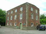 More images |
| Church of St Martin | Burton Agnes, East Riding of Yorkshire | Boiler House | Late 20th century | 30 June 1966 | TA1020863256 54°03′13″N 0°19′05″W / 54.053488°N 0.318015°W / 54.053488; -0.318015 (Church of St Martin) | 1083812 |  More images |
| Gatehouse with Walls and Sets of Gate Piers Adjoining to Front of Burton Agnes Hall | Burton Agnes, East Riding of Yorkshire | Gate Pier | c. 1610 | 17 July 1987 | TA1030763155 54°03′09″N 0°19′00″W / 54.05256°N 0.31654°W / 54.05256; -0.31654 (Gatehouse with Walls and Sets of Gate Piers Adjoining to Front of Burton Agnes Hall) | 1083815 | 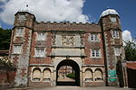 More images |
| Remains of Treadmill and Bakery with Attached Wall at Burton Agnes Hall | Burton Agnes, East Riding of Yorkshire | Wall | c. 1600 | 17 July 1987 | TA1024163260 54°03′13″N 0°19′03″W / 54.053517°N 0.31751°W / 54.053517; -0.31751 (Remains of Treadmill and Bakery with Attached Wall at Burton Agnes Hall) | 1346453 | Upload Photo |
| Burton Constable Hall | Burton Constable, East Riding of Yorkshire | Country House | Late 16th century | 4 March 1952 | TA1887136784 53°48′50″N 0°11′46″W / 53.81376°N 0.196041°W / 53.81376; -0.196041 (Burton Constable Hall) | 1083444 | 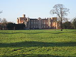 More images |
| Stables and Carriage House Approximately 20 Metres to South-east of Burton Constable Hall | Burton Constable Park, Burton Constable, East Riding of Yorkshire | Courtyard | 1760–1770 | 16 December 1966 | TA1897836634 53°48′45″N 0°11′40″W / 53.812388°N 0.194475°W / 53.812388; -0.194475 (Stables and Carriage House Approximately 20 Metres to South-east of Burton Constable Hall) | 1366245 | 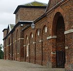 More images |
| Church of Saint Peter and Saint Paul | Burton Pidsea, East Riding of Yorkshire | Church | Early 13th century | 16 December 1966 | TA2519631102 53°45′40″N 0°06′08″W / 53.761236°N 0.102338°W / 53.761236; -0.102338 (Church of Saint Peter and Saint Paul) | 1083494 |  More images |
| Church of All Saints | Low Catton, East Riding of Yorkshire | Church | 12th century | 26 January 1967 | SE7048053990 53°58′38″N 0°55′37″W / 53.977177°N 0.926872°W / 53.977177; -0.926872 (Church of All Saints) | 1346407 |  More images |
| Church of Saint Mary | Cottingham, East Riding of Yorkshire | Church | Early 14th century | 31 January 1967 | TA0475832937 53°46′56″N 0°24′42″W / 53.782228°N 0.411603°W / 53.782228; -0.411603 (Church of Saint Mary) | 1103394 |  More images |
| Church of Saint Mary | South Dalton, East Riding of Yorkshire | Church | 1858–61 | 7 February 1968 | SE9672445558 53°53′50″N 0°31′46″W / 53.89718°N 0.529519°W / 53.89718; -0.529519 (Church of Saint Mary) | 1103439 |  More images |
| Summer Pavilion to West of Dalton Hall | Dalton Holme, East Riding of Yorkshire | Pavilion | Before 1737 | 7 February 1968 | SE9485544858 53°53′28″N 0°33′29″W / 53.891235°N 0.558168°W / 53.891235; -0.558168 (Summer Pavilion to West of Dalton Hall) | 1103438 | Upload Photo |
| Church of All Saints | Driffield, East Riding of Yorkshire | Church | Pre-conquest | 27 November 1963 | TA0220657976 54°00′28″N 0°26′31″W / 54.007698°N 0.441972°W / 54.007698; -0.441972 (Church of All Saints) | 1083378 |  More images |
| Church of All Saints | Easington, East Riding of Yorkshire | Parish Church | 12th century | 16 December 1966 | TA3989319170 53°39′01″N 0°06′54″E / 53.650329°N 0.115065°E / 53.650329; 0.115065 (Church of All Saints) | 1346602 |  More images |
| Church of St Michael | Garton, East Riding of Yorkshire | Church | Early 13th century | 16 December 1966 | TA2704535454 53°48′00″N 0°04′21″W / 53.799883°N 0.072516°W / 53.799883; -0.072516 (Church of St Michael) | 1215863 | 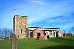 More images |
| Grimston Garth | Grimston, East Riding of Yorkshire | House | 1781–6 | 16 December 1966 | TA2828635100 53°47′47″N 0°03′14″W / 53.796399°N 0.053833°W / 53.796399; -0.053833 (Grimston Garth) | 1215935 | Upload Photo |
| Church of St Michael | Eastrington, East Riding of Yorkshire | Church | 11th century | 16 December 1966 | SE7964929978 53°45′36″N 0°47′36″W / 53.76008°N 0.793329°W / 53.76008; -0.793329 (Church of St Michael) | 1031835 |  More images |
| Church of All Saints | Aughton, East Riding of Yorkshire | Church | Late 12th century | 16 December 1966 | SE7016338650 53°50′22″N 0°56′07″W / 53.839371°N 0.935215°W / 53.839371; -0.935215 (Church of All Saints) | 1346742 |  More images |
| Chapel of the Virgin and Saint Everilda | Everingham Park, Everingham, East Riding of Yorkshire | Church | 1836–39 | 26 January 1967 | SE8057642153 53°52′10″N 0°46′34″W / 53.869341°N 0.776088°W / 53.869341; -0.776088 (Chapel of the Virgin and Saint Everilda) | 1346301 |  More images |
| Everingham Hall | Everingham Park, Everingham, East Riding of Yorkshire | House | 1757–64 | 26 January 1967 | SE8061242121 53°52′09″N 0°46′32″W / 53.869047°N 0.775549°W / 53.869047; -0.775549 (Everingham Hall) | 1084130 |  More images |
| Church of St Mary | Fridaythorpe, East Riding of Yorkshire | Church | 12th century | 20 September 1966 | SE8747059263 54°01′19″N 0°39′59″W / 54.021965°N 0.66638°W / 54.021965; -0.66638 (Church of St Mary) | 1346479 |  More images |
| Church of St Michael | Garton on the Wolds, East Riding of Yorkshire | Church | c. 1132 | 20 September 1966 | SE9819759328 54°01′14″N 0°30′10″W / 54.020622°N 0.502684°W / 54.020622; -0.502684 (Church of St Michael) | 1160977 |  More images |
| Church of All Hallows | Goodmanham, East Riding of Yorkshire | Church | 7th century | 4 March 1986 | SE8898843143 53°52′37″N 0°38′52″W / 53.876864°N 0.647909°W / 53.876864; -0.647909 (Church of All Hallows) | 1084132 |  More images |
| Church of All Saints | Halsham, East Riding of Yorkshire | Parish Church | Early 12th century | 16 December 1966 | TA2681027742 53°43′50″N 0°04′45″W / 53.730664°N 0.079247°W / 53.730664; -0.079247 (Church of All Saints) | 1160776 |  More images |
| Church of Saint John of Beverley | Harpham, East Riding of Yorkshire | Church | 12th century | 20 September 1966 | TA0922861583 54°02′19″N 0°20′01″W / 54.038667°N 0.333579°W / 54.038667; -0.333579 (Church of Saint John of Beverley) | 1083345 |  More images |
| Church of St. Martin | Hayton, East Riding of Yorkshire | Church | 12th century | 26 January 1967 | SE8209146023 53°54′14″N 0°45′07″W / 53.903878°N 0.752019°W / 53.903878; -0.752019 (Church of St. Martin) | 1084144 |  More images |
| Church of St Augustine | Hedon, East Riding of Yorkshire | Parish Church | 13th century | 9 January 1954 | TA1883128736 53°44′29″N 0°11′59″W / 53.74147°N 0.199746°W / 53.74147; -0.199746 (Church of St Augustine) | 1346568 |  More images |
| Church of All Saints | Hessle, East Riding of Yorkshire | Church | 12th century | 31 January 1967 | TA0330326433 53°43′27″N 0°26′09″W / 53.724082°N 0.435848°W / 53.724082; -0.435848 (Church of All Saints) | 1161766 | 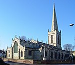 More images |
| Church of All Saints | Holme upon Spalding Moor, East Riding of Yorkshire | Church | 13th century | 16 December 1966 | SE8209938940 53°50′25″N 0°45′14″W / 53.840231°N 0.75379°W / 53.840231; -0.75379 (Church of All Saints) | 1025868 |  More images |
| Church of Saint Nicholas | Hornsea, East Riding of Yorkshire | Church | 13th century | 22 April 1965 | TA2009847639 53°54′40″N 0°10′23″W / 53.910993°N 0.173172°W / 53.910993; -0.173172 (Church of Saint Nicholas) | 1249386 |  More images |
| Minster Church of St Peter and St Paul and Chapter House | Howden, East Riding of Yorkshire | Tower | Late 14th century | 16 December 1966 | SE7480328251 53°44′43″N 0°52′02″W / 53.745278°N 0.867236°W / 53.745278; -0.867236 (Minster Church of St Peter and St Paul and Chapter House) | 1160491 | 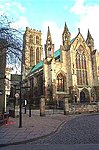 More images |
| Church of St. Mary | Huggate, East Riding of Yorkshire | Church | 12th century | 26 January 1967 | SE8823055510 53°59′17″N 0°39′21″W / 53.988114°N 0.65587°W / 53.988114; -0.65587 (Church of St. Mary) | 1084147 | 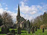 More images |
| Church of Saint Peter | Humbleton, East Riding of Yorkshire | Statue | 1637 | 16 December 1966 | TA2264034853 53°47′44″N 0°08′23″W / 53.79554°N 0.139598°W / 53.79554; -0.139598 (Church of Saint Peter) | 1216050 |  More images |
| Church of St Nicholas | Keyingham, East Riding of Yorkshire | Parish Church | 12th–13th centuries | 16 December 1966 | TA2451825500 53°42′40″N 0°06′54″W / 53.711075°N 0.11487°W / 53.711075; -0.11487 (Church of St Nicholas) | 1160841 | 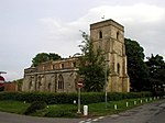 More images |
| Church of All Saints | Kilham, East Riding of Yorkshire | Church | 12th century | 20 September 1966 | TA0642464407 54°03′53″N 0°22′31″W / 54.064623°N 0.375388°W / 54.064623; -0.375388 (Church of All Saints) | 1309840 |  More images |
| Church of All Saints | Kirby Underdale, East Riding of Yorkshire | Church | 11th century | 14 April 1987 | SE8084258590 54°01′01″N 0°46′04″W / 54.016997°N 0.767699°W / 54.016997; -0.767699 (Church of All Saints) | 1083837 | 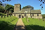 More images |
| Church of Saint Andrew | Kirk Ella, East Riding of Yorkshire | Church | Early 13th century | 31 January 1967 | TA0202729726 53°45′14″N 0°27′15″W / 53.75392°N 0.454094°W / 53.75392; -0.454094 (Church of Saint Andrew) | 1103401 |  More images |
| Church of St Mary | Kirkburn, East Riding of Yorkshire | Church | c. 1139 | 20 September 1966 | SE9796755060 53°58′56″N 0°30′27″W / 53.982319°N 0.507565°W / 53.982319; -0.507565 (Church of St Mary) | 1083797 |  More images |
| Church of Saint Peter | Langtoft, East Riding of Yorkshire | Church | 13th century | 20 September 1966 | TA0083067017 54°05′21″N 0°27′36″W / 54.089195°N 0.459958°W / 54.089195; -0.459958 (Church of Saint Peter) | 1083356 |  More images |
| Church of St. Catherine | Leconfield, East Riding of Yorkshire | Church | 12th century or Earlier | 7 February 1968 | TA0151243749 53°52′48″N 0°27′26″W / 53.880012°N 0.457281°W / 53.880012; -0.457281 (Church of St. Catherine) | 1103450 |  More images |
| Church of St. Leonard | Scorborough, East Riding of Yorkshire | Church | 1857–1859 | 7 February 1968 | TA0157145329 53°53′39″N 0°27′21″W / 53.894197°N 0.45586°W / 53.894197; -0.45586 (Church of St. Leonard) | 1103451 |  More images |
| Church of St. Mary | Lockington, East Riding of Yorkshire | Church | 12th century | 7 February 1968 | SE9971846855 53°54′30″N 0°29′01″W / 53.908266°N 0.483551°W / 53.908266; -0.483551 (Church of St. Mary) | 1310465 |  More images |
| Church of All Saints | Londesborough, East Riding of Yorkshire | Cross | 11th century | 26 January 1967 | SE8686145384 53°53′50″N 0°40′47″W / 53.89736°N 0.679619°W / 53.89736; -0.679619 (Church of All Saints) | 1084136 |  More images |
| Gates, Gatepiers, Flanking Walls and Abutments | Londesborough Park, Londesborough, East Riding of Yorkshire | Gate | c.1660–70 | 26 January 1967 | SE8662545227 53°53′46″N 0°41′00″W / 53.895989°N 0.683253°W / 53.895989; -0.683253 (Gates, Gatepiers, Flanking Walls and Abutments) | 1310607 | Upload Photo |
| Church of All Saints | Market Weighton, East Riding of Yorkshire | Church | 11th century | 26 January 1967 | SE8775941797 53°51′54″N 0°40′01″W / 53.864979°N 0.666982°W / 53.864979; -0.666982 (Church of All Saints) | 1160460 | 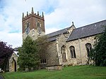 More images |
| Church of St Margaret | Millington, East Riding of Yorkshire | Church | 12th century | 26 January 1967 | SE8302751862 53°57′22″N 0°44′10″W / 53.956196°N 0.736192°W / 53.956196; -0.736192 (Church of St Margaret) | 1161938 |  More images |
| Church of All Saints | Nafferton, East Riding of Yorkshire | Church | 12th century | 20 September 1966 | TA0555659003 54°00′59″N 0°23′26″W / 54.016251°N 0.390521°W / 54.016251; -0.390521 (Church of All Saints) | 1346661 | 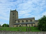 More images |
| Church of Saint Nicholas | North Newbald, East Riding of Yorkshire | Church | c. 1140 | 7 February 1968 | SE9118536578 53°49′03″N 0°36′59″W / 53.817495°N 0.616448°W / 53.817495; -0.616448 (Church of Saint Nicholas) | 1346990 |  More images |
| Church of All Saints | North Cave, East Riding of Yorkshire | Church | Late 12th century | 16 December 1966 | SE8968332728 53°46′59″N 0°38′25″W / 53.783162°N 0.640375°W / 53.783162; -0.640375 (Church of All Saints) | 1203419 |  More images |
| Church of Saint James | Nunburnholme, East Riding of Yorkshire | Cross | c. 1000 | 26 January 1967 | SE8477447791 53°55′10″N 0°42′39″W / 53.919333°N 0.710704°W / 53.919333; -0.710704 (Church of Saint James) | 1309850 | 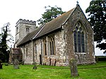 More images |
| Church of St Wilfrid | Ottringham, East Riding of Yorkshire | Parish Church | 12th century | 16 December 1966 | TA2678224427 53°42′03″N 0°04′52″W / 53.700892°N 0.081027°W / 53.700892; -0.081027 (Church of St Wilfrid) | 1160874 |  More images |
| Church of St Germain | Winestead, East Riding of Yorkshire | Parish Church | 12th century | 16 December 1966 | TA2986823746 53°41′38″N 0°02′05″W / 53.694017°N 0.034596°W / 53.694017; -0.034596 (Church of St Germain) | 1161091 |  More images |
| Church of St Patrick | Patrington, East Riding of Yorkshire | Parish Church | First half of 14th century | 16 December 1966 | TA3155422541 53°40′58″N 0°00′35″W / 53.682771°N 0.009589°W / 53.682771; -0.009589 (Church of St Patrick) | 1083450 |  More images |
| Church of St Andrew | Paull, East Riding of Yorkshire | Parish Church | Mid 14th century–15th century | 16 December 1966 | TA1722825738 53°42′54″N 0°13′31″W / 53.714899°N 0.225173°W / 53.714899; -0.225173 (Church of St Andrew) | 1083434 |  More images |
| Paull Holme Tower | Paull Holme, Paull, East Riding of Yorkshire | Tower House | Mid–Late 15th century | 21 May 1987 | TA1852224881 53°42′25″N 0°12′21″W / 53.706908°N 0.205903°W / 53.706908; -0.205903 (Paull Holme Tower) | 1366242 |  More images |
| Church of All Saints | Pocklington, East Riding of Yorkshire | Church | 12th century or earlier | 26 January 1967 | SE8023248974 53°55′50″N 0°46′46″W / 53.930686°N 0.779534°W / 53.930686; -0.779534 (Church of All Saints) | 1162006 |  More images |
| Church of All Saints | Preston, East Riding of Yorkshire | Parish Church | 13th century | 16 December 1966 | TA1871330602 53°45′30″N 0°12′03″W / 53.75826°N 0.200818°W / 53.75826; -0.200818 (Church of All Saints) | 1083438 | 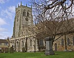 More images |
| Church of All Saints | Tunstall, East Riding of Yorkshire | Church | 13th century | 16 December 1966 | TA3055231990 53°46′04″N 0°01′15″W / 53.7679°N 0.020768°W / 53.7679; -0.020768 (Church of All Saints) | 1216255 |  More images |
| Church of All Saints | Roos, East Riding of Yorkshire | Church | Pre 13th century | 16 December 1966 | TA2907129613 53°44′49″N 0°02′39″W / 53.746916°N 0.044215°W / 53.746916; -0.044215 (Church of All Saints) | 1287781 |  More images |
| Church of All Saints | Rudston, East Riding of Yorkshire | Church | 12th century | 30 June 1966 | TA0978667731 54°05′38″N 0°19′22″W / 54.09378°N 0.322838°W / 54.09378; -0.322838 (Church of All Saints) | 1162387 |  More images |
| Dairy at Thorpe Hall | Rudston, East Riding of Yorkshire | Dairy | Early 19th century | 30 June 1966 | TA1085267699 54°05′36″N 0°18′24″W / 54.093264°N 0.306559°W / 54.093264; -0.306559 (Dairy at Thorpe Hall) | 1083403 | Upload Photo |
| Monolith Approximately 7 Metres North of Church of All Saints | Rudston, East Riding of Yorkshire | Standing Stone | Probably Bronze Age | 30 June 1966 | TA0980367743 54°05′38″N 0°19′21″W / 54.093884°N 0.322574°W / 54.093884; -0.322574 (Monolith Approximately 7 Metres North of Church of All Saints) | 1083402 |  More images |
| Houghton Hall | Sancton, East Riding of Yorkshire | House | c. 1760 | 18 January 1952 | SE8883339145 53°50′27″N 0°39′05″W / 53.840967°N 0.651422°W / 53.840967; -0.651422 (Houghton Hall) | 1160656 |  More images |
| Church of All Saints | Shipton Thorpe, East Riding of Yorkshire | Church | 12th century | 26 January 1967 | SE8523343158 53°52′39″N 0°42′18″W / 53.877628°N 0.705005°W / 53.877628; -0.705005 (Church of All Saints) | 1310431 |  More images |
| Church of St Helen | Skeffling, East Riding of Yorkshire | Parish Church | 1460s | 16 December 1966 | TA3707719050 53°39′00″N 0°04′21″E / 53.649996°N 0.072437°E / 53.649996; 0.072437 (Church of St Helen) | 1161165 |  More images |
| Church of St Leonard | Skerne, East Riding of Yorkshire | Church | 12th century | 20 September 1966 | TA0466155115 53°58′53″N 0°24′20″W / 53.981503°N 0.40551°W / 53.981503; -0.40551 (Church of St Leonard) | 1084138 |  More images |
| Church of All Saints | Skipsea, East Riding of Yorkshire | Boiler House | 20th century | 30 June 1966 | TA1656054977 53°58′40″N 0°13′27″W / 53.97772°N 0.224206°W / 53.97772; -0.224206 (Church of All Saints) | 1083824 |  More images |
| Church of St Augustine | Skirlaugh, East Riding of Yorkshire | Church | c. 1401 | 16 December 1966 | TA1417039705 53°50′28″N 0°15′59″W / 53.841054°N 0.266321°W / 53.841054; -0.266321 (Church of St Augustine) | 1161844 |  More images |
| Sledmere House | Sledmere, East Riding of Yorkshire | Country House | 1751 | 7 September 1987 | SE9308264669 54°04′10″N 0°34′45″W / 54.069556°N 0.579092°W / 54.069556; -0.579092 (Sledmere House) | 1083802 |  More images |
| Eleanor Cross | Sledmere, East Riding of Yorkshire | Memorial cross | 1898 | 2 March 2016 | SE9286364622 54°04′09″N 0°34′57″W / 54.069174°N 0.582452°W / 54.069174; -0.582452 (Eleanor Cross) | 1083806 | 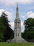 More images |
| Wagoners' Memorial | Sledmere, East Riding of Yorkshire | Memorial | 1920 | 18 March 2016 | SE9289864690 54°04′11″N 0°34′55″W / 54.069778°N 0.581897°W / 54.069778; -0.581897 (Wagoners' Memorial) | 1161354 |  More images |
| Church of St Lawrence | Snaith, East Riding of Yorkshire | Parish Church | 12th century | 14 February 1967 | SE6410022169 53°41′31″N 1°01′51″W / 53.692043°N 1.030756°W / 53.692043; -1.030756 (Church of St Lawrence) | 1161899 |  More images |
| Cowick Hall | East Cowick, East Riding of Yorkshire | Country House | 1660–90 | 23 April 1952 | SE6568021107 53°40′56″N 1°00′25″W / 53.682304°N 1.007057°W / 53.682304; -1.007057 (Cowick Hall) | 1083323 | 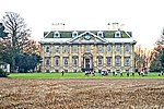 More images |
| Church of Saint Michael and All Angels | Sutton upon Derwent, East Riding of Yorkshire | Tower | 15th century | 26 January 1967 | SE7058547308 53°55′02″N 0°55′37″W / 53.917117°N 0.926813°W / 53.917117; -0.926813 (Church of Saint Michael and All Angels) | 1162085 |  More images |
| Church of St Mary | Swine, East Riding of Yorkshire | Church | c. 1180 | 16 December 1966 | TA1342535816 53°48′23″N 0°16′45″W / 53.806279°N 0.279071°W / 53.806279; -0.279071 (Church of St Mary) | 1083427 |  More images |
| Church of All Saints | Thwing, East Riding of Yorkshire | Church | 12th century | 30 June 1966 | TA0490870212 54°07′02″N 0°23′48″W / 54.117085°N 0.396532°W / 54.117085; -0.396532 (Church of All Saints) | 1083406 |  More images |
| Church of All Saints | Adlingfleet, East Riding of Yorkshire | Parish Church | Mid 13th century | 14 February 1967 | SE8439521003 53°40′43″N 0°43′26″W / 53.678686°N 0.723802°W / 53.678686; -0.723802 (Church of All Saints) | 1083144 |  More images |
| Church of St Mary Magdalene | Whitgift, East Riding of Yorkshire | Parish Church | 12th century | 14 February 1967 | SE8086722699 53°41′40″N 0°46′36″W / 53.694483°N 0.776758°W / 53.694483; -0.776758 (Church of St Mary Magdalene) | 1083151 |  More images |
| Church of St Mary | Watton, East Riding of Yorkshire | Church | 15th century | 20 September 1966 | TA0219749732 53°56′01″N 0°26′42″W / 53.933632°N 0.444869°W / 53.933632; -0.444869 (Church of St Mary) | 1083772 |  More images |
| Watton Abbey | Watton, East Riding of Yorkshire | House | 19th century | 12 February 1952 | TA0234449798 53°56′03″N 0°26′33″W / 53.934196°N 0.442609°W / 53.934196; -0.442609 (Watton Abbey) | 1161550 |  More images |
| Church of St Peter | Wawne, East Riding of Yorkshire | Church | 12th century or Earlier | 7 February 1968 | TA0911736819 53°48′58″N 0°20′39″W / 53.816211°N 0.344104°W / 53.816211; -0.344104 (Church of St Peter) | 1103427 |  More images |
| Church of St Mary | Welwick, East Riding of Yorkshire | Parish Church | Late 13th century | 16 December 1966 | TA3415621115 53°40′09″N 0°01′45″E / 53.669301°N 0.029166°E / 53.669301; 0.029166 (Church of St Mary) | 1366256 | 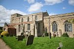 More images |
| Church of St John the Baptist | Wilberfoss, East Riding of Yorkshire | Tower | 19th century | 26 January 1967 | SE7327250995 53°57′00″N 0°53′06″W / 53.949877°N 0.885029°W / 53.949877; -0.885029 (Church of St John the Baptist) | 1162096 |  More images |
| Ruins of Wressle Castle | Wressle, East Riding of Yorkshire | Castle | c. 1380 | 16 December 1966 | SE7066031547 53°46′32″N 0°55′45″W / 53.775474°N 0.929291°W / 53.775474; -0.929291 (Ruins of Wressle Castle) | 1083170 |  More images |
| Humber Bridge | Hessle | Suspension bridge | 1981 | 12 July 2017 | TA0241224487 53°42′24″N 0°27′00″W / 53.706773°N 0.44998943°W / 53.706773; -0.44998943 (Humber Bridge) | 1447321 |  More images |
See also
- Category:Grade I listed buildings in the East Riding of Yorkshire
- Grade I listed churches in the East Riding of Yorkshire
Notes
- ^ a b The date given is the date used by Historic England as significant for the initial building or that of an important part in the structure's description.
- ^ a b Sometimes known as OSGB36, the grid reference is based on the British national grid reference system used by the Ordnance Survey.
- ^ a b The "List Entry Number" is a unique number assigned to each listed building and scheduled monument by Historic England.
References
Map all coordinates using OpenStreetMap
Download coordinates as:
- KML
- GPX (all coordinates)
- GPX (primary coordinates)
- GPX (secondary coordinates)
Wikimedia Commons has media related to Grade I listed buildings in the East Riding of Yorkshire.
- Historic England Images of England
- v
- t
- e
- Bedfordshire
- Berkshire
- Bristol
- Buckinghamshire
- Cambridgeshire
- Cheshire
- Cornwall
- Cumbria
- Derbyshire
- Devon
- Dorset
- Durham
- East Sussex
- East Riding of Yorkshire
- Essex
- Gloucestershire
- Greater London
- Greater Manchester
- Hampshire
- Herefordshire
- Hertfordshire
- Isle of Wight
- Kent
- Lancashire
- Leicestershire
- Lincolnshire
- Merseyside
- Norfolk
- North Yorkshire
- Northamptonshire
- Northumberland
- Nottinghamshire
- Oxfordshire
- Rutland
- Shropshire
- Somerset
- South Yorkshire
- Staffordshire
- Suffolk
- Surrey
- Tyne and Wear
- Warwickshire
- West Midlands
- West Sussex
- West Yorkshire
- Wiltshire
- Worcestershire
- Babergh
- Bath and North East Somerset
- Bradford
- Brighton and Hove
- Broadland
- Cheltenham
- Cheshire East
- Cheshire West and Chester
- Cotswold
- Craven
- Dartford
- Dover
- Forest Heath
- Forest of Dean
- Ipswich
- Maidstone
- Mendip
- Mid Suffolk
- North Somerset
- Sedgemoor
- South Gloucestershire
- South Somerset
- St Edmundsbury
- Stroud
- Suffolk Coastal
- Taunton Deane
- Tewkesbury
- Waveney
- West Somerset
- Churches
- War memorials
- 20th century
| |
|---|---|
Yorkshire Portal | |
| Unitary authorities | |
| Major settlements (cities in italics) | |
| Rivers | |
| Canals | |
| Topics |
|


