Grade I listed buildings in Nottinghamshire

Map all coordinates using OpenStreetMap
Download coordinates as:
- KML
- GPX (all coordinates)
- GPX (primary coordinates)
- GPX (secondary coordinates)
There are over 9,000 Grade I listed buildings in England. This page is a list of these buildings in the county of Nottinghamshire, by district.
Ashfield
| Name | Location | Type | Completed [note 1] | Date designated | Grid ref.[note 2] Geo-coordinates | Entry number [note 3] | Image |
|---|---|---|---|---|---|---|---|
| Ruins of Church of All Saints | Annesley Park, Annesley | Parish Church | 12th century | 13 October 1966 | SK5034952363 53°03′58″N 1°15′00″W / 53.066144°N 1.250077°W / 53.066144; -1.250077 (Ruins of Church of All Saints) | 1234999 |  More images |
| Church of St Katharine | Teversal | Tower | 13th century | 12 October 1988 | SK4833961902 53°09′07″N 1°16′43″W / 53.152068°N 1.278638°W / 53.152068; -1.278638 (Church of St Katharine) | 1234886 |  More images |
Bassetlaw
| Name | Location | Type | Completed [note 1] | Date designated | Grid ref.[note 2] Geo-coordinates | Entry number [note 3] | Image |
|---|---|---|---|---|---|---|---|
| Church of All Saints | Babworth, Bassetlaw | Parish Church | 15th century | 27 November 1984 | SK6863380851 53°19′13″N 0°58′16″W / 53.320146°N 0.97115°W / 53.320146; -0.97115 (Church of All Saints) | 1370370 |  More images |
| Blyth New Bridge | Blyth | Bridge | c. 1770 | 4 January 1952 | SK6173287204 53°22′41″N 1°04′25″W / 53.378092°N 1.073495°W / 53.378092; -1.073495 (Blyth New Bridge) | 1238969 | 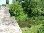 More images |
| St. Mary and St. Martin’s Church, Blyth | Blyth | Church | Late 11th century | 30 November 1966 | SK6240387292 53°22′44″N 1°03′48″W / 53.378804°N 1.063393°W / 53.378804; -1.063393 (St. Mary and St. Martin’s Church, Blyth) | 1239182 |  More images |
| Serlby Hall | Blyth | House | 1812 | 4 January 1952 | SK6345589342 53°23′50″N 1°02′50″W / 53.397103°N 1.04717°W / 53.397103; -1.04717 (Serlby Hall) | 1045126 |  More images |
| St John the Evangelist's Church, Carlton in Lindrick | South Carlton, Carlton in Lindrick | Church | 14th century | 30 November 1966 | SK5882683902 53°20′55″N 1°07′04″W / 53.348746°N 1.117786°W / 53.348746; -1.117786 (St John the Evangelist's Church, Carlton in Lindrick) | 1045742 |  More images |
| Church of St John the Baptist | Clarborough, Clarborough and Welham | Parish Church | 13th century | 1 February 1967 | SK7346283279 53°20′29″N 0°53′53″W / 53.34132°N 0.89811°W / 53.34132; -0.89811 (Church of St John the Baptist) | 1370125 |  More images |
| St. Peter's Church, Clayworth | Clayworth | Parish Church | 12th century | 1 February 1967 | SK7263488428 53°23′16″N 0°54′34″W / 53.387708°N 0.909363°W / 53.387708; -0.909363 (St. Peter's Church, Clayworth) | 1212157 | 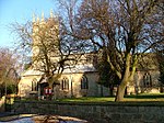 More images |
| Church of St Mary the Virgin, Clumber Park | Clumber Park, Clumber and Hardwick, Bassetlaw | Chapel | 1886-1889 | 13 February 1967 | SK6267274606 53°15′53″N 1°03′43″W / 53.264757°N 1.061853°W / 53.264757; -1.061853 (Church of St Mary the Virgin, Clumber Park) | 1045032 |  More images |
| St Mary's Church, Norton Cuckney | Cuckney | Church | 12th century | 30 November 1966 | SK5663271391 53°14′12″N 1°09′11″W / 53.236539°N 1.152967°W / 53.236539; -1.152967 (St Mary's Church, Norton Cuckney) | 1206551 |  More images |
| St Oswald's Church, Dunham-on-Trent | Dunham-on-Trent | Parish Church | 15th century | 1 February 1967 | SK8150874487 53°15′40″N 0°46′46″W / 53.261133°N 0.779548°W / 53.261133; -0.779548 (St Oswald's Church, Dunham-on-Trent) | 1370101 |  More images |
| Church of St Peter and St Paul, East Drayton | East Drayton, Bassetlaw | Parish Church | Late 12th century | 1 February 1967 | SK7755975330 53°16′09″N 0°50′19″W / 53.2693°N 0.838529°W / 53.2693; -0.838529 (Church of St Peter and St Paul, East Drayton) | 1212946 | 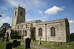 More images |
| Church of St John the Baptist, East Markham | East Markham | Church | 14th century | 1 February 1967 | SK7432072661 53°14′45″N 0°53′16″W / 53.245776°N 0.887707°W / 53.245776; -0.887707 (Church of St John the Baptist, East Markham) | 1223679 |  More images |
| Apleyhead Lodge, Clumber Park | Clumber Park, Elkesley | Gate | c. 1770 | 1 February 1967 | SK6449877322 53°17′20″N 1°02′02″W / 53.288949°N 1.033931°W / 53.288949; -1.033931 (Apleyhead Lodge, Clumber Park) | 1267083 |  More images |
| St Giles' Church, Elkesley | Elkesley | Parish Church | c. 1300 | 1 February 1967 | SK6892375514 53°16′20″N 0°58′05″W / 53.272144°N 0.967954°W / 53.272144; -0.967954 (St Giles' Church, Elkesley) | 1223919 |  More images |
| St Gregory's Church, Fledborough | Fledborough | Sundial | 12th century | 1 February 1967 | SK8120772196 53°14′26″N 0°47′05″W / 53.24059°N 0.784642°W / 53.24059; -0.784642 (St Gregory's Church, Fledborough) | 1045689 |  More images |
| Church of St Peter | Gamston | Parish Church | 13th century | 1 February 1967 | SK7087476022 53°16′35″N 0°56′19″W / 53.276453°N 0.938591°W / 53.276453; -0.938591 (Church of St Peter) | 1224125 |  More images |
| Church of St Peter | Hayton | Parish Church | 12th century | 1 February 1967 | SK7271984183 53°20′58″N 0°54′33″W / 53.349547°N 0.90906°W / 53.349547; -0.90906 (Church of St Peter) | 1034425 | 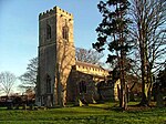 More images |
| St. Peter's Church, Headon-cum-Upton | Headon, Headon cum Upton | Parish Church | 13th century | 1 February 1967 | SK7485477066 53°17′07″N 0°52′43″W / 53.285289°N 0.878672°W / 53.285289; -0.878672 (St. Peter's Church, Headon-cum-Upton) | 1224198 |  More images |
| Hodsock Priory Gatehouse and Bridge | Hodsock | Gatehouse | 16th century | 4 January 1952 | SK6114085462 53°21′45″N 1°04′58″W / 53.362504°N 1.082729°W / 53.362504; -1.082729 (Hodsock Priory Gatehouse and Bridge) | 1187689 |  More images |
| St Peter's Church, Laneham | Church Laneham, Laneham | Parish Church | 12th century | 1 February 1967 | SK8148276570 53°16′47″N 0°46′46″W / 53.279856°N 0.779404°W / 53.279856; -0.779404 (St Peter's Church, Laneham) | 1233511 |  More images |
| St Wilfrid's Church, Low Marnham | Low Marnham, Marnham | Parish Church | 13th century | 1 February 1967 | SK8068069391 53°12′56″N 0°47′36″W / 53.215462°N 0.793246°W / 53.215462; -0.793246 (St Wilfrid's Church, Low Marnham) | 1276534 |  More images |
| All Saints' Church, Mattersey | Mattersey | Parish Church | 13th century | 1 February 1967 | SK6906589383 53°23′48″N 0°57′46″W / 53.396769°N 0.962807°W / 53.396769; -0.962807 (All Saints' Church, Mattersey) | 1239190 | 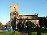 More images |
| Church of St John the Baptist and Boundary Wall | Misson | Church | 19th century | 1 February 1967 | SK6910694931 53°26′48″N 0°57′40″W / 53.446623°N 0.960976°W / 53.446623; -0.960976 (Church of St John the Baptist and Boundary Wall) | 1045108 | 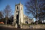 More images |
| All Saints' Church, Misterton | Misterton | Parish Church | c. 1200 | 1 February 1967 | SK7647194774 53°26′39″N 0°51′01″W / 53.444197°N 0.850146°W / 53.444197; -0.850146 (All Saints' Church, Misterton) | 1302717 |  More images |
| St Martin's Church, North Leverton | North Leverton with Habblesthorpe | Parish Church | 12th century | 1 February 1967 | SK7871282261 53°19′53″N 0°49′10″W / 53.331418°N 0.819529°W / 53.331418; -0.819529 (St Martin's Church, North Leverton) | 1234265 | 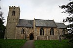 More images |
| Church of All Saints | Rampton, Rampton and Woodbeck | Parish Church | 10th century | 1 February 1967 | SK7995078580 53°17′53″N 0°48′07″W / 53.298152°N 0.80187°W / 53.298152; -0.80187 (Church of All Saints) | 1233879 |  More images |
| Gateway from Manor Farm to Churchyard and Attached Walls 7 Metres West of Manor Farmhouse | Rampton, Rampton and Woodbeck | Gate | Mid 16th century | 28 February 1952 | SK7997278590 53°17′54″N 0°48′06″W / 53.298239°N 0.801538°W / 53.298239; -0.801538 (Gateway from Manor Farm to Churchyard and Attached Walls 7 Metres West of Manor Farmhouse) | 1276407 |  More images |
| St Martin of Tours' Church, Saundby | Saundby | Parish Church | 13th century | 1 February 1967 | SK7854587982 53°22′58″N 0°49′14″W / 53.382855°N 0.820618°W / 53.382855; -0.820618 (St Martin of Tours' Church, Saundby) | 1045083 |  More images |
| Remains of Church of St Helen | South Wheatley, North and South Wheatley | Parish Church | 12th century | 1 February 1967 | SK7664185529 53°21′40″N 0°50′59″W / 53.36109°N 0.84983°W / 53.36109; -0.84983 (Remains of Church of St Helen) | 1216694 |  More images |
| Church of St Nicholas, Littleborough | Littleborough, Sturton Le Steeple | Parish Church | 11th century | 1 February 1967 | SK8245482619 53°20′03″N 0°45′48″W / 53.334066°N 0.76326°W / 53.334066; -0.76326 (Church of St Nicholas, Littleborough) | 1216860 |  More images |
| Church of St Bartholomew | Sutton | Parish Church | 12th century | 1 February 1967 | SK6808984975 53°21′26″N 0°58′42″W / 53.35728°N 0.97843°W / 53.35728; -0.97843 (Church of St Bartholomew) | 1239776 |  More images |
| Church of St John the Baptist | Treswell | Parish Church | 13th century | 1 February 1967 | SK7815879396 53°18′21″N 0°49′43″W / 53.305752°N 0.828551°W / 53.305752; -0.828551 (Church of St John the Baptist) | 1234072 |  More images |
| St Nicholas' Church, Tuxford | Tuxford | Parish Church | 12th century | 1 February 1967 | SK7366771064 53°13′53″N 0°53′52″W / 53.231514°N 0.89786°W / 53.231514; -0.89786 (St Nicholas' Church, Tuxford) | 1224269 |  More images |
| St Mary Magdalene's Church, Walkeringham | Walkeringham | Parish Church | 13th century | 1 February 1967 | SK7706792227 53°25′16″N 0°50′30″W / 53.421221°N 0.841797°W / 53.421221; -0.841797 (St Mary Magdalene's Church, Walkeringham) | 1045085 |  More images |
| Welbeck Abbey College Offices | Welbeck Abbey, Welbeck | Offices | 1985 | 8 February 1972 | SK5632574329 53°15′47″N 1°09′25″W / 53.262978°N 1.157047°W / 53.262978; -1.157047 (Welbeck Abbey College Offices) | 1224773 |  |
| Welbeck Abbey and Attached Picture Gallery, Chapel and Library | Welbeck Abbey, Welbeck | Country House | Early 17th century | 8 February 1972 | SK5635874302 53°15′46″N 1°09′24″W / 53.262732°N 1.156557°W / 53.262732; -1.156557 (Welbeck Abbey and Attached Picture Gallery, Chapel and Library) | 1224867 | More images |
| All Saints' Church, West Markham (Milton Mausoleum) | Milton, West Markham | Parish Church | 1832 | 1 February 1967 | SK7151272999 53°14′57″N 0°55′47″W / 53.249199°N 0.929704°W / 53.249199; -0.929704 (All Saints' Church, West Markham (Milton Mausoleum)) | 1224544 | 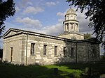 More images |
| All Saints' Church, West Markham | Markham Clinton, West Markham | Parish Church | Late 12th century | 1 February 1967 | SK7214372684 53°14′47″N 0°55′13″W / 53.246283°N 0.92032°W / 53.246283; -0.92032 (All Saints' Church, West Markham) | 1224486 |  More images |
| Church of St Cuthbert and St Mary, Worksop Priory, and Remains of Cloister Wall | Worksop | Church | Various | 13 February 1967 | SK5902778906 53°18′14″N 1°06′57″W / 53.303821°N 1.115696°W / 53.303821; -1.115696 (Church of St Cuthbert and St Mary, Worksop Priory, and Remains of Cloister Wall) | 1156758 |  More images |
| Manor Lodge | Worksop | Country House | c. 1590 | 13 February 1967 | SK5649179196 53°18′24″N 1°09′13″W / 53.306704°N 1.153695°W / 53.306704; -1.153695 (Manor Lodge) | 1045041 |  More images |
| Worksop Manor, House and Stable Block | Worksop | Country House | 1701-1704 | 13 February 1967 | SK5699078018 53°17′46″N 1°08′47″W / 53.296063°N 1.146418°W / 53.296063; -1.146418 (Worksop Manor, House and Stable Block) | 1370406 |  More images |
| Worksop Priory Gatehouse | Worksop | Museum | Mid 14th century | 27 September 1951 | SK5899078805 53°18′11″N 1°06′59″W / 53.302918°N 1.11627°W / 53.302918; -1.11627 (Worksop Priory Gatehouse) | 1045028 |  More images |
Broxtowe
| Name | Location | Type | Completed [note 1] | Date designated | Grid ref.[note 2] Geo-coordinates | Entry number [note 3] | Image |
|---|---|---|---|---|---|---|---|
| Stapleford Cross | Stapleford | Cross | 11th century | 14 April 1987 | SK4890337350 52°55′53″N 1°16′26″W / 52.931335°N 1.273921°W / 52.931335; -1.273921 (Stapleford Cross) | 1278059 | 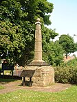 More images |
| Church of All Saints | Strelley | Parish Church | 13th century | 13 October 1966 | SK5065042090 52°58′26″N 1°14′50″W / 52.973778°N 1.247194°W / 52.973778; -1.247194 (Church of All Saints) | 1248224 |  More images |
| St. Mary's Church, Attenborough | Attenborough | Parish Church | 12th century | 14 April 1987 | SK5187034331 52°54′14″N 1°13′49″W / 52.903921°N 1.230267°W / 52.903921; -1.230267 (St. Mary's Church, Attenborough) | 1263869 |  More images |
| Building D6 at Boots Factory Site | Beeston | Industrial Building | Mid 20th Century | 14 April 1987 | SK5430236774 52°55′32″N 1°11′37″W / 52.92564°N 1.193705°W / 52.92564; -1.193705 (Building D6 at Boots Factory Site) | 1278028 |  More images |
| D10 Building at Boots Factory Site, That Part in Nottingham Civil Parish | Beeston | Pharmaceutical Works | 1932 | 28 January 1971 | SK5445436630 52°55′28″N 1°11′29″W / 52.92433°N 1.191468°W / 52.92433; -1.191468 (D10 Building at Boots Factory Site, That Part in Nottingham Civil Parish) | 1247927 |  More images |
City of Nottingham
| Name | Location | Type | Completed [note 1] | Date designated | Grid ref.[note 2] Geo-coordinates | Entry number [note 3] | Image |
|---|---|---|---|---|---|---|---|
| Building D10 at Boots Factory Site | City of Nottingham (mainly in Beeston) | Pharmaceutical Works | 1932 | 28 January 1971 | 52°55′27″N 1°11′32″W / 52.9241°N 1.1923°W / 52.9241; -1.1923 (Building D10 at Boots Factory Site) | 1247927 | More images |
| Castle Museum and Art Gallery | City of Nottingham | Art Gallery | 1876-78 | 11 August 1952 | SK5691439447 52°56′58″N 1°09′16″W / 52.949395°N 1.154388°W / 52.949395; -1.154388 (Castle Museum and Art Gallery) | 1271188 |  More images |
| Church of St Mary | Lace Market, City of Nottingham | Parish Church | Late 14th century | 11 August 1952 | SK5767339654 52°57′04″N 1°08′35″W / 52.951175°N 1.143056°W / 52.951175; -1.143056 (Church of St Mary) | 1342118 | 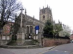 More images |
| Church of St Mary the Virgin | Clifton, City of Nottingham | Tower | Late 14th century | 14 April 1954 | SK5411134805 52°54′29″N 1°11′49″W / 52.907961°N 1.196873°W / 52.907961; -1.196873 (Church of St Mary the Virgin) | 1270726 | 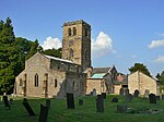 More images |
| Church of St Peter with St James | City of Nottingham | Obelisk | 1811 | 11 August 1952 | SK5730539769 52°57′08″N 1°08′55″W / 52.952248°N 1.148513°W / 52.952248; -1.148513 (Church of St Peter with St James) | 1255013 |  More images |
| Clifton Hall | Clifton, City of Nottingham | Country House | Late 16th century | 14 April 1954 | SK5403434842 52°54′30″N 1°11′53″W / 52.908301°N 1.198012°W / 52.908301; -1.198012 (Clifton Hall) | 1247639 |  More images |
| Building D6 at Boots Factory Site | City of Nottingham | Pharmaceutical Works | 1938 | 4 April 1991 | SK5435736804 52°55′33″N 1°11′34″W / 52.925904°N 1.192882°W / 52.925904; -1.192882 (Building D6 at Boots Factory Site) | 1247645 | More images |
| Nottingham Castle Gatehouse, Outer Bridge and Adjoining Gateway | City of Nottingham | Castle | 1252-55 | 11 August 1952 | SK5694939583 52°57′02″N 1°09′14″W / 52.950614°N 1.153843°W / 52.950614; -1.153843 (Nottingham Castle Gatehouse, Outer Bridge and Adjoining Gateway) | 1247094 | 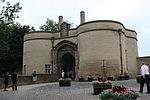 More images |
| Nottingham Castle Outer Bailey Wall and Towers | City of Nottingham | Tower | c. 1280 | 12 July 1972 | SK5704139462 52°56′58″N 1°09′09″W / 52.949517°N 1.152495°W / 52.949517; -1.152495 (Nottingham Castle Outer Bailey Wall and Towers) | 1246765 |  |
| Statue of Captain Albert Ball | City of Nottingham | Statue | 1921 | 12 July 1972 | SK5695139510 52°57′00″N 1°09′14″W / 52.949958°N 1.1538263°W / 52.949958; -1.1538263 (Statue of Captain Albert Ball) | 1246929 |  More images |
| Wollaton Hall | Wollaton Park | Country House | 1580-88 | 11 August 1952 | SK5320239242 52°56′53″N 1°12′35″W / 52.947933°N 1.209662°W / 52.947933; -1.209662 (Wollaton Hall) | 1255269 |  More images |
Gedling
| Name | Location | Type | Completed [note 1] | Date designated | Grid ref.[note 2] Geo-coordinates | Entry number [note 3] | Image |
|---|---|---|---|---|---|---|---|
| St Helen's Church, Burton Joyce | Burton Joyce | Tower | 13th century | 13 October 1966 | SK6478043694 52°59′12″N 1°02′11″W / 52.986677°N 1.036486°W / 52.986677; -1.036486 (St Helen's Church, Burton Joyce) | 1227460 |  More images |
| Holy Trinity Church, Lambley | Lambley | Tower | 13th century | 13 October 1966 | SK6312045435 53°00′09″N 1°03′39″W / 53.002523°N 1.06087°W / 53.002523; -1.06087 (Holy Trinity Church, Lambley) | 1264623 | 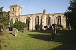 More images |
| Newstead Abbey and Adjoining Boundary Wall | Newstead Park, Newstead | Kitchen | 1819 | 14 May 1952 | SK5416253770 53°04′42″N 1°11′35″W / 53.078418°N 1.192944°W / 53.078418; -1.192944 (Newstead Abbey and Adjoining Boundary Wall) | 1265325 |  More images |
| Church of St James, Papplewick | Papplewick Hall, Papplewick | Parish Church | 14th century | 13 October 1966 | SK5456951526 53°03′30″N 1°11′14″W / 53.058208°N 1.187249°W / 53.058208; -1.187249 (Church of St James, Papplewick) | 1264291 |  More images |
| Papplewick Hall | Papplewick | Country House | c. 1785 | 14 May 1952 | SK5482851721 53°03′36″N 1°11′00″W / 53.059934°N 1.183352°W / 53.059934; -1.183352 (Papplewick Hall) | 1265296 |  More images |
| All Hallows Church, Gedling | Gedling | Cross | 13th century | 18 January 1950 | SK6183842570 52°58′37″N 1°04′50″W / 52.976921°N 1.080518°W / 52.976921; -1.080518 (All Hallows Church, Gedling) | 1235924 |  More images |
Mansfield
| Name | Location | Type | Completed [note 1] | Date designated | Grid ref.[note 2] Geo-coordinates | Entry number [note 3] | Image |
|---|---|---|---|---|---|---|---|
| Church of St Augustine | Sookholme, Warsop | Parish Church | Early 12th century | 29 July 1966 | SK5483466906 53°11′47″N 1°10′50″W / 53.196417°N 1.180671°W / 53.196417; -1.180671 (Church of St Augustine) | 1262532 |  More images |
| Church of St Peter and St Paul | Church Warsop, Warsop | Church | 11th century | 29 July 1966 | SK5678568801 53°12′48″N 1°09′04″W / 53.213244°N 1.151135°W / 53.213244; -1.151135 (Church of St Peter and St Paul) | 1240271 | 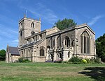 More images |
| Church of St Peter and St Paul | Mansfield | Church | c. 1300 | 19 December 1955 | SK5407861008 53°08′37″N 1°11′35″W / 53.143483°N 1.192981°W / 53.143483; -1.192981 (Church of St Peter and St Paul) | 1214166 | 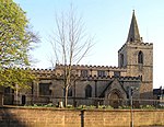 More images |
Newark and Sherwood
| Name | Location | Type | Completed [note 1] | Date designated | Grid ref.[note 2] Geo-coordinates | Entry number [note 3] | Image |
|---|---|---|---|---|---|---|---|
| Church of St Michael | Averham | Parish Church | 11th century | 11 August 1961 | SK7681254367 53°04′52″N 0°51′17″W / 53.081012°N 0.854755°W / 53.081012; -0.854755 (Church of St Michael) | 1046008 |  More images |
| Church of St Giles | Balderton | Parish Church | 12th century | 16 January 1967 | SK8200151578 53°03′19″N 0°46′41″W / 53.055177°N 0.778019°W / 53.055177; -0.778019 (Church of St Giles) | 1369963 | 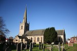 More images |
| Church of All Saints | Barnby in the Willows | Parish Church | 13th century | 16 January 1967 | SK8603352189 53°03′36″N 0°43′04″W / 53.060035°N 0.717715°W / 53.060035; -0.717715 (Church of All Saints) | 1302715 |  More images |
| Church of St Margaret | Bilsthorpe | Church | 13th century | 28 April 1986 | SK6545460255 53°08′08″N 1°01′23″W / 53.135442°N 1.023087°W / 53.135442; -1.023087 (Church of St Margaret) | 1045616 | 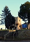 More images |
| Church of St Andrew | Caunton | Parish Church | C12-15 | 11 August 1961 | SK7456660029 53°07′56″N 0°53′13″W / 53.132216°N 0.886965°W / 53.132216; -0.886965 (Church of St Andrew) | 1045974 |  More images |
| Church of All Saints | Collingham | Parish Church | 12th century | 16 January 1967 | SK8297462044 53°08′57″N 0°45′39″W / 53.149084°N 0.760806°W / 53.149084; -0.760806 (Church of All Saints) | 1156985 |  More images |
| Church of St John the Baptist | Collingham | Parish Church | 12th century | 16 January 1967 | SK8266561311 53°08′33″N 0°45′56″W / 53.142544°N 0.765614°W / 53.142544; -0.765614 (Church of St John the Baptist) | 1046050 |  More images |
| Church of St Giles | Cromwell | Parish Church | 13th century | 11 August 1961 | SK7993561536 53°08′42″N 0°48′23″W / 53.144982°N 0.806361°W / 53.144982; -0.806361 (Church of St Giles) | 1369982 | 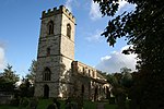 More images |
| Church of St Mary | Edwinstowe | Parish Church | 12th century | 11 August 1961 | SK6252066939 53°11′45″N 1°03′56″W / 53.195867°N 1.065632°W / 53.195867; -1.065632 (Church of St Mary) | 1045467 |  More images |
| Church of St Mary | Egmanton | Parish Church | 11th century | 11 August 1961 | SK7359968914 53°12′44″N 0°53′58″W / 53.212201°N 0.899374°W / 53.212201; -0.899374 (Church of St Mary) | 1156553 |  More images |
| Elston Chapel | Elston | Parish Church | 12th century | 25 February 1952 | SK7617148227 53°01′33″N 0°51′57″W / 53.025921°N 0.865772°W / 53.025921; -0.865772 (Elston Chapel) | 1157196 |  More images |
| Church of the Holy Cross | Epperstone | Parish Church | 13th century | 11 August 1961 | SK6507648527 53°01′48″N 1°01′52″W / 53.030079°N 1.031105°W / 53.030079; -1.031105 (Church of the Holy Cross) | 1045543 | 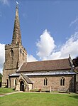 More images |
| Church of St Peter | Farndon | Parish Church | 12th century | 16 January 1967 | SK7679051794 53°03′28″N 0°51′21″W / 53.057891°N 0.855696°W / 53.057891; -0.855696 (Church of St Peter) | 1178470 |  More images |
| Church of St Michael the Archangel and Attached Wall and Railings | Halam | Church | 12th century | 11 August 1961 | SK6781354364 53°04′56″N 0°59′21″W / 53.082201°N 0.989074°W / 53.082201; -0.989074 (Church of St Michael the Archangel and Attached Wall and Railings) | 1045520 | 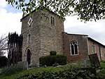 More images |
| Church of All Saints | Hawton | Parish Church | 13th century | 16 January 1967 | SK7883251138 53°03′06″N 0°49′31″W / 53.051698°N 0.825396°W / 53.051698; -0.825396 (Church of All Saints) | 1046031 | 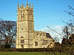 More images |
| Church of St Giles | Holme | Parish Church | 12th century | 16 January 1967 | SK8028159107 53°07′23″N 0°48′06″W / 53.123101°N 0.801797°W / 53.123101; -0.801797 (Church of St Giles) | 1302380 |  More images |
| Church of St Wilfrid | Kelham | Parish Church | 14th century | 11 August 1961 | SK7737755391 53°05′24″N 0°50′46″W / 53.090133°N 0.846076°W / 53.090133; -0.846076 (Church of St Wilfrid) | 1302213 | 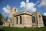 More images |
| Kelham Hall | Kelham | Kitchen | 1859-61 | 13 June 1973 | SK7737255551 53°05′30″N 0°50′46″W / 53.091572°N 0.846112°W / 53.091572; -0.846112 (Kelham Hall) | 1045982 |  More images |
| Church of St Bartholomew | Kneesall | Church | 11th century | 11 August 1961 | SK7041764198 53°10′13″N 0°56′53″W / 53.170247°N 0.94805°W / 53.170247; -0.94805 (Church of St Bartholomew) | 1156936 |  More images |
| Church of St Bartholomew | Langford | Parish Church | 13th century | 16 January 1967 | SK8211459079 53°07′21″N 0°46′28″W / 53.12257°N 0.77442°W / 53.12257; -0.77442 (Church of St Bartholomew) | 1302343 |  More images |
| Church of St Michael | Laxton, Laxton and Moorhouse | Church | 1820 | 11 August 1961 | SK7220067068 53°11′45″N 0°55′15″W / 53.195803°N 0.920735°W / 53.195803; -0.920735 (Church of St Michael) | 1370158 | 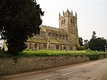 More images |
| Church of St Mary | Lowdham | Parish Church | 13th century | 11 August 1961 | SK6627846827 53°00′53″N 1°00′49″W / 53.014653°N 1.013534°W / 53.014653; -1.013534 (Church of St Mary) | 1285738 |  More images |
| Church of St Radegund | Maplebeck | Parish Church | 13th century | 11 August 1961 | SK7108960764 53°08′21″N 0°56′20″W / 53.139296°N 0.938761°W / 53.139296; -0.938761 (Church of St Radegund) | 1045596 |  More images |
| Church of St Mary Magdalene and Attached Railing | Newark-on-Trent | Tower | c. 1220 | 29 September 1950 | SK7994553928 53°04′36″N 0°48′29″W / 53.076607°N 0.808103°W / 53.076607; -0.808103 (Church of St Mary Magdalene and Attached Railing) | 1279450 |  More images |
| Governor's House | Newark-on-Trent | House | Late 18th century | 29 September 1950 | SK7981053853 53°04′33″N 0°48′36″W / 53.075953°N 0.810137°W / 53.075953; -0.810137 (Governor's House) | 1297633 |  More images |
| Remains of Newark Castle | Newark-on-Trent | Castle | c1133-1148 | 29 September 1950 | SK7963854079 53°04′41″N 0°48′46″W / 53.07801°N 0.812648°W / 53.07801; -0.812648 (Remains of Newark Castle) | 1196278 |  More images |
| Town Hall | Newark-on-Trent | Town Hall and former gaol | c. 1983 | 29 September 1950 | SK7981053908 53°04′35″N 0°48′36″W / 53.076448°N 0.810123°W / 53.076448; -0.810123 (Town Hall) | 1196430 |  More images |
| Church of St Wilfrid | North Muskham | Parish Church | 13th century | 11 August 1961 | SK7982158597 53°07′07″N 0°48′32″W / 53.118586°N 0.808796°W / 53.118586; -0.808796 (Church of St Wilfrid) | 1178997 |  More images |
| Church of St Lawrence | Norwell | Church | Early 14th century | 11 August 1961 | SK7756361763 53°08′51″N 0°50′30″W / 53.147372°N 0.841761°W / 53.147372; -0.841761 (Church of St Lawrence) | 1369970 | 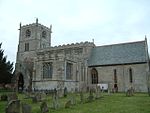 More images |
| Church of the Holy Rood | Ossington | Church | 1782-3 | 11 August 1961 | SK7591065156 53°10′41″N 0°51′56″W / 53.178103°N 0.865668°W / 53.178103; -0.865668 (Church of the Holy Rood) | 1045958 | 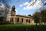 More images |
| Church of St Peter and St Paul | Oxton | Parish Church | 12th century | 11 August 1961 | SK6301251398 53°03′22″N 1°03′41″W / 53.05613°N 1.061317°W / 53.05613; -1.061317 (Church of St Peter and St Paul) | 1285622 |  More images |
| Statue of Sphinx, 70m west of Thoresby Hall | Thoresby Park, Perlethorpe cum Budby | Statue | c. 1685 | 20 June 1986 | SK6375871128 53°14′00″N 1°02′47″W / 53.233369°N 1.046269°W / 53.233369; -1.046269 (Statue of Sphinx, 70m west of Thoresby Hall) | 1302483 |  |
| Thoresby Hall and adjoining outbuildings, gate and railings | Thoresby Park, Perlethorpe cum Budby | House | Early 17th century | 11 August 1961 | SK6384271171 53°14′01″N 1°02′42″W / 53.233746°N 1.045002°W / 53.233746; -1.045002 (Thoresby Hall and adjoining outbuildings, gate and railings) | 1045449 |  More images |
| Church of Holy Trinity | Rolleston | Cross | 11th century | 11 August 1961 | SK7418552503 53°03′53″N 0°53′40″W / 53.06463°N 0.894394°W / 53.06463; -0.894394 (Church of Holy Trinity) | 1045559 |  More images |
| Rufford Abbey | Rufford | Abbey | 1147 | 18 March 1949 | SK6456564780 53°10′34″N 1°02′08″W / 53.176219°N 1.035462°W / 53.176219; -1.035462 (Rufford Abbey) | 1302352 |  More images |
| Church of St Wilfrid | South Muskham | Parish Church | 13th century | 11 August 1961 | SK7938657318 53°06′26″N 0°48′56″W / 53.107157°N 0.81561°W / 53.107157; -0.81561 (Church of St Wilfrid) | 1179422 |  More images |
| Church of St Helena | South Scarle | Parish Church | 12th century | 16 January 1967 | SK8482664024 53°10′00″N 0°43′57″W / 53.166586°N 0.732597°W / 53.166586; -0.732597 (Church of St Helena) | 1302469 |  More images |
| Bishops Manor and Remains of Bishops Palace | Southwell | Archbishops Palace | 1379-1396 | 7 August 1952 | SK7015453744 53°04′35″N 0°57′15″W / 53.076327°N 0.954267°W / 53.076327; -0.954267 (Bishops Manor and Remains of Bishops Palace) | 1211315 |  More images |
| Minster Church of St Mary the Virgin with attached Chapter House | Southwell | Church | 1120-1250 | 11 August 1961 | SK7017153802 53°04′37″N 0°57′14″W / 53.076846°N 0.954°W / 53.076846; -0.954 (Minster Church of St Mary the Virgin with attached Chapter House) | 1374853 | 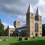 More images |
| Church of All Saints | Sutton-on-Trent | Parish Church | 13th century | 11 August 1961 | SK8006765949 53°11′05″N 0°48′12″W / 53.184622°N 0.803285°W / 53.184622; -0.803285 (Church of All Saints) | 1301889 |  More images |
| Church of St Peter | Thurgarton | Church | c1119-39 | 11 August 1961 | SK6917349192 53°02′08″N 0°58′12″W / 53.035543°N 0.969883°W / 53.035543; -0.969883 (Church of St Peter) | 1045527 |  More images |
| Church of St Peter and St Paul | Upton | Parish Church | 13th century | 11 August 1961 | SK7367754271 53°04′50″N 0°54′06″W / 53.08059°N 0.901569°W / 53.08059; -0.901569 (Church of St Peter and St Paul) | 1369997 |  More images |
| Church of All Saints | Weston | Parish Church | 13th century | 11 August 1961 | SK7741668015 53°12′13″N 0°50′33″W / 53.203581°N 0.842448°W / 53.203581; -0.842448 (Church of All Saints) | 1179778 |  More images |
| Church of St John of Jerusalem | Winkburn | Tower | 17th century | 11 August 1961 | SK7117458310 53°07′02″N 0°56′17″W / 53.117229°N 0.938034°W / 53.117229; -0.938034 (Church of St John of Jerusalem) | 1285594 |  More images |
| Winkburn Hall and Attached Wall | Winkburn | Country House | c. 1700 | 7 August 1952 | SK7119658332 53°07′03″N 0°56′16″W / 53.117424°N 0.9377°W / 53.117424; -0.9377 (Winkburn Hall and Attached Wall) | 1370194 | 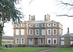 More images |
Rushcliffe
| Name | Location | Type | Completed [note 1] | Date designated | Grid ref.[note 2] Geo-coordinates | Entry number [note 3] | Image |
|---|---|---|---|---|---|---|---|
| Church of St George | Barton in Fabis | Church | 1892 | 13 October 1966 | SK5224532758 52°53′23″N 1°13′30″W / 52.889745°N 1.224944°W / 52.889745; -1.224944 (Church of St George) | 1248685 | 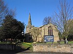 More images |
| Church of St Mary and All Saints | Bingham | Parish Church | 1225 | 1 December 1965 | SK7074439948 52°57′08″N 0°56′55″W / 52.952256°N 0.948479°W / 52.952256; -0.948479 (Church of St Mary and All Saints) | 1045660 |  More images |
| Bunny Hall | Bunny | Country House | c. 1720 | 14 May 1952 | SK5842429594 52°51′38″N 1°08′01″W / 52.860672°N 1.133685°W / 52.860672; -1.133685 (Bunny Hall) | 1249018 |  More images |
| Church of St Mary and adjoining wall | Bunny | Tower | 14th century | 13 October 1966 | SK5828829598 52°51′39″N 1°08′09″W / 52.860723°N 1.135704°W / 52.860723; -1.135704 (Church of St Mary and adjoining wall) | 1248713 |  More images |
| Church of St Mary | Car Colston | Tower | 13th century | 1 December 1965 | SK7208243037 52°58′47″N 0°55′40″W / 52.979841°N 0.927881°W / 52.979841; -0.927881 (Church of St Mary) | 1045667 |  More images |
| Remains of Church of St Mary | Colston Bassett | Church | 12th century | 1 December 1965 | SK6949233842 52°53′51″N 0°58′06″W / 52.89754°N 0.968416°W / 52.89754; -0.968416 (Remains of Church of St Mary) | 1210576 | 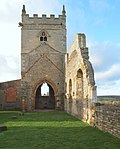 More images |
| Church of All Saints | Cotgrave | Church | Late 14th century | 1 December 1965 | SK6441235344 52°54′42″N 1°02′37″W / 52.911671°N 1.043623°W / 52.911671; -1.043623 (Church of All Saints) | 1277792 |  More images |
| Church of St Giles | Cropwell Bishop | Church | 13th century | 1 December 1965 | SK6847735522 52°54′46″N 0°58′59″W / 52.91277°N 0.983148°W / 52.91277; -0.983148 (Church of St Giles) | 1045650 |  More images |
| Church of St Peter | East Bridgford | Churcn | 11th Century | 1 December 1965 | SK6908643130 52°58′52″N 0°58′21″W / 52.981071°N 0.972475°W / 52.981071; -0.972475 (Church of St Peter) | 1272697 |  More images |
| Church of St Mary | East Leake | Parish Church | 12th century | 13 October 1966 | SK5517826215 52°49′50″N 1°10′57″W / 52.830642°N 1.182462°W / 52.830642; -1.182462 (Church of St Mary) | 1260244 |  More images |
| Church of St Augustine | Flintham | Parish Church | 12th century | 1 December 1965 | SK7388246104 53°00′26″N 0°54′01″W / 53.007161°N 0.900378°W / 53.007161; -0.900378 (Church of St Augustine) | 1272726 | 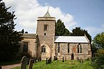 More images |
| Flintham Hall and Adjoining Terrace Wall | Flintham Hall Park, Flintham | Country House | 17th century | 28 November 1972 | SK7383946104 53°00′26″N 0°54′04″W / 53.007167°N 0.901019°W / 53.007167; -0.901019 (Flintham Hall and Adjoining Terrace Wall) | 1272727 | 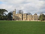 More images |
| Church of St Lawrence | Gotham | Parish Church | 13th century | 13 October 1966 | SK5363330083 52°51′56″N 1°12′17″W / 52.865565°N 1.204757°W / 52.865565; -1.204757 (Church of St Lawrence) | 1260206 |  More images |
| Church of All Saints | Granby | Church | Pre Conquest | 1 December 1965 | SK7510336205 52°55′05″N 0°53′04″W / 52.918024°N 0.884477°W / 52.918024; -0.884477 (Church of All Saints) | 1265230 |  More images |
| Church of St Luke | Hickling | Church | 14th century | 1 December 1965 | SK6918829279 52°51′24″N 0°58′26″W / 52.856567°N 0.973902°W / 52.856567; -0.973902 (Church of St Luke) | 1264986 |  More images |
| Church of St Edmund | Holme Pierrepont | Parish Church | 13th century | 1 December 1965 | SK6261639224 52°56′48″N 1°04′10″W / 52.946757°N 1.069579°W / 52.946757; -1.069579 (Church of St Edmund) | 1249315 |  More images |
| Holme Pierrepont Hall | Holme Pierrepont | Country House | Later 17th century | 12 February 1952 | SK6267139246 52°56′49″N 1°04′08″W / 52.946948°N 1.068756°W / 52.946948; -1.068756 (Holme Pierrepont Hall) | 1249330 |  More images |
| Church of St Mary Magdalene | Keyworth | Church | Early 15th century | 1 December 1965 | SK6138930836 52°52′17″N 1°05′22″W / 52.871506°N 1.089419°W / 52.871506; -1.089419 (Church of St Mary Magdalene) | 1039626 |  More images |
| Church of St Winifred | Kingston on Soar | Parish Church | c. 1540 | 13 October 1966 | SK5018427742 52°50′41″N 1°15′23″W / 52.844854°N 1.256344°W / 52.844854; -1.256344 (Church of St Winifred) | 1242066 |  More images |
| Church of St Andrew | Langar, Langar cum Barnstone | Church | 1712 | 1 December 1965 | SK7212734652 52°54′16″N 0°55′45″W / 52.904473°N 0.929073°W / 52.904473; -0.929073 (Church of St Andrew) | 1264793 |  More images |
| Church of St James | Normanton on Soar | Parish Church | 13th century | 13 October 1966 | SK5187222912 52°48′05″N 1°13′55″W / 52.80128°N 1.23205°W / 52.80128; -1.23205 (Church of St James) | 1242162 | 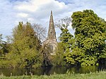 More images |
| Church of St Mary | Orston | Tower | 1766 | 1 December 1965 | SK7694041184 52°57′45″N 0°51′22″W / 52.962513°N 0.855983°W / 52.962513; -0.855983 (Church of St Mary) | 1272710 |  More images |
| Church of Holy Trinity | Ratcliffe on Soar | Parish Church | 13th century | 13 October 1966 | SK4948328898 52°51′19″N 1°16′00″W / 52.85531°N 1.266576°W / 52.85531; -1.266576 (Church of Holy Trinity) | 1242163 | 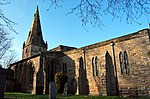 More images |
| Church of St John of Beverley | Scarrington | Tower | Early 14th century | 1 December 1965 | SK7349641597 52°58′00″N 0°54′26″W / 52.966707°N 0.907152°W / 52.966707; -0.907152 (Church of St John of Beverley) | 1272713 |  More images |
| Church of St Wilfrid | Screveton | Church | 15th century | 1 December 1965 | SK7288043414 52°58′59″N 0°54′57″W / 52.983122°N 0.915914°W / 52.983122; -0.915914 (Church of St Wilfrid) | 1243811 | 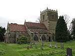 More images |
| Church of St Peter | Sibthorpe | Church | 13th century | 1 December 1965 | SK7639345409 53°00′02″N 0°51′47″W / 53.000563°N 0.863128°W / 53.000563; -0.863128 (Church of St Peter) | 1244670 |  More images |
| Pigeoncote, Church Lane | Sibthorpe | Dovecote | 14th century | 1 December 1965 | SK7649845396 53°00′02″N 0°51′42″W / 53.000431°N 0.861567°W / 53.000431; -0.861567 (Pigeoncote, Church Lane) | 1243820 | 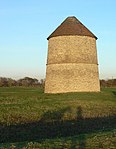 More images |
| Church of St John the Baptist | Stanford on Soar | Parish Church | 13th century | 13 October 1966 | SK5433422004 52°47′34″N 1°11′44″W / 52.792876°N 1.195687°W / 52.792876; -1.195687 (Church of St John the Baptist) | 1242187 | 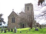 More images |
| Church of St Helena | Thoroton | Church | 14th century | 1 December 1965 | SK7648242531 52°58′29″N 0°51′45″W / 52.974685°N 0.862482°W / 52.974685; -0.862482 (Church of St Helena) | 1272720 |  More images |
| Thrumpton Hall and attached range of outbuildings | Thrumpton Hall Park, Thrumpton | Country House | 1617 | 14 May 1952 | SK5073031259 52°52′35″N 1°14′52″W / 52.876416°N 1.247692°W / 52.876416; -1.247692 (Thrumpton Hall and attached range of outbuildings) | 1242464 |  More images |
| Church of the Holy Trinity | Tithby Village, Tithby | Church | 14th century | 1 December 1965 | SK6984036944 52°55′31″N 0°57′45″W / 52.925375°N 0.962578°W / 52.925375; -0.962578 (Church of the Holy Trinity) | 1235979 |  More images |
| Church of St Luke | Upper Broughton | Church | c. 1200 | 23 June 1989 | SK6834226238 52°49′46″N 0°59′14″W / 52.829343°N 0.987101°W / 52.829343; -0.987101 (Church of St Luke) | 1264583 |  More images |
| Church of St Mary and All Saints | Willoughby on the Wolds | Parish Church | 13th century | 13 October 1966 | SK6338525418 52°49′21″N 1°03′39″W / 52.822577°N 1.060821°W / 52.822577; -1.060821 (Church of St Mary and All Saints) | 1242526 |  More images |
| Holy Trinity Church | Wysall | Parish Church | 12th century | 13 October 1966 | SK6042427131 52°50′18″N 1°06′16″W / 52.838313°N 1.104439°W / 52.838313; -1.104439 (Holy Trinity Church) | 1259980 |  More images |
See also
- Category:Grade I listed buildings in Nottinghamshire
- Grade II* listed buildings in Nottinghamshire
Notes
- ^ a b c d e f g h The date given is the date used by Historic England as significant for the initial building or that of an important part in the structure's description.
- ^ a b c d e f g h Sometimes known as OSGB36, the grid reference is based on the British national grid reference system used by the Ordnance Survey.
- ^ a b c d e f g h The "List Entry Number" is a unique number assigned to each listed building and scheduled monument by Historic England.
References
National Heritage List for England
- Search for information on England's historic sites and buildings, including images of listed buildings.
External links
![]() Media related to Grade I listed buildings in Nottinghamshire at Wikimedia Commons
Media related to Grade I listed buildings in Nottinghamshire at Wikimedia Commons
- v
- t
- e
- Bedfordshire
- Berkshire
- Bristol
- Buckinghamshire
- Cambridgeshire
- Cheshire
- Cornwall
- Cumbria
- Derbyshire
- Devon
- Dorset
- Durham
- East Sussex
- East Riding of Yorkshire
- Essex
- Gloucestershire
- Greater London
- Greater Manchester
- Hampshire
- Herefordshire
- Hertfordshire
- Isle of Wight
- Kent
- Lancashire
- Leicestershire
- Lincolnshire
- Merseyside
- Norfolk
- North Yorkshire
- Northamptonshire
- Northumberland
- Nottinghamshire
- Oxfordshire
- Rutland
- Shropshire
- Somerset
- South Yorkshire
- Staffordshire
- Suffolk
- Surrey
- Tyne and Wear
- Warwickshire
- West Midlands
- West Sussex
- West Yorkshire
- Wiltshire
- Worcestershire
- Babergh
- Bath and North East Somerset
- Bradford
- Brighton and Hove
- Broadland
- Cheltenham
- Cheshire East
- Cheshire West and Chester
- Cotswold
- Craven
- Dartford
- Dover
- Forest Heath
- Forest of Dean
- Ipswich
- Maidstone
- Mendip
- Mid Suffolk
- North Somerset
- Sedgemoor
- South Gloucestershire
- South Somerset
- St Edmundsbury
- Stroud
- Suffolk Coastal
- Taunton Deane
- Tewkesbury
- Waveney
- West Somerset
- Churches
- War memorials
- 20th century


