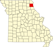
National Register of Historic Places listings in Lewis County, Missouri
This is a list of the National Register of Historic Places listings in Lewis County, Missouri.
This is intended to be a complete list of the properties and districts on the National Register of Historic Places in Lewis County, Missouri, United States. Latitude and longitude coordinates are provided for many National Register properties and districts; these locations may be seen together in a map.[1]
There are 12 properties and districts listed on the National Register in the county.
This National Park Service list is complete through NPS recent listings posted April 26, 2024.[2]
Map all coordinates using OpenStreetMap
Download coordinates as:
- KML
- GPX (all coordinates)
- GPX (primary coordinates)
- GPX (secondary coordinates)
Current listings
| [3] | Name on the Register | Image | Date listed[4] | Location | City or town | Description |
|---|---|---|---|---|---|---|
| 1 | First Presbyterian Church |  | August 28, 2012 (#12000562) | 401 Jefferson 40°02′38″N 91°30′05″W / 40.043889°N 91.501389°W / 40.043889; -91.501389 (First Presbyterian Church) | La Grange | |
| 2 | William Gray House |  | June 3, 1999 (#99000666) | 407 Washington 40°02′35″N 91°30′07″W / 40.042917°N 91.501944°W / 40.042917; -91.501944 (William Gray House) | La Grange | |
| 3 | Dr. J.A. Hay House |  | June 3, 1999 (#99000664) | 406 W. Monroe St. 40°02′44″N 91°30′06″W / 40.045556°N 91.501667°W / 40.045556; -91.501667 (Dr. J.A. Hay House) | La Grange | |
| 4 | Henderson Hall |  | October 2, 1978 (#78001666) | College Hill 40°07′50″N 91°31′49″W / 40.130556°N 91.530278°W / 40.130556; -91.530278 (Henderson Hall) | Canton | |
| 5 | Joseph Hipkins House | Upload image | May 8, 2008 (#08000376) | 500 S. 3rd St. 40°02′19″N 91°30′03″W / 40.038713°N 91.500718°W / 40.038713; -91.500718 (Joseph Hipkins House) | La Grange | |
| 6 | Lewis County Courthouse |  | January 12, 2005 (#04001476) | 100 E. Lafayette St. 40°07′05″N 91°42′51″W / 40.118056°N 91.714167°W / 40.118056; -91.714167 (Lewis County Courthouse) | Monticello | |
| 7 | Lincoln School |  | February 10, 1983 (#83001029) | MO B 40°07′32″N 91°31′02″W / 40.125417°N 91.517361°W / 40.125417; -91.517361 (Lincoln School) | Canton | |
| 8 | Lock and Dam No. 20 Historic District |  | March 10, 2004 (#04000180) | 0.5 miles (0.80 km) north of Henderson St. 40°08′38″N 91°30′41″W / 40.143889°N 91.511389°W / 40.143889; -91.511389 (Lock and Dam No. 20 Historic District) | Canton | Extends into Adams County, Illinois |
| 9 | John McKoon House |  | June 3, 1999 (#99000665) | 500 W. Monroe St. 40°02′44″N 91°30′08″W / 40.045556°N 91.502222°W / 40.045556; -91.502222 (John McKoon House) | La Grange | |
| 10 | Quincy, Missouri, and Pacific Railroad Station | Upload image | May 7, 1979 (#79001379) | Off MO 16 40°05′11″N 91°48′26″W / 40.086389°N 91.807222°W / 40.086389; -91.807222 (Quincy, Missouri, and Pacific Railroad Station) | Lewistown | |
| 11 | Fred Rhoda House | Upload image | June 3, 1999 (#99000662) | 200 S. Second St. 40°02′27″N 91°29′57″W / 40.040833°N 91.499167°W / 40.040833; -91.499167 (Fred Rhoda House) | La Grange | |
| 12 | A.C. Waltman House |  | June 3, 1999 (#99000663) | 302 Lewis St. 40°02′25″N 91°30′02″W / 40.040278°N 91.500556°W / 40.040278; -91.500556 (A.C. Waltman House) | La Grange |
See also
- List of National Historic Landmarks in Missouri
- National Register of Historic Places listings in Missouri
References
Wikimedia Commons has media related to National Register of Historic Places in Lewis County, Missouri.
- ^ The latitude and longitude information provided in this table was derived originally from the National Register Information System, which has been found to be fairly accurate for about 99% of listings. Some locations in this table may have been corrected to current GPS standards.
- ^ National Park Service, United States Department of the Interior, "National Register of Historic Places: Weekly List Actions", retrieved April 26, 2024.
- ^ Numbers represent an alphabetical ordering by significant words. Various colorings, defined here, differentiate National Historic Landmarks and historic districts from other NRHP buildings, structures, sites or objects.
- ^ The eight-digit number below each date is the number assigned to each location in the National Register Information System database, which can be viewed by clicking the number.
- v
- t
- e
- List of U.S. National Historic Landmarks by state:
- Alabama
- Alaska
- Arizona
- Arkansas
- California
- Colorado
- Connecticut
- Delaware
- Florida
- Georgia
- Hawaii
- Idaho
- Illinois
- Indiana
- Iowa
- Kansas
- Kentucky
- Louisiana
- Maine
- Maryland
- Massachusetts
- Michigan
- Minnesota
- Mississippi
- Missouri
- Montana
- Nebraska
- Nevada
- New Hampshire
- New Jersey
- New Mexico
- New York
- North Carolina
- North Dakota
- Ohio
- Oklahoma
- Oregon
- Pennsylvania
- Rhode Island
- South Carolina
- South Dakota
- Tennessee
- Texas
- Utah
- Vermont
- Virginia
- Washington
- West Virginia
- Wisconsin
- Wyoming
 National Register of Historic Places portal
 Category


Municipalities and communities of Lewis County, Missouri, United States | ||
|---|---|---|
County seat: Monticello | ||
| Cities |  | |
| Village | ||
| Townships | ||
| CDP | ||
| Other communities | ||
| Ghost town | ||
| ||


