National Register of Historic Places listings in Washington County, Missouri

This is a list of the National Register of Historic Places listings in Washington County, Missouri.
This is intended to be a complete list of the properties and districts on the National Register of Historic Places in Washington County, Missouri, United States. Latitude and longitude coordinates are provided for many National Register properties and districts; these locations may be seen together in a map.[1]
There are 11 properties and districts listed on the National Register in the county.
This National Park Service list is complete through NPS recent listings posted April 26, 2024.[2]
Map all coordinates using OpenStreetMap
Download coordinates as:
- KML
- GPX (all coordinates)
- GPX (primary coordinates)
- GPX (secondary coordinates)
Current listings
| [3] | Name on the Register | Image | Date listed[4] | Location | City or town | Description |
|---|---|---|---|---|---|---|
| 1 | Caledonia Historic District |  | October 27, 1986 (#86003389) | Roughly bounded by Patrick, College, and Alexander Sts., and MO 21 37°45′48″N 90°46′18″W / 37.763333°N 90.771667°W / 37.763333; -90.771667 (Caledonia Historic District) | Caledonia | |
| 2 | Cresswell Petroglyph Archeological Site | Upload image | February 12, 1971 (#71000482) | Address restricted | Fertile | |
| 3 | George Cresswell Furnace | Upload image | May 23, 1988 (#88000613) | MO F 38°02′27″N 90°50′20″W / 38.040833°N 90.838889°W / 38.040833; -90.838889 (George Cresswell Furnace) | Potosi | |
| 4 | Land Archeological Site | Upload image | May 5, 1972 (#72000734) | Address restricted | Caledonia | |
| 5 | Lost Creek Pictograph Archeological Site | Upload image | January 25, 1971 (#71000481) | Address restricted | Caledonia | |
| 6 | Palmer Historic Mining District | Upload image | November 29, 2010 (#10000964) | Surrounding Palmer for several miles in all directions[5] 37°50′40″N 90°59′15″W / 37.844444°N 90.987500°W / 37.844444; -90.987500 (Palmer Historic Mining District) | Potosi | More than 15 miles (24 km) of land in the Mark Twain National Forest[6] |
| 7 | Harrison Queen House |  | June 27, 2002 (#02000700) | Hwy C, 1.3 mi. W of MO 21 37°46′48″N 90°47′55″W / 37.78°N 90.798611°W / 37.78; -90.798611 (Harrison Queen House) | Caledonia | |
| 8 | Susan Cave (23WA190) | Upload image | July 8, 1989 (#89000758) | Address restricted | Shirley | |
| 9 | Washington County Courthouse |  | October 25, 2011 (#11000765) | 102 N. Missouri St. 37°56′12″N 90°47′17″W / 37.936667°N 90.788056°W / 37.936667; -90.788056 (Washington County Courthouse) | Potosi | |
| 10 | Washington State Park CCC Historic District | 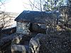 | March 4, 1985 (#85000517) | Roughly bounded by MO 102 and MO 104 38°05′01″N 90°41′13″W / 38.083611°N 90.686944°W / 38.083611; -90.686944 (Washington State Park CCC Historic District) | Potosi | |
| 11 | Washington State Park Petroglyph Archeological Site |  | April 3, 1970 (#70000352) | Address restricted | Fertile |
See also
- List of National Historic Landmarks in Missouri
- National Register of Historic Places listings in Missouri
References
Wikimedia Commons has media related to National Register of Historic Places in Washington County, Missouri.
- ^ The latitude and longitude information provided in this table was derived originally from the National Register Information System, which has been found to be fairly accurate for about 99% of listings. Some locations in this table may have been corrected to current GPS standards.
- ^ National Park Service, United States Department of the Interior, "National Register of Historic Places: Weekly List Actions", retrieved April 26, 2024.
- ^ Numbers represent an alphabetical ordering by significant words. Various colorings, defined here, differentiate National Historic Landmarks and historic districts from other NRHP buildings, structures, sites or objects.
- ^ The eight-digit number below each date is the number assigned to each location in the National Register Information System database, which can be viewed by clicking the number.
- ^ Wettstaed, James R. "A Different View of the Lead Mines of Missouri: Archaeological Investigations in the Palmer Mining District". Missouri Archaeologist 56 Whole Volume (1995): 60-92: 63.
- ^ Mark Twain National Forest Seeks Volunteers to Survey Historic Mining Town near Potosi, United States Forest Service, 2011-02-19. Accessed 2013-03-30.
- v
- t
- e
- List of U.S. National Historic Landmarks by state:
- Alabama
- Alaska
- Arizona
- Arkansas
- California
- Colorado
- Connecticut
- Delaware
- Florida
- Georgia
- Hawaii
- Idaho
- Illinois
- Indiana
- Iowa
- Kansas
- Kentucky
- Louisiana
- Maine
- Maryland
- Massachusetts
- Michigan
- Minnesota
- Mississippi
- Missouri
- Montana
- Nebraska
- Nevada
- New Hampshire
- New Jersey
- New Mexico
- New York
- North Carolina
- North Dakota
- Ohio
- Oklahoma
- Oregon
- Pennsylvania
- Rhode Island
- South Carolina
- South Dakota
- Tennessee
- Texas
- Utah
- Vermont
- Virginia
- Washington
- West Virginia
- Wisconsin
- Wyoming
 National Register of Historic Places portal
 Category


Municipalities and communities of Washington County, Missouri, United States | ||
|---|---|---|
County seat: Potosi | ||
| Cities |  | |
| Villages | ||
| Townships | ||
| Unincorporated communities |
| |
| Ghost towns | ||
| Footnotes | ‡This populated place also has portions in an adjacent county or counties | |
| ||


